The DH6 4 postcode sector is within the county of Durham.
Did you know? According to the 2021 Census, the DH6 4 postcode sector is home to a bustling 7,235 residents!
Given that each sector allows for 400 unique postcode combinations. Letters C, I, K, M, O and V are not allowed in the last two letters of a postcode. With 220 postcodes already in use, this leaves 180 units available.
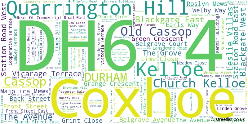
The largest settlement in the DH6 4 postal code is Coxhoe followed by Kelloe, and Quarrington Hill.
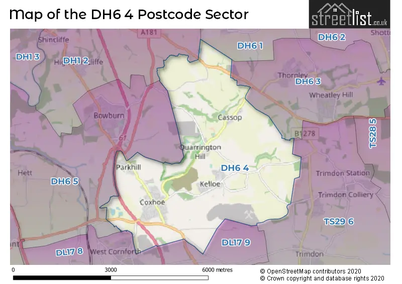
The DH6 4 Postcode shares a border with DH1 2 (DURHAM, High Shincliffe, Shincliffe), DH6 5 (Bowburn, Croxdale, Tursdale), DL17 9 (West Cornforth, Bishop Middleham, Garmondsway), TS29 6 (Trimdon, TRIMDON STATION, Trimdon Grange), DH6 1 (Sherburn Village, Sherburn Hill, High Pittington) and DH6 3 (Wheatley Hill, Thornley).
The sector is within the post town of DURHAM.
DH6 4 is a postcode sector within the DH6 postcode district which is within the DH Durham postcode area.
The Royal Mail delivery office for the DH6 4 postal sector is the Durham Delivery Office.
The area of the DH6 4 postcode sector is 8.35 square miles which is 21.62 square kilometres or 5,341.96 square acres.
The DH6 4 postcode sector is crossed by the A1M Major A road.
The DH6 4 postcode sector is crossed by the A177 Major A road.

Map of the DH6 4 Postcode Sector
Explore the DH6 4 postcode sector by using our free interactive map.
| D | H | 6 | - | 4 | X | X |
| D | H | 6 | Space | 4 | Letter | Letter |
Official List of Streets
Kelloe (16 Streets)
Quarrington Hill (14 Streets)
Coxhoe (95 Streets)
Cassop (9 Streets)
Old Cassop (1 Streets)
Unofficial Streets or Alternative Spellings
Schools and Places of Education Within the DH6 4 Postcode Sector
Cassop Primary School
Community school
Cassop, Durham, , DH6 4RA
Head: Ms Victoria Hewison
Ofsted Rating: Good
Inspection: 2023-03-29 (433 days ago)
Website: Visit Cassop Primary School Website
Phone: 01913770293
Number of Pupils: 142
Coxhoe Primary School
Community school
Cornforth Lane, Durham, , DH6 4EJ
Head: Mrs Jayne Bartle
Ofsted Rating: Good
Inspection: 2022-05-25 (741 days ago)
Website: Visit Coxhoe Primary School Website
Phone: 01913770294
Number of Pupils: 320
House Prices in the DH6 4 Postcode Sector
| Type of Property | 2018 Average | 2018 Sales | 2017 Average | 2017 Sales | 2016 Average | 2016 Sales | 2015 Average | 2015 Sales |
|---|---|---|---|---|---|---|---|---|
| Detached | £200,661 | 18 | £196,157 | 22 | £176,767 | 26 | £183,414 | 28 |
| Semi-Detached | £89,193 | 47 | £82,891 | 40 | £98,390 | 36 | £84,362 | 31 |
| Terraced | £104,759 | 26 | £73,684 | 19 | £74,494 | 16 | £89,644 | 27 |
| Flats | £0 | 0 | £0 | 0 | £0 | 0 | £74,000 | 1 |
Important Postcodes DH6 4 in the Postcode Sector
DH6 4DW is the postcode for Coxhoe District Sports Centre, Linden Grove
DH6 4EJ is the postcode for Coxhoe Primary School, Cornforth Lane, and Coxhoe Primary School, Cornforth Lane, Coxhoe
DH6 4PG is the postcode for Kelloe Community Primary School, Front Street, SURE START BLOCK, Kelloe Community Primary School, Front Street, and Kelloe Community Primary School, Front Street, Kelloe
DH6 4RA is the postcode for Cassop Primary School, Cassop
| The DH6 4 Sector is within these Local Authorities |
|
|---|---|
| The DH6 4 Sector is within these Counties |
|
| The DH6 4 Sector is within these Water Company Areas |
|