The E1W 2 postcode sector is within the county of Greater London.
Did you know? According to the 2021 Census, the E1W 2 postcode sector is home to a bustling 4,925 residents!
Given that each sector allows for 400 unique postcode combinations. Letters C, I, K, M, O and V are not allowed in the last two letters of a postcode. With 119 postcodes already in use, this leaves 281 units available.
The E1W 2 postal code covers the settlement of LONDON .
The E1W 2 Postcode shares a border with E1W 1 (LONDON ), E1 0 (LONDON ), E1 8 (LONDON ) and E1W 3 (LONDON ).
The sector is within the post town of LONDON.
E1W 2 is a postcode sector within the E1W postcode district which is within the E East London postcode area.
The Royal Mail delivery office for the E1W 2 postal sector is the Whitechapel Delivery Office (e1).
The area of the E1W 2 postcode sector is 0.15 square miles which is 0.39 square kilometres or 97.33 square acres.

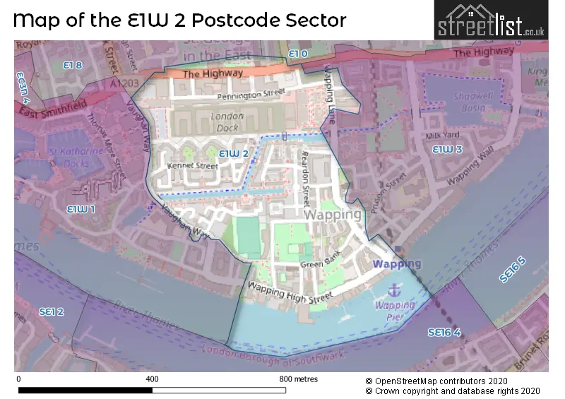
Map of the E1W 2 Postcode Sector
Explore the E1W 2 postcode sector by using our free interactive map.
| E | 1 | W | - | 2 | X | X |
| E | 1 | W | Space | 2 | Letter | Letter |
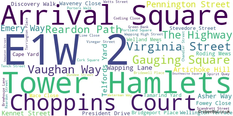
Official List of Streets
Tower Hamlets (48 Streets)
Unofficial Streets or Alternative Spellings
Tower Hamlets
CANNON STREET ROAD CINNAMON STREET CROWDER STREET KNIGHTEN STREET PRUSOM STREET RAINE STREET SOVEREIGN CLOSE STOCKHOLM WAY SWEDENBORG GARDENS BALKAN WALK BETTS STREET BREEZERS HILL CHIGWELL HILL HOGSHEAD PASSAGE KING HENRYS STAIRS MEETING HOUSE ALLEY PIER HEAD PRINCES COURT PROMENADE QUAYSIDE WAPPING DOCK STAIRS WAPPING DOCK STREET WAPPING NEW STAIRS WAPPING OLD STAIRS WELLCLOSE STREETSchools and Places of Education Within the E1W 2 Postcode Sector
Hermitage Primary School
Community school
Vaughan Way, London, , E1W 2PT
Head: Ms Sophie Alcock
Ofsted Rating: Requires improvement
Inspection: 2023-05-11 (378 days ago)
Website: Visit Hermitage Primary School Website
Phone: 02077021037
Number of Pupils: 312
House Prices in the E1W 2 Postcode Sector
| Type of Property | 2018 Average | 2018 Sales | 2017 Average | 2017 Sales | 2016 Average | 2016 Sales | 2015 Average | 2015 Sales |
|---|---|---|---|---|---|---|---|---|
| Detached | £0 | 0 | £0 | 0 | £1,220,000 | 1 | £670,000 | 1 |
| Semi-Detached | £0 | 0 | £1,109,950 | 1 | £0 | 0 | £0 | 0 |
| Terraced | £872,931 | 8 | £780,000 | 3 | £1,219,000 | 5 | £783,767 | 15 |
| Flats | £1,081,662 | 129 | £891,399 | 150 | £786,638 | 37 | £447,257 | 90 |
Important Postcodes E1W 2 in the Postcode Sector
E1W 2BP is the postcode for Mary Sambrook Childrens Centre, 125 The Highway
E1W 2NE is the postcode for Metropolitan Police, Wapping Police Station, 98-102 Wapping High Street
E1W 2PT is the postcode for Hermitage Primary School, 15 Vaughan Way
E1W 2QD is the postcode for John Orwell Sports Centre, Tench Street, and Wapping Youth Centre, Tench Street
E1W 2QH is the postcode for Dental Surgery, St. Peters Centre, Reardon Street
E1W 2QL is the postcode for Wapping Childrens Centre, 15 Chandler Street
E1W 2QT is the postcode for Hurtado Jesuit Centre, 2 Chandler Street
| The E1W 2 Sector is within these Local Authorities |
|
|---|---|
| The E1W 2 Sector is within these Counties |
|
| The E1W 2 Sector is within these Water Company Areas |
|