The EC1V 9 postcode sector is within the county of Greater London.
Did you know? According to the 2021 Census, the EC1V 9 postcode sector is home to a bustling 1,894 residents!
Given that each sector allows for 400 unique postcode combinations. Letters C, I, K, M, O and V are not allowed in the last two letters of a postcode. With 82 postcodes already in use, this leaves 318 units available.
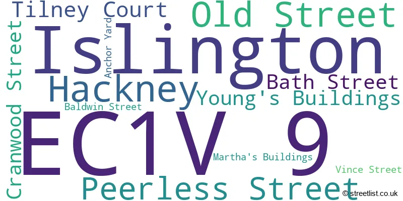
The largest settlements in the EC1V 9 postal code are ISLINGTON and HACKNEY .
The EC1V 9 Postcode shares a border with E1 6 (LONDON , HACKNEY ), E2 7 (LONDON , HACKNEY ), EC1V 7 (ISLINGTON ), EC1V 8 (ISLINGTON ), EC1Y 0 (LONDON , ISLINGTON ), EC1Y 1 (ISLINGTON ), EC1Y 2 (ISLINGTON ), EC1Y 8 (ISLINGTON ), EC2A 3 (HACKNEY ), EC2A 4 (HACKNEY , ISLINGTON ), E2 8 (HACKNEY , LONDON ), EC1M 7 (ISLINGTON , LONDON ), EC1V 1 (ISLINGTON , HACKNEY ), EC1V 2 (ISLINGTON ), EC1V 3 (ISLINGTON ) and N1 6 (HACKNEY ).
The sector is within the post town of LONDON.
EC1V 9 is a postcode sector within the EC1V postcode district which is within the EC East Central London postcode area.
The Royal Mail delivery office for the EC1V 9 postal sector is the unknown.
The area of the EC1V 9 postcode sector is 0.06 square miles which is 0.15 square kilometres or 37.24 square acres.

Map of the EC1V 9 Postcode Sector
Explore the EC1V 9 postcode sector by using our free interactive map.
| E | C | 1 | V | - | 9 | X | X |
| E | C | 1 | V | Space | 9 | Letter | Letter |
Official List of Streets
Islington (9 Streets)
Unofficial Streets or Alternative Spellings
Hackney
BOOT STREET BRUNSWICK PLACE CHARLOTTE ROAD CITY ROAD CORONET STREET CURTAIN ROAD GREAT EASTERN STREET HACKNEY ROAD HOXTON MARKET HOXTON SQUARE HOXTON STREET KINGSLAND ROAD PITFIELD STREET RUFUS STREET SHOREDITCH HIGH STREET SINGER STREET CAYTON STREET CITY CLOISTERS OLD STREET ROUNDABOUT PRINTING HOUSE YARD STAFF STREET WENLAKE ESTATE PATHIslington
BUNHILL ROW CENTRAL STREET CRESCENT ROW DOMINGO STREET GALWAY STREET HELMET ROW HONDURAS STREET LEVER STREET MALLOW STREET RADNOR STREET ST. AGNES WELL SYCAMORE STREET TIMBER STREETCity of London
GOLDEN LANE WHITECROSS STREET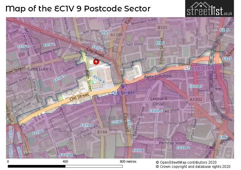
House Prices in the EC1V 9 Postcode Sector
| Type of Property | 2018 Average | 2018 Sales | 2017 Average | 2017 Sales | 2016 Average | 2016 Sales | 2015 Average | 2015 Sales |
|---|---|---|---|---|---|---|---|---|
| Detached | £0 | 0 | £0 | 0 | £0 | 0 | £0 | 0 |
| Semi-Detached | £0 | 0 | £0 | 0 | £0 | 0 | £0 | 0 |
| Terraced | £0 | 0 | £0 | 0 | £0 | 0 | £0 | 0 |
| Flats | £466,620 | 6 | £587,143 | 7 | £636,833 | 9 | £527,813 | 8 |
Important Postcodes EC1V 9 in the Postcode Sector
EC1V 9BR is the postcode for H M Immigration Service, Communications House, 210 Old Street
EC1V 9BW is the postcode for Churchill House, 142-146 Old Street
EC1V 9EL is the postcode for ASHTON BUILDING, Institute of Ophthalmology, 11-43 Bath Street, Institute of Ophthalmology, 11-43 Bath Street, PHASE 6B, Institute of Ophthalmology, 11-43 Bath Street, PHASE 6A, Institute of Ophthalmology, 11-43 Bath Street, 17-25 CAYTON STRRET, Institute of Ophthalmology, 11-43 Bath Street, and WOLFSON 27-29 CAYTON STREET, Institute of Ophthalmology, 11-43 Bath Street
EC1V 9EY is the postcode for Shoreditch Fire Station, 235 Old Street
EC1V 9EZ is the postcode for Richard Desmond Childrens Eye Centre, 3 Peerless Street
EC1V 9HQ is the postcode for 148 Old Street, and Royal Mail, Royal Mail House, 148 Old Street
EC1V 9HX is the postcode for Islington Council, Old Street Area Housing Office
EC1V 9LF is the postcode for Moorfields Eye Hospital NHS FT, 7-9 Bath Street, and Moorfields Private Outpatient Centre, 7-9 Bath Street
EC1V 9TY is the postcode for London Borough of Islington, 69-85 Old Street
| The EC1V 9 Sector is within these Local Authorities |
|
|---|---|
| The EC1V 9 Sector is within these Counties |
|
| The EC1V 9 Sector is within these Water Company Areas |
|