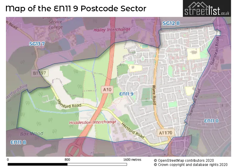
The EN11 9 postcode sector is within the county of Hertfordshire.
Did you know? According to the 2021 Census, the EN11 9 postcode sector is home to a bustling 8,691 residents!
Given that each sector allows for 400 unique postcode combinations. Letters C, I, K, M, O and V are not allowed in the last two letters of a postcode. With 182 postcodes already in use, this leaves 218 units available.
The EN11 9 postal code covers the settlement of HODDESDON.
The EN11 9 Postcode shares a border with SG13 7 (HERTFORD, Hertford Heath, Hailey), SG12 8 (Stanstead Abbotts, Hunsdon, Widford), EN11 0 (HODDESDON) and EN11 8 (HODDESDON).
The sector is within the post town of HODDESDON.
EN11 9 is a postcode sector within the EN1 postcode district which is within the EN Enfield postcode area.
The Royal Mail delivery office for the EN11 9 postal sector is the unknown.
The area of the EN11 9 postcode sector is 1.10 square miles which is 2.84 square kilometres or 702.37 square acres.
Waterways within the EN11 9 postcode sector include the Woollensbrook.

Map of the EN11 9 Postcode Sector
Explore the EN11 9 postcode sector by using our free interactive map.
| E | N | 1 | 1 | - | 9 | X | X |
| E | N | 1 | 1 | Space | 9 | Letter | Letter |
Official List of Streets
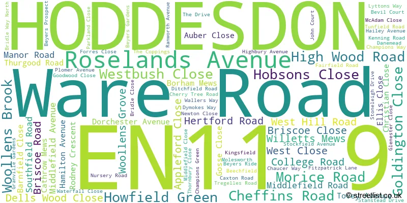
HODDESDON (81 Streets)
Unofficial Streets or Alternative Spellings
Schools and Places of Education Within the EN11 9 Postcode Sector
Roselands Primary School
Academy converter
High Wood Road, Hoddesdon, Hertfordshire, EN11 9AR
Head: Mrs J Carson
Ofsted Rating: Good
Inspection: 2019-06-11 (1808 days ago)
Website: Visit Roselands Primary School Website
Phone: 01992442407
Number of Pupils: 297
The Cranbourne Primary School
Academy converter
Bridleway North, Hoddesdon, Hertfordshire, EN11 9PP
Head: Mrs Rachel Semark
Ofsted Rating: Good
Inspection: 2020-02-06 (1568 days ago)
Website: Visit The Cranbourne Primary School Website
Phone: 01992416220
Number of Pupils: 438
House Prices in the EN11 9 Postcode Sector
| Type of Property | 2018 Average | 2018 Sales | 2017 Average | 2017 Sales | 2016 Average | 2016 Sales | 2015 Average | 2015 Sales |
|---|---|---|---|---|---|---|---|---|
| Detached | £518,579 | 19 | £610,714 | 7 | £509,833 | 18 | £491,066 | 15 |
| Semi-Detached | £412,214 | 35 | £397,874 | 53 | £401,935 | 33 | £351,698 | 35 |
| Terraced | £371,516 | 32 | £377,211 | 33 | £349,943 | 37 | £299,899 | 41 |
| Flats | £240,687 | 16 | £228,682 | 22 | £209,948 | 29 | £186,015 | 29 |
Important Postcodes EN11 9 in the Postcode Sector
EN11 9AR is the postcode for Roselands Primary School, High Wood Road
EN11 9FF is the postcode for Hailey View Surgery, 39 Christian Close
EN11 9PP is the postcode for Cranbourne Primary School, Bridle Way North
| The EN11 9 Sector is within these Local Authorities |
|
|---|---|
| The EN11 9 Sector is within these Counties |
|
| The EN11 9 Sector is within these Water Company Areas |
|