The HG3 4 postcode sector is within the county of North Yorkshire.
Did you know? According to the 2021 Census, the HG3 4 postcode sector is home to a bustling 1,735 residents!
Given that each sector allows for 400 unique postcode combinations. Letters C, I, K, M, O and V are not allowed in the last two letters of a postcode. With 107 postcodes already in use, this leaves 293 units available.
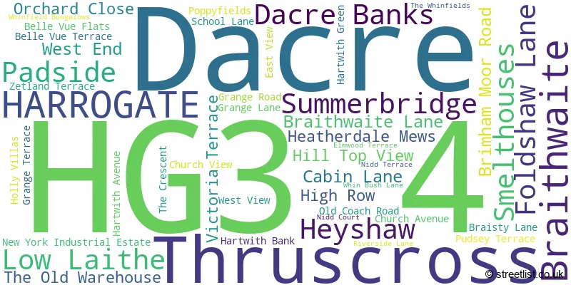
The largest settlement in the HG3 4 postal code is Summerbridge followed by Dacre, and Dacre Banks.
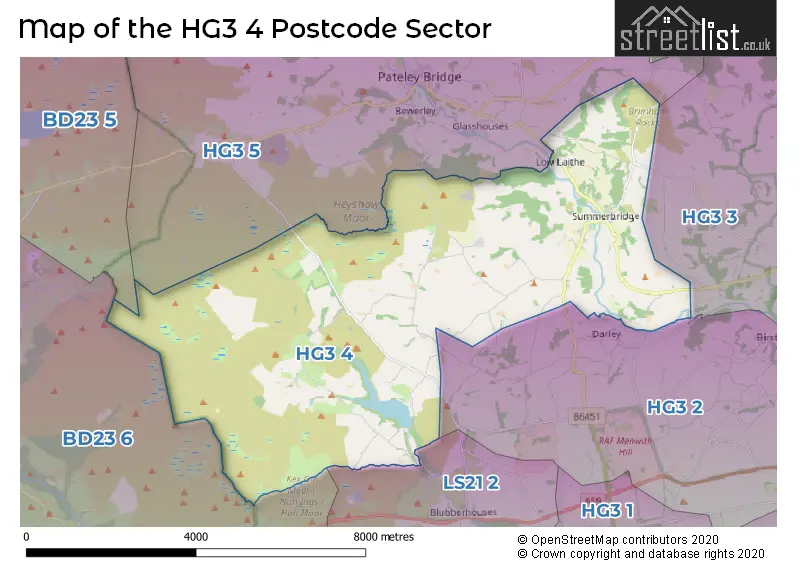
The HG3 4 Postcode shares a border with HG3 2 (HARROGATE, Killinghall, Darley), HG3 3 (Bishop Monkton, Burton Leonard, Bishop Thornton), HG3 5 (Greenhow Hill, Pateley Bridge, Glasshouses), BD23 5 (Grassington, Threshfield, Kettlewell), BD23 6 (Embsay, Skyreholme, SKIPTON) and LS21 2 (OTLEY, Leathley, Blubberhouses).
The sector is within the post town of HARROGATE.
HG3 4 is a postcode sector within the HG3 postcode district which is within the HG Harrogate postcode area.
The Royal Mail delivery office for the HG3 4 postal sector is the Summerbridge Scale Payment Delivery Office.
The area of the HG3 4 postcode sector is 23.02 square miles which is 59.61 square kilometres or 14,729.82 square acres.
Waterways within the HG3 4 postcode sector include the River Nidd, River Washburn, Darley Beck, Greenhow Sike, Harden Gill, Black Sike.

Map of the HG3 4 Postcode Sector
Explore the HG3 4 postcode sector by using our free interactive map.
| H | G | 3 | - | 4 | X | X |
| H | G | 3 | Space | 4 | Letter | Letter |
Official List of Streets
Low Laithe (5 Streets)
Summerbridge (19 Streets)
Dacre (2 Streets)
Dacre Banks (12 Streets)
Unofficial Streets or Alternative Spellings
Summerbridge
WHINFIELD BUNGALOWS BANK DIKE HILL BIRCH LANE BRAMLEY BRIDGE BRAMLEY HEAD LANE CLOGGER LANE CLOGGERS LANE COARSE LANE DACRE HALL PARK DACRE LANE DACRE PASTURE LANE DIKE LANE DUKES LANE EDGE OF CLIFF FALL LANE FOUNDRY LANE GREENHOW HILL ROAD HAREWELL LANE HARPER LANE HARTWITH VIEW HEYSHAW ROAD HILL LANE HOLE GATE HOODSTORTH LANE LANE FOOT ROAD MILL HURST MONK ING ROAD NEW ROAD NEW YORK LANE NORTH MOOR ROAD NOUGHT MOOR ROAD OAK LANE PLUMPTON WAY REDLISH ROAD REDLISH ROAD OR BLAKE GATE RESERVOIR ROAD RIGGS SPRING SANDY GATE SCOT LANE SKYREHOLME BANK STATION CLOSE STREET LANE THOMAS GILL ROAD THRUSCROSS LANE TURWATH BRIDGE WESTEND LANE WHINBUSH LANE WHIT MOOR ROAD WHITE HOUSE LANE WOODMANWRAY LANEBurnt Yates
BRIMHAM ROCKS ROADDarley
DAIRY LANESchools and Places of Education Within the HG3 4 Postcode Sector
Dacre Braithwaite Church of England Primary School
Academy converter
Braithwaite, Harrogate, North Yorkshire, HG3 4AN
Head: Mrs Jo Dobbs
Ofsted Rating: Good
Inspection: 2023-11-22 (183 days ago)
Website: Visit Dacre Braithwaite Church of England Primary School Website
Phone: 01423780285
Number of Pupils: 80
House Prices in the HG3 4 Postcode Sector
| Type of Property | 2018 Average | 2018 Sales | 2017 Average | 2017 Sales | 2016 Average | 2016 Sales | 2015 Average | 2015 Sales |
|---|---|---|---|---|---|---|---|---|
| Detached | £592,772 | 9 | £479,929 | 7 | £410,875 | 12 | £565,250 | 10 |
| Semi-Detached | £262,016 | 6 | £240,356 | 7 | £257,786 | 7 | £192,333 | 3 |
| Terraced | £206,758 | 12 | £250,711 | 9 | £184,458 | 12 | £221,274 | 7 |
| Flats | £0 | 0 | £115,000 | 2 | £70,000 | 1 | £62,500 | 1 |
Important Postcodes HG3 4 in the Postcode Sector
HG3 4AN is the postcode for Dacre Braithwaite C of E Primary School, Braithwaite, and Dacre Braithwaite Church Of England Primary School, Dacre Braithwaite End School
HG3 4DX is the postcode for Nidderdale Group Practice, The Grange Medical Centre
| The HG3 4 Sector is within these Local Authorities |
|
|---|---|
| The HG3 4 Sector is within these Counties |
|
| The HG3 4 Sector is within these Water Company Areas |
|