The KT15 3 postcode sector is within the county of Surrey.
Did you know? According to the 2021 Census, the KT15 3 postcode sector is home to a bustling 9,473 residents!
Given that each sector allows for 400 unique postcode combinations. Letters C, I, K, M, O and V are not allowed in the last two letters of a postcode. With 214 postcodes already in use, this leaves 186 units available.
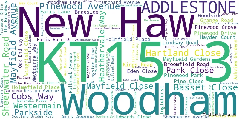
The largest settlement in the KT15 3 postal code is ADDLESTONE followed by NEW HAW , and WOODHAM .
The KT15 3 Postcode shares a border with KT14 7 (BYFLEET ), KT15 1 (ADDLESTONE , OTTERSHAW ), KT15 2 (ADDLESTONE , MEADOWLANDS PARK , MEADOWLANDS ), KT16 0 (CHERTSEY, OTTERSHAW, Longcross), GU21 5 (WOKING, SHEERWATER, WOODHAM), KT13 0 (WEYBRIDGE , BROOKLANDS INDUSTRIAL PARK ) and KT14 6 (WEST BYFLEET , BYFLEET ).
The sector is within the post town of ADDLESTONE.
KT15 3 is a postcode sector within the KT15 postcode district which is within the KT Kingston upon Thames postcode area.
The Royal Mail delivery office for the KT15 3 postal sector is the Addlestone Delivery Office.
The area of the KT15 3 postcode sector is 1.86 square miles which is 4.83 square kilometres or 1,192.65 square acres.
The KT15 3 postcode sector is crossed by the M25 motorway.
Waterways within the KT15 3 postcode sector include the Wey Navigation, Basingstoke Canal, River Wey, River Bourne.

Map of the KT15 3 Postcode Sector
Explore the KT15 3 postcode sector by using our free interactive map.
| K | T | 1 | 5 | - | 3 | X | X |
| K | T | 1 | 5 | Space | 3 | Letter | Letter |
Official List of Streets
Woodham (27 Streets)
New Haw (70 Streets)
Unofficial Streets or Alternative Spellings
Byfleet
OYSTER LANE BARN ROAD BOUNDARY ROAD EAST BOUNDARY ROAD NORTH BOUNDARY ROAD WEST BOURNE ROAD BYFLEET ROAD CYCLE PATH CHANCE MAIN EAST DRIVE FARM ROAD FIRST AVENUE GRANGE FARM HEATHERFIELDS PALACE ROAD PEAKE PLACE PINE GARDENS RIVER WEY NAVIGATION PATH SCOTLAND BRIDGE SECOND AVENUE SHEERWATER BRIDGE WEIGHBRIDGE ROAD WEST DRIVE WESTFIELD PARADE WORKS ROADNew Haw
FULBROOK AVENUEADDLESTONE
NEW HAW ROAD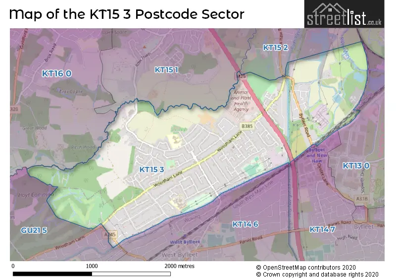
House Prices in the KT15 3 Postcode Sector
| Type of Property | 2018 Average | 2018 Sales | 2017 Average | 2017 Sales | 2016 Average | 2016 Sales | 2015 Average | 2015 Sales |
|---|---|---|---|---|---|---|---|---|
| Detached | £663,380 | 38 | £646,013 | 49 | £601,760 | 40 | £631,217 | 72 |
| Semi-Detached | £450,960 | 58 | £442,385 | 57 | £423,552 | 63 | £390,798 | 65 |
| Terraced | £406,458 | 12 | £367,286 | 7 | £354,375 | 12 | £317,212 | 21 |
| Flats | £279,040 | 11 | £280,796 | 27 | £250,688 | 24 | £281,447 | 33 |
Important Postcodes KT15 3 in the Postcode Sector
KT15 3ET is the postcode for The Woodham & New Haw Day Centre, Amis Avenue
KT15 3HW is the postcode for EAST BLOCK, Fullbrook School, Selsdon Road, SIXTH FORM BLOCK, Fullbrook School, Selsdon Road, MAIN BUILDING, Fullbrook School, Selsdon Road, SPORTS HALL, Fullbrook School, Selsdon Road, and NORTH BLOCK, Fullbrook School, Selsdon Road
KT15 3NB is the postcode for THE WEYBOURNE BUILDING, Department for Environment Food & Rural Affairs (D E F R A), Central Veterinary Laboratory, Woodham Lane, Department for Environment Food & Rural Affairs (D E F R A), Central Veterinary Laboratory, Woodham Lane, and STEWART STOCKMAN BUILDING, Department for Environment Food & Rural Affairs (D E F R A), Central Veterinary Laboratory, Woodham Lane
KT15 3RL is the postcode for New Haw Community School, The Avenue, New Haw, Grange Cp School, The Avenue, New Haw Community Junior School, The Avenue, New Haw Community School, The Avenue, The Grange Community Infant School, The Avenue, and New Haw Community Junior School, The Avenue, New Haw
| The KT15 3 Sector is within these Local Authorities |
|
|---|---|
| The KT15 3 Sector is within these Counties |
|
| The KT15 3 Sector is within these Water Company Areas |
|