The L1 9 postcode sector is within the county of Merseyside.
Did you know? According to the 2021 Census, the L1 9 postcode sector is home to a bustling 1,195 residents!
Given that each sector allows for 400 unique postcode combinations. Letters C, I, K, M, O and V are not allowed in the last two letters of a postcode. With 51 postcodes already in use, this leaves 349 units available.
The L1 9 postal code covers the settlement of LIVERPOOL.
The L1 9 Postcode shares a border with L8 7 (LIVERPOOL, Toxteth), L1 4 (LIVERPOOL), L1 7 (LIVERPOOL), L1 2 (LIVERPOOL), L3 5 (LIVERPOOL) and L7 7 (LIVERPOOL, Edge Hill).
The sector is within the post town of LIVERPOOL.
L1 9 is a postcode sector within the L1 postcode district which is within the L Liverpool postcode area.
The Royal Mail delivery office for the L1 9 postal sector is the Liverpool 1-3.
The area of the L1 9 postcode sector is 0.06 square miles which is 0.16 square kilometres or 39.93 square acres.

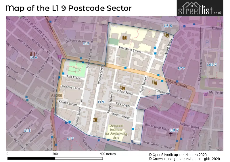
Map of the L1 9 Postcode Sector
Explore the L1 9 postcode sector by using our free interactive map.
| L | 1 | - | 9 | X | X |
| L | 1 | Space | 9 | Letter | Letter |
Official List of Streets
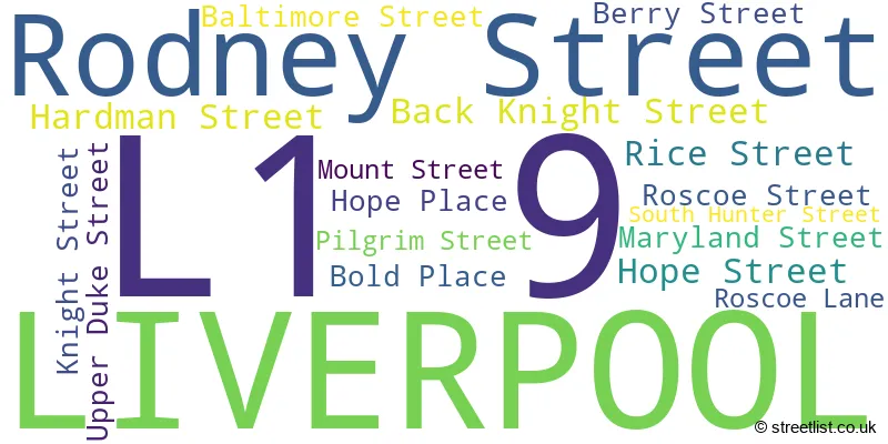
LIVERPOOL (17 Streets)
Unofficial Streets or Alternative Spellings
Weather Forecast for L1 9
Press Button to Show Forecast for Edge Hill
| Time Period | Icon | Description | Temperature | Rain Probability | Wind |
|---|---|---|---|---|---|
| 00:00 to 03:00 | Cloudy | 10.0°C (feels like 8.0°C) | 10.00% | SSE 13 mph | |
| 03:00 to 06:00 | Cloudy | 10.0°C (feels like 7.0°C) | 7.00% | SE 16 mph | |
| 06:00 to 09:00 | Cloudy | 9.0°C (feels like 6.0°C) | 5.00% | SE 18 mph | |
| 09:00 to 12:00 | Cloudy | 12.0°C (feels like 8.0°C) | 8.00% | SE 18 mph | |
| 12:00 to 15:00 | Cloudy | 14.0°C (feels like 11.0°C) | 9.00% | SSE 18 mph | |
| 15:00 to 18:00 | Cloudy | 15.0°C (feels like 11.0°C) | 15.00% | SSE 16 mph | |
| 18:00 to 21:00 | Light rain shower (day) | 13.0°C (feels like 11.0°C) | 35.00% | SSE 11 mph | |
| 21:00 to 00:00 | Overcast | 11.0°C (feels like 10.0°C) | 16.00% | SE 9 mph |
Press Button to Show Forecast for Edge Hill
| Time Period | Icon | Description | Temperature | Rain Probability | Wind |
|---|---|---|---|---|---|
| 00:00 to 03:00 | Cloudy | 10.0°C (feels like 9.0°C) | 7.00% | SE 9 mph | |
| 03:00 to 06:00 | Cloudy | 9.0°C (feels like 7.0°C) | 4.00% | SE 7 mph | |
| 06:00 to 09:00 | Cloudy | 9.0°C (feels like 7.0°C) | 4.00% | SE 7 mph | |
| 09:00 to 12:00 | Cloudy | 11.0°C (feels like 10.0°C) | 5.00% | ESE 7 mph | |
| 12:00 to 15:00 | Cloudy | 14.0°C (feels like 13.0°C) | 8.00% | SE 7 mph | |
| 15:00 to 18:00 | Cloudy | 15.0°C (feels like 14.0°C) | 13.00% | NW 7 mph | |
| 18:00 to 21:00 | Cloudy | 14.0°C (feels like 13.0°C) | 12.00% | WNW 7 mph | |
| 21:00 to 00:00 | Cloudy | 13.0°C (feels like 11.0°C) | 11.00% | NW 9 mph |
Press Button to Show Forecast for Edge Hill
| Time Period | Icon | Description | Temperature | Rain Probability | Wind |
|---|---|---|---|---|---|
| 00:00 to 03:00 | Cloudy | 12.0°C (feels like 10.0°C) | 12.00% | NNW 7 mph | |
| 03:00 to 06:00 | Cloudy | 11.0°C (feels like 9.0°C) | 9.00% | NNW 7 mph | |
| 06:00 to 09:00 | Cloudy | 11.0°C (feels like 10.0°C) | 7.00% | N 7 mph | |
| 09:00 to 12:00 | Partly cloudy (day) | 13.0°C (feels like 11.0°C) | 5.00% | N 9 mph | |
| 12:00 to 15:00 | Sunny day | 16.0°C (feels like 14.0°C) | 5.00% | N 9 mph | |
| 15:00 to 18:00 | Sunny day | 17.0°C (feels like 15.0°C) | 3.00% | N 11 mph | |
| 18:00 to 21:00 | Sunny day | 17.0°C (feels like 14.0°C) | 4.00% | N 11 mph | |
| 21:00 to 00:00 | Clear night | 14.0°C (feels like 12.0°C) | 3.00% | NNE 11 mph |
Schools and Places of Education Within the L1 9 Postcode Sector
LIPA Sixth Form College
Free schools 16 to 19
41 Upper Duke Street, Liverpool, , L1 9DY
Head: Mr Charles Bartholomew
Ofsted Rating: Outstanding
Inspection: 2019-02-28 (1888 days ago)
Website: Visit LIPA Sixth Form College Website
Phone: 01513303232
Number of Pupils: 371
House Prices in the L1 9 Postcode Sector
| Type of Property | 2018 Average | 2018 Sales | 2017 Average | 2017 Sales | 2016 Average | 2016 Sales | 2015 Average | 2015 Sales |
|---|---|---|---|---|---|---|---|---|
| Detached | £0 | 0 | £0 | 0 | £0 | 0 | £0 | 0 |
| Semi-Detached | £0 | 0 | £0 | 0 | £0 | 0 | £0 | 0 |
| Terraced | £378,242 | 6 | £259,988 | 4 | £477,083 | 6 | £430,357 | 7 |
| Flats | £155,125 | 4 | £111,700 | 5 | £70,000 | 2 | £122,988 | 4 |
Important Postcodes L1 9 in the Postcode Sector
L1 9AA is the postcode for Regional Forensic Psychiatry Service, 36 Rodney Street
L1 9BG is the postcode for Liverpool John Moores University, Joe Makin Building, Hope Place, and Joe H Makin, Hope Place
L1 9BH is the postcode for EVERYMAN THEATRE, Liverpool & Merseyside Theatres Trust Ltd, 13 Hope Street
L1 9BP is the postcode for Royal Liverpool Philharmonic Society, Philharmonic Hall, Hope Street
L1 9BZ is the postcode for LIVERPOOL SCHOOL OF ART & DESIGN, 68, Hope Street, and Liverpool School of Art & Design, 68 Hope Street
L1 9DE is the postcode for Liverpool John Moores University, Aquinas Building, Liverpool John Moores University, Aquinas Building, Maryland Street, Aldham Robarts Learning Resource and Pavilion, Maryland Stree, Aquinas Building, Maryland Street, Education Building, 4 MARYLAND STREET, Aldham Robarts Learning Resource Centre, Maryland Street, and Liverpool Students Union, Haigh Building, Maryland Street
L1 9DW is the postcode for Liverpool Community College, Roscoe Street, The City of Liverpool College, The Learning Exchange, 52 Roscoe Street, The City of Liverpool College, The Learning Exchange, and The City of Liverpool College, The City of Liverpool College, The Learning Exchange
L1 9EB is the postcode for I C L, 70 Hope Street
L1 9ED is the postcode for Merseycare NHS Trust, 3-5 Rodney Street
L1 9EF is the postcode for Plus Housing Group, 11-15 Rodney Street
L1 9HF is the postcode for Liverpool Institute for Performing Arts, Mount Street
L1 9HW is the postcode for Liverpool John Moores University, Hahnemann House, 42 Hope Street
| The L1 9 Sector is within these Local Authorities |
|
|---|---|
| The L1 9 Sector is within these Counties |
|
| The L1 9 Sector is within these Water Company Areas |
|
Tourist Attractions within the L1 9 Postcode Area
We found 1 visitor attractions within the L1 postcode area
| Mr Hardman's Home Photographic Studio |
|---|
| Historic Properties |
| Historic House / House and Garden / Palace |
| View Mr Hardman's Home Photographic Studio on Google Maps |