The L11 5 postcode sector is within the county of Merseyside.
Did you know? According to the 2021 Census, the L11 5 postcode sector is home to a bustling 1,738 residents!
Given that each sector allows for 400 unique postcode combinations. Letters C, I, K, M, O and V are not allowed in the last two letters of a postcode. With 29 postcodes already in use, this leaves 371 units available.
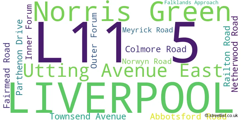
The largest settlements in the L11 5 postal code are LIVERPOOL and Norris Green.
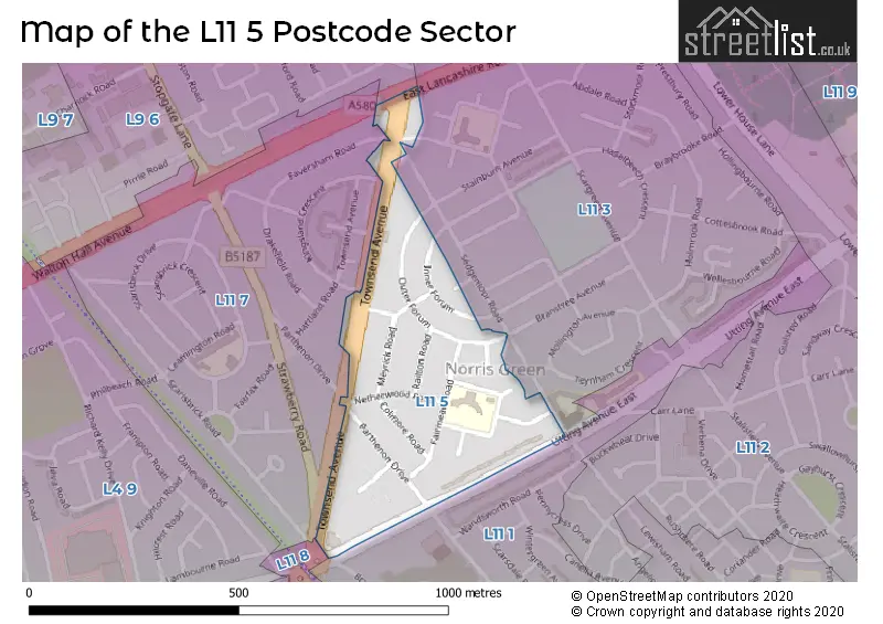
The L11 5 Postcode shares a border with L9 6 (LIVERPOOL, Walton), L11 1 (LIVERPOOL, Norris Green), L11 3 (LIVERPOOL), L11 7 (LIVERPOOL, Norris Green) and L11 8 (LIVERPOOL, Norris Green, West Derby).
The sector is within the post town of LIVERPOOL.
L11 5 is a postcode sector within the L1 postcode district which is within the L Liverpool postcode area.
The Royal Mail delivery office for the L11 5 postal sector is the Liverpool 1-3.
The area of the L11 5 postcode sector is 0.11 square miles which is 0.28 square kilometres or 68.50 square acres.

Map of the L11 5 Postcode Sector
Explore the L11 5 postcode sector by using our free interactive map.
| L | 1 | 1 | - | 5 | X | X |
| L | 1 | 1 | Space | 5 | Letter | Letter |
Official List of Streets
Norris Green (2 Streets)
LIVERPOOL (11 Streets)
Unofficial Streets or Alternative Spellings
Weather Forecast for L11 5
Press Button to Show Forecast for Fazakerley
| Time Period | Icon | Description | Temperature | Rain Probability | Wind |
|---|---|---|---|---|---|
| 03:00 to 06:00 | Cloudy | 10.0°C (feels like 7.0°C) | 7.00% | SE 16 mph | |
| 06:00 to 09:00 | Cloudy | 10.0°C (feels like 7.0°C) | 4.00% | SE 16 mph | |
| 09:00 to 12:00 | Cloudy | 12.0°C (feels like 9.0°C) | 5.00% | SE 18 mph | |
| 12:00 to 15:00 | Cloudy | 15.0°C (feels like 11.0°C) | 8.00% | SSE 18 mph | |
| 15:00 to 18:00 | Cloudy | 15.0°C (feels like 12.0°C) | 14.00% | SSE 16 mph | |
| 18:00 to 21:00 | Cloudy | 13.0°C (feels like 11.0°C) | 15.00% | SSE 11 mph | |
| 21:00 to 00:00 | Overcast | 12.0°C (feels like 10.0°C) | 15.00% | SE 9 mph |
Press Button to Show Forecast for Fazakerley
| Time Period | Icon | Description | Temperature | Rain Probability | Wind |
|---|---|---|---|---|---|
| 00:00 to 03:00 | Cloudy | 11.0°C (feels like 9.0°C) | 9.00% | SE 9 mph | |
| 03:00 to 06:00 | Cloudy | 10.0°C (feels like 8.0°C) | 5.00% | SE 7 mph | |
| 06:00 to 09:00 | Cloudy | 9.0°C (feels like 8.0°C) | 4.00% | SE 7 mph | |
| 09:00 to 12:00 | Cloudy | 12.0°C (feels like 10.0°C) | 5.00% | ESE 7 mph | |
| 12:00 to 15:00 | Cloudy | 14.0°C (feels like 13.0°C) | 7.00% | SSE 7 mph | |
| 15:00 to 18:00 | Cloudy | 15.0°C (feels like 14.0°C) | 10.00% | NW 7 mph | |
| 18:00 to 21:00 | Cloudy | 14.0°C (feels like 12.0°C) | 11.00% | NW 7 mph | |
| 21:00 to 00:00 | Cloudy | 12.0°C (feels like 11.0°C) | 10.00% | NNW 9 mph |
Press Button to Show Forecast for Fazakerley
| Time Period | Icon | Description | Temperature | Rain Probability | Wind |
|---|---|---|---|---|---|
| 00:00 to 03:00 | Cloudy | 11.0°C (feels like 10.0°C) | 11.00% | N 9 mph | |
| 03:00 to 06:00 | Cloudy | 11.0°C (feels like 9.0°C) | 8.00% | N 7 mph | |
| 06:00 to 09:00 | Cloudy | 11.0°C (feels like 10.0°C) | 6.00% | N 7 mph | |
| 09:00 to 12:00 | Partly cloudy (day) | 13.0°C (feels like 11.0°C) | 4.00% | N 9 mph | |
| 12:00 to 15:00 | Sunny day | 15.0°C (feels like 14.0°C) | 3.00% | NNE 11 mph | |
| 15:00 to 18:00 | Partly cloudy (day) | 17.0°C (feels like 14.0°C) | 3.00% | N 11 mph | |
| 18:00 to 21:00 | Sunny day | 16.0°C (feels like 13.0°C) | 3.00% | N 11 mph | |
| 21:00 to 00:00 | Clear night | 13.0°C (feels like 11.0°C) | 3.00% | NNE 11 mph |
Schools and Places of Education Within the L11 5 Postcode Sector
Wellesbourne Community Primary School
Community school
Abbotsford Road, Liverpool, Merseyside, L11 5BA
Head: Mrs Nicola Ryan
Ofsted Rating: Good
Inspection: 2022-01-13 (838 days ago)
Website: Visit Wellesbourne Community Primary School Website
Phone: 01512269765
Number of Pupils: 391
House Prices in the L11 5 Postcode Sector
| Type of Property | 2018 Average | 2018 Sales | 2017 Average | 2017 Sales | 2016 Average | 2016 Sales | 2015 Average | 2015 Sales |
|---|---|---|---|---|---|---|---|---|
| Detached | £0 | 0 | £0 | 0 | £0 | 0 | £0 | 0 |
| Semi-Detached | £89,250 | 4 | £57,500 | 2 | £65,100 | 2 | £74,667 | 3 |
| Terraced | £82,143 | 7 | £80,390 | 5 | £85,374 | 8 | £74,143 | 7 |
| Flats | £75,000 | 2 | £69,950 | 1 | £35,000 | 1 | £51,000 | 1 |
Important Postcodes L11 5 in the Postcode Sector
L11 5AF is the postcode for Mersey Care NHS Foundation Trust, Norris Green Health Centre, Townsend Avenue, and Liverpool City Council, Norris Green Library, Townsend Avenue
L11 5BA is the postcode for Wellesbourne Primary & Nursery School, Abbotsford Road, and Wellesbourne Primary & Nursery School, Abbotsford Road, Norris Green
L11 5BS is the postcode for Norris Green Day Centre, Falklands Approach, Liverpool Mutual Housing, 3 Falklands Approach, and Mersey Care NHS Trust Community Hub, 3 Falklands Approach
| The L11 5 Sector is within these Local Authorities |
|
|---|---|
| The L11 5 Sector is within these Counties |
|
| The L11 5 Sector is within these Water Company Areas |
|