The L12 3 postcode sector is within the county of Merseyside.
Did you know? According to the 2021 Census, the L12 3 postcode sector is home to a bustling 846 residents!
Given that each sector allows for 400 unique postcode combinations. Letters C, I, K, M, O and V are not allowed in the last two letters of a postcode. With 18 postcodes already in use, this leaves 382 units available.
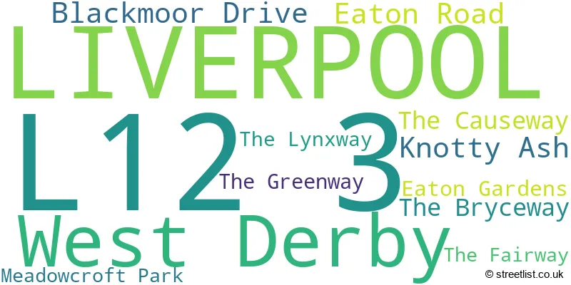
The largest settlement in the L12 3 postal code is LIVERPOOL followed by Knotty Ash, and West Derby.
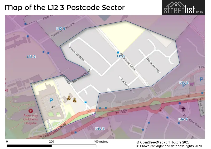
The L12 3 Postcode shares a border with L12 9 (LIVERPOOL, West Derby), L12 2 (West Derby, LIVERPOOL, Sandfield Park), L14 2 (LIVERPOOL) and L14 5 (LIVERPOOL).
The sector is within the post town of LIVERPOOL.
L12 3 is a postcode sector within the L1 postcode district which is within the L Liverpool postcode area.
The Royal Mail delivery office for the L12 3 postal sector is the Liverpool 1-3.
The area of the L12 3 postcode sector is 0.07 square miles which is 0.17 square kilometres or 42.19 square acres.

Map of the L12 3 Postcode Sector
Explore the L12 3 postcode sector by using our free interactive map.
| L | 1 | 2 | - | 3 | X | X |
| L | 1 | 2 | Space | 3 | Letter | Letter |
Official List of Streets
LIVERPOOL (6 Streets)
Knotty Ash (2 Streets)
Unofficial Streets or Alternative Spellings
Weather Forecast for L12 3
Press Button to Show Forecast for Knotty Ash
| Time Period | Icon | Description | Temperature | Rain Probability | Wind |
|---|---|---|---|---|---|
| 06:00 to 09:00 | Cloudy | 10.0°C (feels like 6.0°C) | 5.00% | SE 16 mph | |
| 09:00 to 12:00 | Cloudy | 12.0°C (feels like 8.0°C) | 8.00% | SE 18 mph | |
| 12:00 to 15:00 | Cloudy | 14.0°C (feels like 11.0°C) | 9.00% | SSE 18 mph | |
| 15:00 to 18:00 | Cloudy | 15.0°C (feels like 12.0°C) | 15.00% | SSE 16 mph | |
| 18:00 to 21:00 | Light rain shower (day) | 13.0°C (feels like 11.0°C) | 35.00% | SSE 11 mph | |
| 21:00 to 00:00 | Cloudy | 11.0°C (feels like 10.0°C) | 16.00% | SE 9 mph |
Press Button to Show Forecast for Knotty Ash
| Time Period | Icon | Description | Temperature | Rain Probability | Wind |
|---|---|---|---|---|---|
| 00:00 to 03:00 | Cloudy | 10.0°C (feels like 9.0°C) | 8.00% | SE 7 mph | |
| 03:00 to 06:00 | Cloudy | 9.0°C (feels like 8.0°C) | 4.00% | SE 7 mph | |
| 06:00 to 09:00 | Cloudy | 9.0°C (feels like 7.0°C) | 4.00% | SE 7 mph | |
| 09:00 to 12:00 | Cloudy | 11.0°C (feels like 10.0°C) | 5.00% | ESE 7 mph | |
| 12:00 to 15:00 | Cloudy | 14.0°C (feels like 13.0°C) | 8.00% | SE 7 mph | |
| 15:00 to 18:00 | Cloudy | 15.0°C (feels like 14.0°C) | 13.00% | SSE 7 mph | |
| 18:00 to 21:00 | Cloudy | 14.0°C (feels like 13.0°C) | 12.00% | WNW 7 mph | |
| 21:00 to 00:00 | Cloudy | 13.0°C (feels like 12.0°C) | 11.00% | NW 7 mph |
Press Button to Show Forecast for Knotty Ash
| Time Period | Icon | Description | Temperature | Rain Probability | Wind |
|---|---|---|---|---|---|
| 00:00 to 03:00 | Cloudy | 12.0°C (feels like 10.0°C) | 12.00% | NNW 7 mph | |
| 03:00 to 06:00 | Cloudy | 11.0°C (feels like 10.0°C) | 9.00% | NNW 7 mph | |
| 06:00 to 09:00 | Cloudy | 11.0°C (feels like 10.0°C) | 7.00% | NNW 7 mph | |
| 09:00 to 12:00 | Partly cloudy (day) | 13.0°C (feels like 11.0°C) | 5.00% | N 9 mph | |
| 12:00 to 15:00 | Sunny day | 16.0°C (feels like 14.0°C) | 5.00% | N 9 mph | |
| 15:00 to 18:00 | Sunny day | 17.0°C (feels like 15.0°C) | 3.00% | N 11 mph | |
| 18:00 to 21:00 | Sunny day | 17.0°C (feels like 14.0°C) | 4.00% | N 11 mph | |
| 21:00 to 00:00 | Clear night | 14.0°C (feels like 12.0°C) | 3.00% | NNE 9 mph |
House Prices in the L12 3 Postcode Sector
| Type of Property | 2018 Average | 2018 Sales | 2017 Average | 2017 Sales | 2016 Average | 2016 Sales | 2015 Average | 2015 Sales |
|---|---|---|---|---|---|---|---|---|
| Detached | £266,000 | 1 | £0 | 0 | £235,000 | 2 | £227,250 | 1 |
| Semi-Detached | £196,000 | 5 | £180,408 | 6 | £170,604 | 14 | £171,000 | 6 |
| Terraced | £185,500 | 2 | £167,500 | 2 | £150,000 | 1 | £153,667 | 6 |
| Flats | £0 | 0 | £0 | 0 | £0 | 0 | £0 | 0 |
Important Postcodes L12 3 in the Postcode Sector
L12 3HF is the postcode for Merseyside Police, Police Station, Eaton Road
L12 3HT is the postcode for Springfield House, 416 Eaton Road, and Springfield House, 416 Eaton Road, West Derby
| The L12 3 Sector is within these Local Authorities |
|
|---|---|
| The L12 3 Sector is within these Counties |
|
| The L12 3 Sector is within these Water Company Areas |
|