The L16 9 postcode sector is within the county of Merseyside.
Did you know? According to the 2021 Census, the L16 9 postcode sector is home to a bustling 1,339 residents!
Given that each sector allows for 400 unique postcode combinations. Letters C, I, K, M, O and V are not allowed in the last two letters of a postcode. With 18 postcodes already in use, this leaves 382 units available.
The L16 9 postal code covers the settlement of LIVERPOOL.
The L16 9 Postcode shares a border with L16 7 (LIVERPOOL, Childwall), L16 8 (LIVERPOOL, Childwall) and L16 0 (LIVERPOOL, Childwall).
The sector is within the post town of LIVERPOOL.
L16 9 is a postcode sector within the L1 postcode district which is within the L Liverpool postcode area.
The Royal Mail delivery office for the L16 9 postal sector is the Liverpool 1-3.
The area of the L16 9 postcode sector is 0.08 square miles which is 0.21 square kilometres or 52.69 square acres.

Map of the L16 9 Postcode Sector
Explore the L16 9 postcode sector by using our free interactive map.
| L | 1 | 6 | - | 9 | X | X |
| L | 1 | 6 | Space | 9 | Letter | Letter |
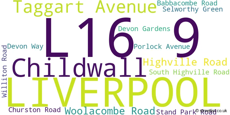
Official List of Streets
LIVERPOOL (11 Streets)
Unofficial Streets or Alternative Spellings
Weather Forecast for L16 9
Press Button to Show Forecast for Childwall
| Time Period | Icon | Description | Temperature | Rain Probability | Wind |
|---|---|---|---|---|---|
| 06:00 to 09:00 | Cloudy | 10.0°C (feels like 6.0°C) | 5.00% | SE 18 mph | |
| 09:00 to 12:00 | Partly cloudy (day) | 12.0°C (feels like 8.0°C) | 5.00% | SE 18 mph | |
| 12:00 to 15:00 | Cloudy | 14.0°C (feels like 11.0°C) | 9.00% | SSE 18 mph | |
| 15:00 to 18:00 | Cloudy | 15.0°C (feels like 11.0°C) | 15.00% | SSE 16 mph | |
| 18:00 to 21:00 | Light rain shower (day) | 13.0°C (feels like 11.0°C) | 35.00% | SSE 11 mph | |
| 21:00 to 00:00 | Cloudy | 11.0°C (feels like 10.0°C) | 16.00% | SE 9 mph |
Press Button to Show Forecast for Childwall
| Time Period | Icon | Description | Temperature | Rain Probability | Wind |
|---|---|---|---|---|---|
| 00:00 to 03:00 | Cloudy | 10.0°C (feels like 9.0°C) | 8.00% | SE 9 mph | |
| 03:00 to 06:00 | Cloudy | 9.0°C (feels like 7.0°C) | 4.00% | SE 7 mph | |
| 06:00 to 09:00 | Cloudy | 9.0°C (feels like 7.0°C) | 4.00% | SE 7 mph | |
| 09:00 to 12:00 | Cloudy | 11.0°C (feels like 10.0°C) | 5.00% | ESE 7 mph | |
| 12:00 to 15:00 | Cloudy | 14.0°C (feels like 13.0°C) | 8.00% | SE 7 mph | |
| 15:00 to 18:00 | Cloudy | 15.0°C (feels like 14.0°C) | 13.00% | SSE 7 mph | |
| 18:00 to 21:00 | Cloudy | 14.0°C (feels like 13.0°C) | 12.00% | WNW 7 mph | |
| 21:00 to 00:00 | Cloudy | 13.0°C (feels like 11.0°C) | 11.00% | NW 7 mph |
Press Button to Show Forecast for Childwall
| Time Period | Icon | Description | Temperature | Rain Probability | Wind |
|---|---|---|---|---|---|
| 00:00 to 03:00 | Cloudy | 12.0°C (feels like 10.0°C) | 12.00% | N 7 mph | |
| 03:00 to 06:00 | Cloudy | 11.0°C (feels like 9.0°C) | 9.00% | NNW 7 mph | |
| 06:00 to 09:00 | Cloudy | 11.0°C (feels like 10.0°C) | 7.00% | NNW 7 mph | |
| 09:00 to 12:00 | Partly cloudy (day) | 13.0°C (feels like 11.0°C) | 5.00% | N 9 mph | |
| 12:00 to 15:00 | Sunny day | 16.0°C (feels like 14.0°C) | 5.00% | N 9 mph | |
| 15:00 to 18:00 | Sunny day | 17.0°C (feels like 15.0°C) | 3.00% | N 11 mph | |
| 18:00 to 21:00 | Sunny day | 17.0°C (feels like 14.0°C) | 4.00% | N 11 mph | |
| 21:00 to 00:00 | Clear night | 14.0°C (feels like 12.0°C) | 3.00% | NNE 9 mph |

House Prices in the L16 9 Postcode Sector
| Type of Property | 2018 Average | 2018 Sales | 2017 Average | 2017 Sales | 2016 Average | 2016 Sales | 2015 Average | 2015 Sales |
|---|---|---|---|---|---|---|---|---|
| Detached | £0 | 0 | £555,000 | 1 | £0 | 0 | £364,500 | 2 |
| Semi-Detached | £307,400 | 10 | £310,538 | 13 | £284,268 | 11 | £267,906 | 8 |
| Terraced | £0 | 0 | £0 | 0 | £0 | 0 | £0 | 0 |
| Flats | £0 | 0 | £0 | 0 | £0 | 0 | £0 | 0 |
Important Postcodes L16 9 in the Postcode Sector
L16 9JD is the postcode for FML/GATEWAY BUILDING, Liverpool Hope University, Hope Park, TERESA BUILDING, Liverpool Hope University, Hope Park, BUSINESS SCHOOL, Liverpool Hope University, Hope Park, HEALTH SCIENCES/SPORTS CENTRE, Liverpool Hope University, Hope Park, HCA/MARKLAND BUILDING, Liverpool Hope University, Hope Park, DERWENT BUILDING, Liverpool Hope University, Hope Park, WARRINGTON BUILDING, Liverpool Hope University, Hope Park, THERESA BUILDING, Liverpool Hope University, Hope Park, WESLEY BUILDING, Liverpool Hope University, Hope Park, SCHOOL OF SOCIAL SCIENCES, LIVERPOOL HOPE UNIVERSITY, HOPE PARK, GLB BUILDING, Liverpool Hope University, Hope Park, FML/GATEWAY BUILDING, Liverpool Hope University College, Hope Park, Taggart Avenue, ANGELA BUILDING, Liverpool Hope University, Hope Park, EDEN BUILDING, Liverpool Hope University, Hope Park, AUSTIN BUILDING, Liverpool Hope University, Hope Park, KESWICK BUILDING, Liverpool Hope University, Hope Park, LTC BUILDING, Liverpool Hope University, Hope Park, Centre of Excellence in Education, Innovation & Enterprise, Liverpool Hope University, and NEWMAN BUILDING, Liverpool Hope University, Hope Park
| The L16 9 Sector is within these Local Authorities |
|
|---|---|
| The L16 9 Sector is within these Counties |
|
| The L16 9 Sector is within these Water Company Areas |
|