The L18 3 postcode sector is within the county of Merseyside.
Did you know? According to the 2021 Census, the L18 3 postcode sector is home to a bustling 3,271 residents!
Given that each sector allows for 400 unique postcode combinations. Letters C, I, K, M, O and V are not allowed in the last two letters of a postcode. With 82 postcodes already in use, this leaves 318 units available.
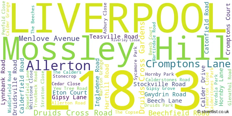
The largest settlement in the L18 3 postal code is LIVERPOOL followed by Mossley Hill, and Allerton.
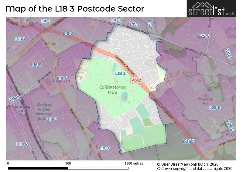
The L18 3 Postcode shares a border with L18 2 (LIVERPOOL, Mossley Hill), L18 6 (LIVERPOOL, Mossley Hill), L18 9 (LIVERPOOL, Allerton, Mossley Hill), L16 8 (LIVERPOOL, Childwall), L16 0 (LIVERPOOL, Childwall), L25 6 (LIVERPOOL, Woolton), L25 4 (LIVERPOOL, Woolton, Gateacre) and L25 7 (Woolton, LIVERPOOL).
The sector is within the post town of LIVERPOOL.
L18 3 is a postcode sector within the L1 postcode district which is within the L Liverpool postcode area.
The Royal Mail delivery office for the L18 3 postal sector is the Liverpool 1-3.
The area of the L18 3 postcode sector is 0.67 square miles which is 1.73 square kilometres or 426.97 square acres.

Map of the L18 3 Postcode Sector
Explore the L18 3 postcode sector by using our free interactive map.
| L | 1 | 8 | - | 3 | X | X |
| L | 1 | 8 | Space | 3 | Letter | Letter |
Official List of Streets
Mossley Hill (2 Streets)
LIVERPOOL (43 Streets)
Allerton (1 Streets)
Unofficial Streets or Alternative Spellings
LIVERPOOL
ALDBOURNE AVENUE BEECH COURT BOOKER AVENUE CINDER LANE CLEVELEY ROAD DUNSDON CLOSE DUNSDON ROAD GLENDYKE ROAD GREENHILL AVENUE MOORCROFT ROAD PRIMROSE ROAD SALISBURY PARK THE GLEN WHEATCROFT ROAD WOOLACOMBE ROADWoolton
BEACONSFIELD ROAD SMALLEY AVENUEAllerton
ALLERTON ROADChildwall
WOOLTON ROAD CROMPTON COURT STONEHOUSE MEWSWeather Forecast for L18 3
Press Button to Show Forecast for Allerton (Merseyside)
| Time Period | Icon | Description | Temperature | Rain Probability | Wind |
|---|---|---|---|---|---|
| 06:00 to 09:00 | Cloudy | 10.0°C (feels like 6.0°C) | 5.00% | SE 16 mph | |
| 09:00 to 12:00 | Cloudy | 12.0°C (feels like 9.0°C) | 8.00% | SE 18 mph | |
| 12:00 to 15:00 | Cloudy | 15.0°C (feels like 11.0°C) | 9.00% | SSE 18 mph | |
| 15:00 to 18:00 | Cloudy | 15.0°C (feels like 12.0°C) | 15.00% | SSE 16 mph | |
| 18:00 to 21:00 | Light rain shower (day) | 13.0°C (feels like 11.0°C) | 35.00% | SSE 11 mph | |
| 21:00 to 00:00 | Overcast | 11.0°C (feels like 10.0°C) | 16.00% | SE 9 mph |
Press Button to Show Forecast for Allerton (Merseyside)
| Time Period | Icon | Description | Temperature | Rain Probability | Wind |
|---|---|---|---|---|---|
| 00:00 to 03:00 | Cloudy | 10.0°C (feels like 9.0°C) | 7.00% | SE 9 mph | |
| 03:00 to 06:00 | Cloudy | 9.0°C (feels like 8.0°C) | 4.00% | SE 7 mph | |
| 06:00 to 09:00 | Cloudy | 9.0°C (feels like 7.0°C) | 4.00% | SE 7 mph | |
| 09:00 to 12:00 | Cloudy | 12.0°C (feels like 10.0°C) | 5.00% | ESE 7 mph | |
| 12:00 to 15:00 | Cloudy | 14.0°C (feels like 13.0°C) | 8.00% | SE 7 mph | |
| 15:00 to 18:00 | Cloudy | 15.0°C (feels like 14.0°C) | 13.00% | SSE 7 mph | |
| 18:00 to 21:00 | Cloudy | 15.0°C (feels like 13.0°C) | 12.00% | WNW 7 mph | |
| 21:00 to 00:00 | Cloudy | 13.0°C (feels like 12.0°C) | 11.00% | NW 7 mph |
Press Button to Show Forecast for Allerton (Merseyside)
| Time Period | Icon | Description | Temperature | Rain Probability | Wind |
|---|---|---|---|---|---|
| 00:00 to 03:00 | Cloudy | 12.0°C (feels like 10.0°C) | 12.00% | N 7 mph | |
| 03:00 to 06:00 | Cloudy | 11.0°C (feels like 10.0°C) | 9.00% | NNW 7 mph | |
| 06:00 to 09:00 | Cloudy | 11.0°C (feels like 10.0°C) | 7.00% | NNW 7 mph | |
| 09:00 to 12:00 | Cloudy | 13.0°C (feels like 12.0°C) | 8.00% | N 9 mph | |
| 12:00 to 15:00 | Sunny day | 16.0°C (feels like 14.0°C) | 5.00% | N 9 mph | |
| 15:00 to 18:00 | Sunny day | 18.0°C (feels like 15.0°C) | 3.00% | N 11 mph | |
| 18:00 to 21:00 | Sunny day | 17.0°C (feels like 14.0°C) | 4.00% | N 11 mph | |
| 21:00 to 00:00 | Clear night | 14.0°C (feels like 12.0°C) | 3.00% | NNE 9 mph |
Schools and Places of Education Within the L18 3 Postcode Sector
Calderstones School
Community school
Harthill Road, Liverpool, Merseyside, L18 3HS
Head: Mr Lee Ratcliffe
Ofsted Rating: Good
Inspection: 2023-01-25 (461 days ago)
Website: Visit Calderstones School Website
Phone: 01517242087
Number of Pupils: 1552
House Prices in the L18 3 Postcode Sector
| Type of Property | 2018 Average | 2018 Sales | 2017 Average | 2017 Sales | 2016 Average | 2016 Sales | 2015 Average | 2015 Sales |
|---|---|---|---|---|---|---|---|---|
| Detached | £456,114 | 22 | £699,090 | 13 | £418,861 | 22 | £473,848 | 23 |
| Semi-Detached | £385,875 | 18 | £419,481 | 24 | £420,932 | 11 | £387,250 | 13 |
| Terraced | £184,167 | 3 | £158,333 | 3 | £170,000 | 1 | £152,483 | 3 |
| Flats | £234,867 | 15 | £214,268 | 22 | £211,140 | 24 | £121,821 | 17 |
Important Postcodes L18 3 in the Postcode Sector
L18 3HS is the postcode for CALDER GYM, Calderstones School, Harthill Road, CALDER HOUSE, Calderstones School, Harthill Road, Calderstones School, Harthill Road, TECHNOLOGY BLOCK, Calderstones School, Harthill Road, SCIENCE BLOCK, Calderstones School, Harthill Road, QUARRY BANK HOUSE, Calderstones School, Harthill Road, QUARRY BANK HALL, Calderstones School, Harthill Road, ART BLOCK & SPORTS HALL, Calderstones School, Harthill Road, and MORRISON WING, Calderstones School, Harthill Road
| The L18 3 Sector is within these Local Authorities |
|
|---|---|
| The L18 3 Sector is within these Counties |
|
| The L18 3 Sector is within these Water Company Areas |
|