The L31 9 postcode sector stands on the Lancashire and Merseyside border.
Did you know? According to the 2021 Census, the L31 9 postcode sector is home to a bustling 4,020 residents!
Given that each sector allows for 400 unique postcode combinations. Letters C, I, K, M, O and V are not allowed in the last two letters of a postcode. With 76 postcodes already in use, this leaves 324 units available.
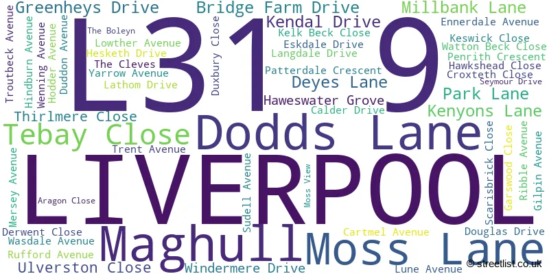
The largest settlements in the L31 9 postal code are LIVERPOOL and Maghull.
The L31 9 Postcode shares a border with L31 1 (Melling, Maghull, LIVERPOOL), L31 4 (LIVERPOOL, Lydiate, Maghull), L31 0 (LIVERPOOL, Maghull, Lydiate), L31 2 (LIVERPOOL, Lydiate, Maghull), L31 6 (LIVERPOOL, Maghull) and L39 6 (Aughton).
The sector is within the post town of LIVERPOOL.
L31 9 is a postcode sector within the L3 postcode district which is within the L Liverpool postcode area.
The Royal Mail delivery office for the L31 9 postal sector is the Liverpool 1-3.
The area of the L31 9 postcode sector is 0.49 square miles which is 1.26 square kilometres or 311.22 square acres.

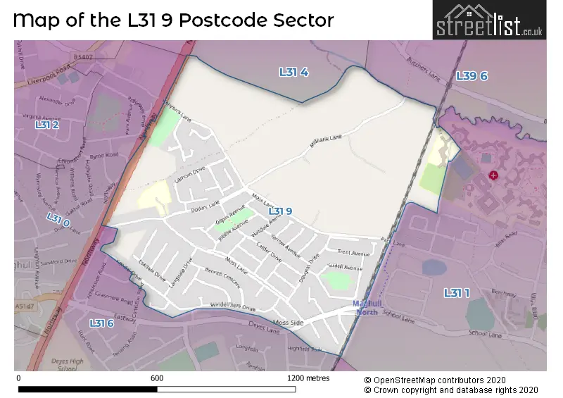
Map of the L31 9 Postcode Sector
Explore the L31 9 postcode sector by using our free interactive map.
| L | 3 | 1 | - | 9 | X | X |
| L | 3 | 1 | Space | 9 | Letter | Letter |
Official List of Streets
LIVERPOOL (42 Streets)
Maghull (11 Streets)
Unofficial Streets or Alternative Spellings
Maghull
AMBLESIDE ROAD CONISTON ROAD SCHOOL LANELIVERPOOL
HIGHFIELD PARK RAVENGLASS AVENUE BROCK AVENUE BROOK AVENUE KELKBECK CLOSEAughton
NORTHWAYLydiate
KENYONS LANESchools and Places of Education Within the L31 9 Postcode Sector
Northway Primary School
Community school
Dodds Lane, Liverpool, Merseyside, L31 9AA
Head: Mrs Kate McKenzie
Ofsted Rating: Good
Inspection: 2023-09-14 (257 days ago)
Website: Visit Northway Primary School Website
Phone: 01515262565
Number of Pupils: 367
House Prices in the L31 9 Postcode Sector
| Type of Property | 2018 Average | 2018 Sales | 2017 Average | 2017 Sales | 2016 Average | 2016 Sales | 2015 Average | 2015 Sales |
|---|---|---|---|---|---|---|---|---|
| Detached | £213,165 | 3 | £221,632 | 3 | £130,000 | 1 | £198,200 | 5 |
| Semi-Detached | £183,990 | 65 | £179,554 | 44 | £175,277 | 42 | £161,280 | 44 |
| Terraced | £192,000 | 1 | £165,200 | 5 | £158,317 | 3 | £150,590 | 5 |
| Flats | £115,475 | 2 | £0 | 0 | £0 | 0 | £105,500 | 1 |
Important Postcodes L31 9 in the Postcode Sector
L31 9AA is the postcode for INFANT BUILDING, Northway Community Nursery & Primary School, Dodds Lane, JUNIOR BUILDING, Northway Community Nursery & Primary School, Dodds Lane, and NORTHWAY PRIMARY SCHOOL, Northway Community Nursery & Primary School, Dodds Lane
| The L31 9 Sector is within these Local Authorities |
|
|---|---|
| The L31 9 Sector is within these Counties |
|
| The L31 9 Sector is within these Water Company Areas |
|