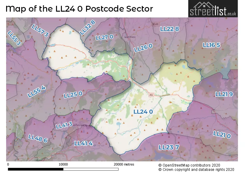
The LL24 0 postcode sector stands on the Clwyd and Gwynedd border.
Did you know? According to the 2021 Census, the LL24 0 postcode sector is home to a bustling 1,953 residents!
Given that each sector allows for 400 unique postcode combinations. Letters C, I, K, M, O and V are not allowed in the last two letters of a postcode. With 193 postcodes already in use, this leaves 207 units available.
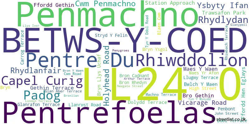
The largest settlement in the LL24 0 postal code is BETWS Y COED followed by PENMACHNO, and PENTREFOELAS.
The LL24 0 Postcode shares a border with LL16 5 (HENLLAN, DENBIGH, LLANSANNAN), LL21 0 (CORWEN, LLANDRILLO, CYNWYD), LL21 9 (CORWEN, GWYDDELWERN, GLYNDYFRDWY), LL22 8 (ABERGELE, LLANDDULAS, LLANGERNYW), LL23 7 (Y BALA, LLANUWCHLLYN, LLANDDERFEL), LL25 0 (DOLWYDDELAN), LL26 0 (LLANRWST, LLANDDOGED, MAENAN), LL27 0 (TREFRIW, LLANRHYCHWYN), LL32 8 (CONWY, TAL Y BONT, DOLGARROG), LL41 3 (BLAENAU FFESTINIOG, TANYGRISIAU, RHIWBRYFDIR), LL41 4 (TRAWSFYNYDD, LLAN FFESTINIOG, MANOD), LL55 4 (LLANBERIS, LLANRUG, WAUNFAWR) and LL57 3 (Bethesda, RACHUB, CARNEDDI).
The sector is within the post town of BETWS-Y-COED.
LL24 0 is a postcode sector within the LL24 postcode district which is within the LL Llandudno postcode area.
The Royal Mail delivery office for the LL24 0 postal sector is the Betws Y Coed Delivery Office and Llanrwst Delivery Office.
The area of the LL24 0 postcode sector is 106.87 square miles which is 276.80 square kilometres or 68,399.20 square acres.

Map of the LL24 0 Postcode Sector
Explore the LL24 0 postcode sector by using our free interactive map.
| L | L | 2 | 4 | - | 0 | X | X |
| L | L | 2 | 4 | Space | 0 | Letter | Letter |
Official List of Streets
Penmachno (14 Streets)
Cwm Penmachno (8 Streets)
BETWS-Y-COED (12 Streets)
Pentrefoelas (3 Streets)
Capel Curig (3 Streets)
Ysbyty Ifan (3 Streets)
Pentre Du (1 Streets)
House Prices in the LL24 0 Postcode Sector
| Type of Property | 2018 Average | 2018 Sales | 2017 Average | 2017 Sales | 2016 Average | 2016 Sales | 2015 Average | 2015 Sales |
|---|---|---|---|---|---|---|---|---|
| Detached | £279,611 | 9 | £290,536 | 14 | £263,125 | 15 | £234,703 | 17 |
| Semi-Detached | £255,420 | 5 | £225,650 | 10 | £197,583 | 6 | £152,189 | 13 |
| Terraced | £118,527 | 20 | £108,972 | 18 | £126,038 | 13 | £140,438 | 8 |
| Flats | £0 | 0 | £0 | 0 | £0 | 0 | £0 | 0 |
Important Postcodes LL24 0 in the Postcode Sector
LL24 0AH is the postcode for Tourist Information Centre, Royal Oak Stables
LL24 0BP is the postcode for Betws-y-Coed Primary School, Ffordd Gethin
LL24 0ET is the postcode for CLIMBING WALL AND POOL, Mountain Training Trust, Plas y Brenin, and Mountain Training Trust, Plas y Brenin
LL24 0LE is the postcode for Ysgol Gynradd Pentrefoelas, Pentrefoelas
LL24 0PT is the postcode for Ysgol Gynradd, Penmachno
| The LL24 0 Sector is within these Local Authorities |
|
|---|---|
| The LL24 0 Sector is within these Counties |
|
| The LL24 0 Sector is within these Water Company Areas |
|
Tourist Attractions within the LL24 0 Postcode Area
We found 1 visitor attractions within the LL24 postcode area
| Llyn Alwen/Brenig |
|---|
| View Llyn Alwen/Brenig on Google Maps |