The LL71 8 postcode sector is within the county of Gwynedd.
Did you know? According to the 2021 Census, the LL71 8 postcode sector is home to a bustling 1,382 residents!
Given that each sector allows for 400 unique postcode combinations. Letters C, I, K, M, O and V are not allowed in the last two letters of a postcode. With 52 postcodes already in use, this leaves 348 units available.
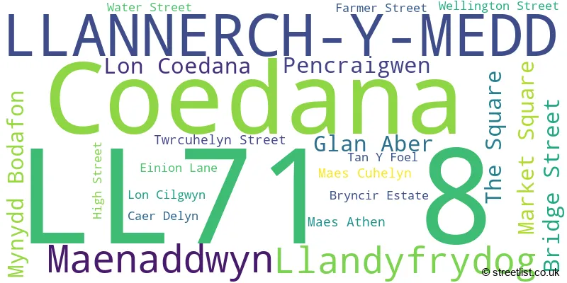
The largest settlement in the LL71 8 postal code is LLANERCHYMEDD followed by LLANDYFRYDOG, and MYNYDD BODAFON.
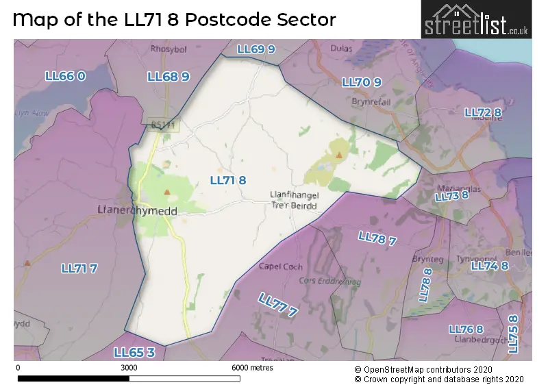
The LL71 8 Postcode shares a border with LL68 9 (AMLWCH, BULL BAY, RHOSYBOL), LL69 9 (PENYSARN), LL70 9 (DULAS), LL73 8 (MARIANGLAS, TRAETH BYCHAN), LL78 7 (BRYNTEG), LL71 7 (LLANERCHYMEDD, CARMEL, LLANDRYGAN), LL65 3 (VALLEY, CAERGEILIOG, BODEDERN), LL72 8 (MOELFRE, MARIANGLAS, LLANALLGO) and LL77 7 (LLANGEFNI, RHOSTREHWFA, BODFFORDD).
The sector is within the post town of LLANNERCH-Y-MEDD.
LL71 8 is a postcode sector within the LL71 postcode district which is within the LL Llandudno postcode area.
The Royal Mail delivery office for the LL71 8 postal sector is the Llangefni Delivery Office.
The area of the LL71 8 postcode sector is 12.55 square miles which is 32.51 square kilometres or 8,034.43 square acres.

Map of the LL71 8 Postcode Sector
Explore the LL71 8 postcode sector by using our free interactive map.
| L | L | 7 | 1 | - | 8 | X | X |
| L | L | 7 | 1 | Space | 8 | Letter | Letter |
Official List of Streets
LLANNERCH-Y-MEDD (17 Streets)
Unofficial Streets or Alternative Spellings
House Prices in the LL71 8 Postcode Sector
| Type of Property | 2018 Average | 2018 Sales | 2017 Average | 2017 Sales | 2016 Average | 2016 Sales | 2015 Average | 2015 Sales |
|---|---|---|---|---|---|---|---|---|
| Detached | £241,445 | 10 | £227,986 | 14 | £200,461 | 14 | £195,000 | 7 |
| Semi-Detached | £141,650 | 3 | £147,000 | 2 | £77,400 | 5 | £161,333 | 3 |
| Terraced | £95,600 | 5 | £101,492 | 6 | £82,000 | 2 | £112,500 | 1 |
| Flats | £0 | 0 | £0 | 0 | £0 | 0 | £0 | 0 |
Important Postcodes LL71 8 in the Postcode Sector
LL71 8DP is the postcode for Ysgol Gymuned Llannerch y Medd, Wellington Street
| The LL71 8 Sector is within these Local Authorities |
|
|---|---|
| The LL71 8 Sector is within these Counties |
|
| The LL71 8 Sector is within these Water Company Areas |
|