The M50 3 postcode sector is within the county of Greater Manchester.
Did you know? According to the 2021 Census, the M50 3 postcode sector is home to a bustling 3,496 residents!
Given that each sector allows for 400 unique postcode combinations. Letters C, I, K, M, O and V are not allowed in the last two letters of a postcode. With 89 postcodes already in use, this leaves 311 units available.
The M50 3 postal code covers the settlement of SALFORD.
The M50 3 Postcode shares a border with M16 0 (MANCHESTER, Old Trafford, Firswood), M5 3 (SALFORD), M5 4 (SALFORD), M17 1 (Trafford Park) and M50 2 (SALFORD, Media City UK).
The sector is within the post town of SALFORD.
M50 3 is a postcode sector within the M50 postcode district which is within the M Manchester postcode area.
The Royal Mail delivery office for the M50 3 postal sector is the Salford Delivery Office.
The area of the M50 3 postcode sector is 0.27 square miles which is 0.70 square kilometres or 173.22 square acres.
Waterways within the M50 3 postcode sector include the Manchester Ship Canal.

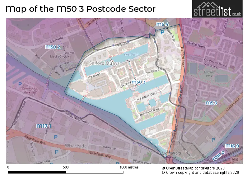
Map of the M50 3 Postcode Sector
Explore the M50 3 postcode sector by using our free interactive map.
| M | 5 | 0 | - | 3 | X | X |
| M | 5 | 0 | Space | 3 | Letter | Letter |
Official List of Streets
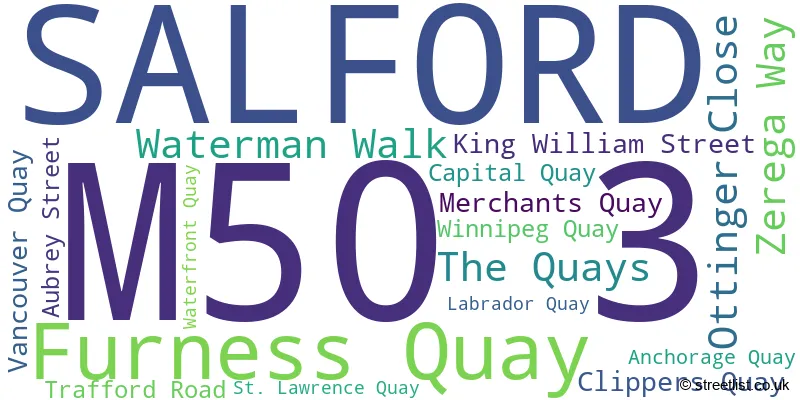
SALFORD (17 Streets)
Unofficial Streets or Alternative Spellings
SALFORD
COLGATE LANE ELMIRA WAY JENNINGS AVENUE MICHIGAN AVENUE OHIO AVENUE ORDSALL LANE PHOEBE STREET ARCHIE STREET CENTRAL WHARF DETROIT BRIDGE EAST WHARVES GLEN STREET IRWELL RIVER PARK LINK FROM PEDESTRIAN AREA TO ROAD LOWRY PLAZA FOOTBRIDGE QUAYSIDE SAINT LAWRENCE QUAY SOUTH WHARF THE LOWRY OUTLET MALLSchools and Places of Education Within the M50 3 Postcode Sector
Oasis Academy MediaCityUK
Academy sponsor led
King William Street, Manchester, , M50 3UQ
Head: Mr Paul McEvoy
Ofsted Rating: Good
Inspection: 2021-09-15 (987 days ago)
Website: Visit Oasis Academy MediaCityUK Website
Phone: 01618866500
Number of Pupils: 960
House Prices in the M50 3 Postcode Sector
| Type of Property | 2018 Average | 2018 Sales | 2017 Average | 2017 Sales | 2016 Average | 2016 Sales | 2015 Average | 2015 Sales |
|---|---|---|---|---|---|---|---|---|
| Detached | £0 | 0 | £297,167 | 3 | £0 | 0 | £0 | 0 |
| Semi-Detached | £375,000 | 2 | £0 | 0 | £0 | 0 | £249,950 | 1 |
| Terraced | £328,538 | 4 | £272,715 | 4 | £297,992 | 6 | £265,250 | 4 |
| Flats | £201,348 | 186 | £189,016 | 412 | £177,060 | 212 | £140,772 | 196 |
Important Postcodes M50 3 in the Postcode Sector
M50 3AH is the postcode for F1A AND F1D CONTOUR, Peel Outlets, The Lowry Designer Outlet
M50 3AZ is the postcode for The Lowry, Pier, 8 The Quays
M50 3NW is the postcode for Clippers House, Clippers Quay
M50 3SQ is the postcode for Watersports Centre, 15 The Quays
M50 3SR is the postcode for Frontier House, Merchants Quay
M50 3UQ is the postcode for Oasis Academy MediaCityUK, Broadway Industrial Estate, King William Street, and Oasis Academy MediaCityUK, Broadway Industrial Estate
M50 3YF is the postcode for H M Revenue & Customs, 2 Anchorage Quay
M50 3YW is the postcode for D W P, 2 Anchorage Quay
M50 3ZZ is the postcode for H M Revenue & Customs, Custom House, Furness Quay
| The M50 3 Sector is within these Local Authorities |
|
|---|---|
| The M50 3 Sector is within these Counties |
|
| The M50 3 Sector is within these Water Company Areas |
|