This section of the site is all about the M Postcode area, also known as the Manchester Postal Area. Explore links to the next level to learn more about specific postcode districts such as M1.
Map of the M Postcode for Manchester
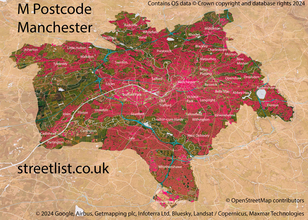
The M postcode area represents a group of postal districts in the Manchester area of the United Kingdom. The area code M stands for the letters m in Manchester. M has a population of 1,167,402 and covers an area of 384,967 hectares. Fun fact: 1.80% of the population of Great Britain lives in this area.
The postcode area falls within the following counties: Greater Manchester (100.00%), Cheshire (0.00%).
Post Towns and Postcode Districts for the M Postcode
-
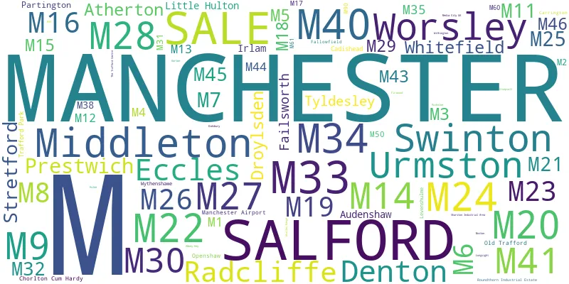
M1 Greater ManchesterM2 Greater ManchesterM3 Greater ManchesterM4 Greater ManchesterM8 Greater ManchesterM9 Greater ManchesterM11 Greater ManchesterM12 Greater ManchesterM13 Greater ManchesterM14 Greater ManchesterM15 Greater ManchesterM16 Greater ManchesterM17 Greater ManchesterM18 Greater ManchesterM19 Greater ManchesterM20 Greater ManchesterM21 Greater ManchesterM22 Greater ManchesterM23 Greater ManchesterM24 Greater ManchesterM25 Greater ManchesterM26 Greater ManchesterM27 Greater ManchesterM28 Greater ManchesterM29 Greater ManchesterM30 Greater ManchesterM31 Greater ManchesterM32 Greater ManchesterM34 Greater ManchesterM35 Greater ManchesterM38 Greater ManchesterM40 Greater ManchesterM41 Greater ManchesterM43 Greater ManchesterM44 Greater ManchesterM45 Greater ManchesterM46 Greater ManchesterM60 M61 M90 Greater ManchesterM99
Where is the M Postcode Area?
The Manchester M Postcode is in North West of England. The postal area borders the following neighbouring postal areas: WN - Wigan, SK - Stockport, OL - Oldham, WA - Warrington and BL - Bolton, and is located inland.
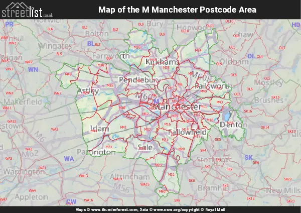
Map of the M Manchester Postcode Area
Explore the M Manchester postcode area by using our interactive map.

Postcode Districts within the M Manchester Postcode Area
There are 43 postcode districts within the Manchester postcode area
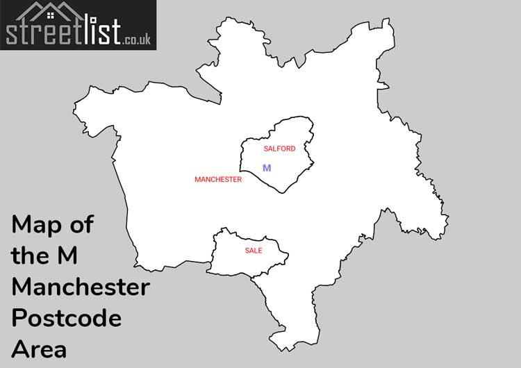
A map showing the boundary of in relation to other areas
There are 29 towns within the Manchester postcode area.

Manchester Area Code Overview
The Manchester postcode area comprises post towns of Manchester, Salford, and Sale, and the M for Manchester includes 48 postcode districts and 303 postcode sectors. The area serves Greater Manchester, and an interesting tidbit is the fictional town of Weatherfield from the iconic Coronation Street soap opera; it's located in Manchester M10.
Historical Evolution: Manchester Postcode Area in 1968
Purpose:
In 1968, Manchester adopted the Postcode system to modernize and hasten mail sorting. This revolutionary shift aimed at automating mail sorting, allowing machines to process 20,000 letters hourly.
Method:
An 18-member team dedicated two years to mapping every street in Manchester, as well as parts of Lancashire and Cheshire. This extensive effort resulted in a directory spanning 500,000 homes with 26,000 unique codes.
Public Awareness:
The initiative's success hinged on at least 80% of letters featuring the postcode. To achieve this, an extensive campaign sent leaflets to over half a million homes.
Coding Strategy:
Streets received codes based on their significance, and prominent businesses also earned unique codes.
Sorting Technology:
Letters with the postcode got marked with phosphorescent dots for machine readability. The "ALF" (Automatic Letter Facing machine) was also introduced to facilitate the process.
Envelope Standards:
Starting in autumn 1969, the Post Office set specific size criteria for envelopes to avail the lowest postage rates, with larger ones incurring higher charges.
Public Response:
While the majority appreciated the innovation, some resisted, particularly the two-tier mail pricing system set to begin in September.
Long-term Aspirations:
The ambition was to automate 80% of UK mail using the Postcode system within nine years.
Manchester's Trajectory:
As part of the second batch of cities, Manchester hoped to achieve full system integration by 1971, keeping up with the requirements of a modernizing society.
| Unit | Area² |
|---|---|
| Hectares | 384,967² |
| Miles | 1,486² |
| Feet | 41,437,462,913² |
| Kilometres | 3,850² |
Postal Delivery Offices serving the M Manchester Postcode Area
- Atherton Delivery Office
- Chorlton Delivery Office
- Denton Delivery Office
- Droylsden Delivery Office
- East Manchester Delivery Office
- Eccles Delivery Office
- Failsworth Delivery Office
- Irlam Delivery Office
- Levenshulme Delivery Office
- Manchester Delivery Office
- Manchester North Delivery Office
- Manchester South Delivery Office
- Middleton (m) Delivery Office
- North East (m) Delivery Office
- North West (m) Delivery Office
- Openshaw Delivery Office
- Prestwich Delivery Office
- Radcliffe Delivery Office
- Sale Delivery Office
- Salford Delivery Office
- South East (m) Delivery Office
- South West (m) Delivery Office
- Stretford Delivery Office
- Tyldesley Delivery Office
- Urmston Delivery Office
- Wythenshawe Delivery Office
Councils with Postcodes in M
Towns and Villages within the M Manchester Postcode Area
- Irlam - town
- Kearsley - town
- Leigh - town
- Little Hulton - Urban Area
- Little Lever - town
- Manchester - city
- Middleton - town
- New Manchester - village
- Old Trafford - Urban Area
- Oldham - town
- Outwood - village
- Partington - town
- Pendlebury - Urban Area
- Prestwich - Urban Area
- Radcliffe - town
- Reddish - Urban Area
- Rhodes - village
- Sale - town
- Salford - city
- Simister - village
- Slattocks - village
- Stockport - town
- Stretford - town
- Swinton - town
- Trafford Park - Urban Area
- Trub - village
- Tyldesley - town
- Urmston - town
- Walkden - town
- Wardley - village
- Whitefield - town
- Woodhouses - village
- Worsley - town
- Wythenshawe - Urban Area