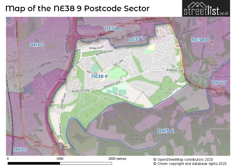
The NE38 9 postcode sector stands on the Durham and Tyne & Wear border.
Did you know? According to the 2021 Census, the NE38 9 postcode sector is home to a bustling 4,951 residents!
Given that each sector allows for 400 unique postcode combinations. Letters C, I, K, M, O and V are not allowed in the last two letters of a postcode. With 92 postcodes already in use, this leaves 308 units available.
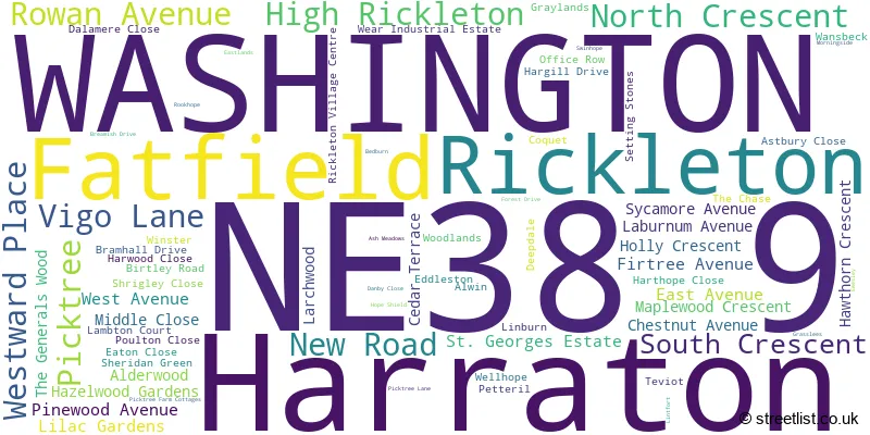
The largest settlement in the NE38 9 postal code is WASHINGTON followed by High Rickleton, and Picktree.
The NE38 9 Postcode shares a border with NE38 0 (WASHINGTON, Crowther), DH3 4 (Great Lumley, CHESTER LE STREET, Lambton Park), NE37 1 (WASHINGTON, Armstrong), NE38 8 (WASHINGTON, Pattinson Industrial Estate) and DH3 2 (Birtley, CHESTER LE STREET).
The sector is within the post town of WASHINGTON.
NE38 9 is a postcode sector within the NE3 postcode district which is within the NE Newcastle upon Tyne postcode area.
The Royal Mail delivery office for the NE38 9 postal sector is the unknown.
The area of the NE38 9 postcode sector is 1.27 square miles which is 3.29 square kilometres or 811.74 square acres.
The NE38 9 postcode sector is crossed by the A1M Major A road.
The NE38 9 postcode sector is crossed by the A167 Major A road.
Waterways within the NE38 9 postcode sector include the Wear.

Map of the NE38 9 Postcode Sector
Explore the NE38 9 postcode sector by using our free interactive map.
| N | E | 3 | 8 | - | 9 | X | X |
| N | E | 3 | 8 | Space | 9 | Letter | Letter |
Official List of Streets
WASHINGTON (62 Streets)
Picktree (2 Streets)
Unofficial Streets or Alternative Spellings
Penshaw
CHESTER ROADWASHINGTON
BONEMILL LANEBirtley
VIGO LANESchools and Places of Education Within the NE38 9 Postcode Sector
Rickleton Primary School
Community school
Vigo Lane, Washington, Tyne and Wear, NE38 9EZ
Head: Mrs Jan Price
Ofsted Rating: Good
Inspection: 2018-11-20 (2023 days ago)
Website: Visit Rickleton Primary School Website
Phone: 01914155050
Number of Pupils: 437
House Prices in the NE38 9 Postcode Sector
| Type of Property | 2018 Average | 2018 Sales | 2017 Average | 2017 Sales | 2016 Average | 2016 Sales | 2015 Average | 2015 Sales |
|---|---|---|---|---|---|---|---|---|
| Detached | £325,696 | 28 | £437,858 | 25 | £343,089 | 28 | £345,571 | 28 |
| Semi-Detached | £156,654 | 13 | £132,500 | 11 | £148,155 | 19 | £125,500 | 10 |
| Terraced | £95,430 | 20 | £97,180 | 15 | £97,500 | 17 | £108,385 | 26 |
| Flats | £47,500 | 1 | £0 | 0 | £67,250 | 2 | £57,750 | 4 |
Important Postcodes NE38 9 in the Postcode Sector
NE38 9EZ is the postcode for Rickleton Primary School, Vigo Lane
| The NE38 9 Sector is within these Local Authorities |
|
|---|---|
| The NE38 9 Sector is within these Counties |
|
| The NE38 9 Sector is within these Water Company Areas |
|