The NG9 1 postcode sector is within the county of Nottinghamshire.
Did you know? According to the 2021 Census, the NG9 1 postcode sector is home to a bustling 9,433 residents!
Given that each sector allows for 400 unique postcode combinations. Letters C, I, K, M, O and V are not allowed in the last two letters of a postcode. With 215 postcodes already in use, this leaves 185 units available.
The NG9 1 postal code covers the settlement of Beeston.
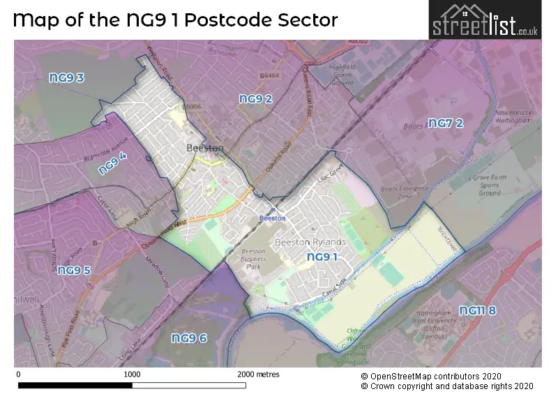
The NG9 1 Postcode shares a border with NG7 2 (NOTTINGHAM, Lenton, Lenton Lane Industrial Estate), NG9 2 (Beeston), NG9 4 (Beeston), NG9 5 (Beeston, Attenborough), NG11 8 (NOTTINGHAM, Clifton Village, Clifton), NG9 3 (Bramcote, Trowell, Beeston) and NG9 6 (Toton, Beeston, Attenborough).
The sector is within the post town of NOTTINGHAM.
NG9 1 is a postcode sector within the NG9 postcode district which is within the NG Nottingham postcode area.
The Royal Mail delivery office for the NG9 1 postal sector is the Beeston Delivery Office.
The area of the NG9 1 postcode sector is 1.16 square miles which is 3.01 square kilometres or 744.04 square acres.
Waterways within the NG9 1 postcode sector include the Nottingham Canal; Beeston Canal, River Trent.

Map of the NG9 1 Postcode Sector
Explore the NG9 1 postcode sector by using our free interactive map.
| N | G | 9 | - | 1 | X | X |
| N | G | 9 | Space | 1 | Letter | Letter |
Official List of Streets
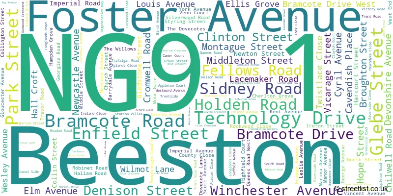
Beeston (129 Streets)
Unofficial Streets or Alternative Spellings
Beeston
ALWYN COURT APPLETON COURT BARTON WAY BRAMCOTE AVENUE CHARNWOOD AVENUE COMMERCIAL AVENUE HIGHFIELD COURT HOLLY LANE LINDEN GROVE NETHER STREET RIVERSIDE CLOSE SOVEREIGN COURT STATION ROAD STORNOWAY COURT THE PARRS THE SQUARE THORNDYKE CLOSE VENN COURT WATERLOO ROAD ALANS WAY AMBER ROAD CHESTNUT AVENUE EILEEN ROAD JAKE ROAD JOHNS ROAD LOCOMOTIVE WAY RAILCAR CLOSE RYAN WAY SLEEPER CLOSE THE MANOR WHEATSTONE GARDENSSchools and Places of Education Within the NG9 1 Postcode Sector
Beeston Rylands Junior School
Community school
Trent Road, Nottingham, Nottinghamshire, NG9 1LJ
Head: Mrs Catherine Turner
Ofsted Rating: Good
Inspection: 2023-11-15 (199 days ago)
Website: Visit Beeston Rylands Junior School Website
Phone: 01159178355
Number of Pupils: 180
Round Hill Primary School
Community school
Foster Avenue, Nottingham, Nottinghamshire, NG9 1AE
Head: Mr Adrian Nash
Ofsted Rating: Good
Inspection: 2023-06-15 (352 days ago)
Website: Visit Round Hill Primary School Website
Phone: 01159179262
Number of Pupils: 518
Trent Vale Infant School
Community school
Trent Road, Nottingham, Nottinghamshire, NG9 1LP
Head: Mrs Janine Barratt
Ofsted Rating: Good
Inspection: 2019-04-04 (1885 days ago)
Website: Visit Trent Vale Infant School Website
Phone: 01159179224
Number of Pupils: 182
House Prices in the NG9 1 Postcode Sector
| Type of Property | 2018 Average | 2018 Sales | 2017 Average | 2017 Sales | 2016 Average | 2016 Sales | 2015 Average | 2015 Sales |
|---|---|---|---|---|---|---|---|---|
| Detached | £326,500 | 21 | £299,355 | 19 | £311,118 | 25 | £260,128 | 26 |
| Semi-Detached | £228,690 | 92 | £221,059 | 73 | £190,771 | 81 | £169,928 | 71 |
| Terraced | £163,164 | 64 | £160,354 | 71 | £157,143 | 57 | £152,080 | 72 |
| Flats | £145,106 | 16 | £136,068 | 14 | £124,171 | 19 | £124,056 | 8 |
Important Postcodes NG9 1 in the Postcode Sector
NG9 1AB is the postcode for Broxtowe Borough Council, Town Hall, Foster Avenue, and Broxtowe Borough Council, Civic Offices
NG9 1AE is the postcode for Nottinghamshire County Council, County Library, Foster Avenue, Beeston, Round Hill Primary School, Foster Avenue, Beeston Library, Foster Avenue, Round Hill primary School, Foster Avenue, Beeston, and Nottinghamshire County Council, County Library, Foster Avenue
NG9 1GA is the postcode for The Manor Surgery, Middle Street
NG9 1GL is the postcode for Beeston Youth & Community Centre, West End, BEESTON YOUTH AND COMMUNITY CENTRE, WEST END, BEESTON, and Beeston Youth And Community Centre, West End
NG9 1GR is the postcode for Beeston Family Centre, Trevor Road
NG9 1LJ is the postcode for Rylands Junior School, Trent Road, and Rylands Junior School, Trent Road, Beeston
NG9 1LP is the postcode for Trent Vale Infant School, Trent Road, Beeston, and Trent Vale Infant School, Trent Road
| The NG9 1 Sector is within these Local Authorities |
|
|---|---|
| The NG9 1 Sector is within these Counties |
|
| The NG9 1 Sector is within these Water Company Areas |
|