The NP18 2 postcode sector is within the county of Gwent.
Did you know? According to the 2021 Census, the NP18 2 postcode sector is home to a bustling 7,036 residents!
Given that each sector allows for 400 unique postcode combinations. Letters C, I, K, M, O and V are not allowed in the last two letters of a postcode. With 167 postcodes already in use, this leaves 233 units available.
The largest settlement in the NP18 2 postal code is LANGSTONE followed by Llanmartin, and NEWPORT.
The NP18 2 Postcode shares a border with NP26 3 (UNDY, MAGOR, ROGIET), NP18 1 (CAERLEON, PONTHIR, NEWPORT), NP19 4 (NEWPORT, LLANWERN, FELNEX INDUSTRIAL ESTATE) and NP19 9 (NEWPORT).
The sector is within the post town of NEWPORT.
NP18 2 is a postcode sector within the NP18 postcode district which is within the NP Newport postcode area.
The Royal Mail delivery office for the NP18 2 postal sector is the Newport East Delivery Office.
The area of the NP18 2 postcode sector is 16.36 square miles which is 42.36 square kilometres or 10,467.26 square acres.


Map of the NP18 2 Postcode Sector
Explore the NP18 2 postcode sector by using our free interactive map.
| N | P | 1 | 8 | - | 2 | X | X |
| N | P | 1 | 8 | Space | 2 | Letter | Letter |
Official List of Streets
Llanmartin (18 Streets)
Langstone (46 Streets)
Bishton (2 Streets)
Llanwern (16 Streets)
Llandevaud (4 Streets)
Nash (7 Streets)
NEWPORT (8 Streets)
Unofficial Streets or Alternative Spellings
Kemeys Inferior
COED Y CAERAU LANELlanwern
PEN-Y-WAL DRIVENEWPORT
BEATTY ROAD ROYAL OAK DRIVEChristchurch
CATSASH ROADQueensway Meadows Industrial Estate
MEADOWS ROAD NASH MEAD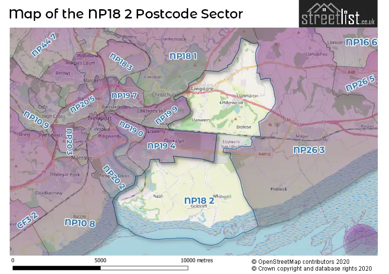
House Prices in the NP18 2 Postcode Sector
| Type of Property | 2018 Average | 2018 Sales | 2017 Average | 2017 Sales | 2016 Average | 2016 Sales | 2015 Average | 2015 Sales |
|---|---|---|---|---|---|---|---|---|
| Detached | £364,709 | 56 | £339,849 | 77 | £332,011 | 73 | £291,121 | 84 |
| Semi-Detached | £226,088 | 18 | £181,540 | 21 | £164,442 | 19 | £167,688 | 21 |
| Terraced | £156,130 | 22 | £119,426 | 31 | £116,136 | 22 | £148,457 | 21 |
| Flats | £0 | 0 | £0 | 0 | £0 | 0 | £0 | 0 |
Important Postcodes NP18 2 in the Postcode Sector
NP18 2EY is the postcode for Underwood Leisure Centre, Waltwood Road
NP18 2HB is the postcode for Llanmartin Primary School, Waltwood Road
NP18 2JU is the postcode for Langstone Junior & Infant School, Old Roman Road
NP18 2LH is the postcode for Columbus House, Langstone Park, Langstone Business Village, Langstone, and Columbus House, Langstone Business Village, Langstone Park
NP18 2LN is the postcode for Ysgol Gymraeg Casnewydd, Hartridge Farm Road
NP18 2YE is the postcode for Llanwern High School, Hartridge Farm Road, LOWER SCHOOL, Hartridge Comprehensive School, Hartridge Farm Road, UPPER SCHOOL, Hartridge Comprehensive School, Hartridge Farm Road, and MIDDLE SCHOOL, Hartridge Comprehensive School, Hartridge Farm Road
| The NP18 2 Sector is within these Local Authorities |
|
|---|---|
| The NP18 2 Sector is within these Counties |
|
| The NP18 2 Sector is within these Water Company Areas |
|
Tourist Attractions within the NP18 2 Postcode Area
We found 1 visitor attractions within the NP18 postcode area
| Newport Wetlands Nature Reserve |
|---|
| View Newport Wetlands Nature Reserve on Google Maps |