The NP18 3 postcode sector is within the county of Gwent.
Did you know? According to the 2021 Census, the NP18 3 postcode sector is home to a bustling 5,401 residents!
Given that each sector allows for 400 unique postcode combinations. Letters C, I, K, M, O and V are not allowed in the last two letters of a postcode. With 141 postcodes already in use, this leaves 259 units available.
The largest settlements in the NP18 3 postal code are CAERLEON and NEWPORT.
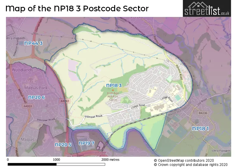
The NP18 3 Postcode shares a border with NP18 1 (CAERLEON, PONTHIR, NEWPORT), NP44 3 (LLANTARNAM, CWMBRAN, Oakfield), NP19 7 (NEWPORT), NP20 5 (NEWPORT) and NP20 6 (NEWPORT, MALPAS).
The sector is within the post town of NEWPORT.
NP18 3 is a postcode sector within the NP18 postcode district which is within the NP Newport postcode area.
The Royal Mail delivery office for the NP18 3 postal sector is the Newport East Delivery Office.
The area of the NP18 3 postcode sector is 1.89 square miles which is 4.88 square kilometres or 1,206.67 square acres.

Map of the NP18 3 Postcode Sector
Explore the NP18 3 postcode sector by using our free interactive map.
| N | P | 1 | 8 | - | 3 | X | X |
| N | P | 1 | 8 | Space | 3 | Letter | Letter |
Official List of Streets
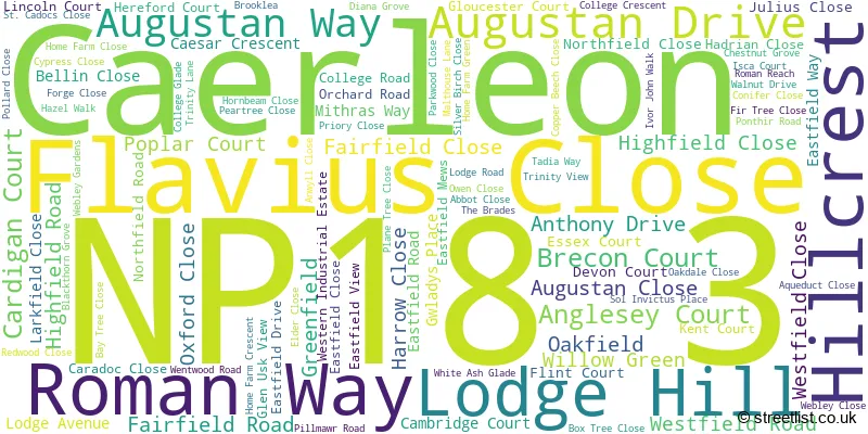
Caerleon (102 Streets)
Unofficial Streets or Alternative Spellings
House Prices in the NP18 3 Postcode Sector
| Type of Property | 2018 Average | 2018 Sales | 2017 Average | 2017 Sales | 2016 Average | 2016 Sales | 2015 Average | 2015 Sales |
|---|---|---|---|---|---|---|---|---|
| Detached | £329,976 | 23 | £258,248 | 61 | £259,028 | 52 | £232,067 | 30 |
| Semi-Detached | £185,460 | 40 | £190,702 | 32 | £153,297 | 43 | £154,773 | 20 |
| Terraced | £178,543 | 21 | £154,400 | 26 | £137,936 | 14 | £121,473 | 22 |
| Flats | £101,056 | 9 | £102,417 | 6 | £103,333 | 3 | £91,143 | 7 |
Important Postcodes NP18 3 in the Postcode Sector
NP18 3BY is the postcode for Lodge Hill Junior School, Lodge Hill
NP18 3QT is the postcode for LIBRARY, University of Wales, Newport, Caerleon Campus, MAIN BUILDING, University of Wales, Newport, Caerleon Campus, SPORTS CENTRE, University of Wales, Newport, Caerleon Campus, KEGIE BUILDING, University of Wales, Newport, Caerleon Campus, RATHMELL BUILDING, University of Wales, Newport, Caerleon Campus, ABERGAVENNY HALLS OF RESIDENCE, University of Wales, Newport, Caerleon Campus, University of Wales, Newport, Caerleon Campus, I B JOHN BUILDING, University of Wales, Newport, Caerleon Campus, and EDWARD ANWYL BUILDING, University of Wales, Newport, Caerleon Campus
NP18 3QZ is the postcode for Eleanor Hodson House, Pillmawr Road
NP18 3XQ is the postcode for HEADQUARTERS BUILDING, Aneurin Bevan Health Board, St. Cadocs Hospital, Lodge Road, Aneurin Bevan Health Board, St. Cadocs Hospital, Lodge Road, and TY BRYN CAMHS, Aneurin Bevan Health Board, St. Cadocs Hospital, Lodge Road
| The NP18 3 Sector is within these Local Authorities |
|
|---|---|
| The NP18 3 Sector is within these Counties |
|
| The NP18 3 Sector is within these Water Company Areas |
|