The NW5 4 postcode sector is within the county of Greater London.
Did you know? According to the 2021 Census, the NW5 4 postcode sector is home to a bustling 8,129 residents!
Given that each sector allows for 400 unique postcode combinations. Letters C, I, K, M, O and V are not allowed in the last two letters of a postcode. With 144 postcodes already in use, this leaves 256 units available.
The NW5 4 postal code covers the settlement of LONDON .
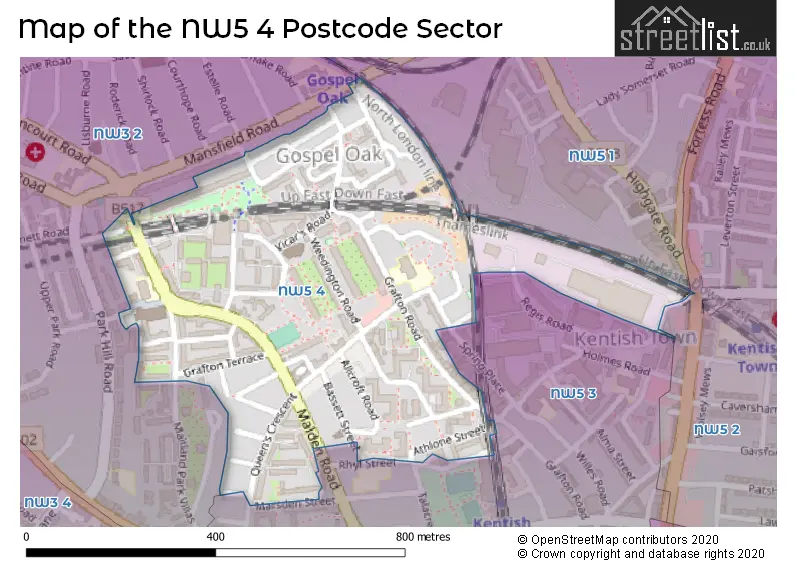
The NW5 4 Postcode shares a border with NW5 3 (LONDON ), NW5 1 (LONDON , ISLINGTON ), NW3 2 (LONDON ) and NW5 2 (LONDON ).
The sector is within the post town of LONDON.
NW5 4 is a postcode sector within the NW5 postcode district which is within the NW North West London postcode area.
The Royal Mail delivery office for the NW5 4 postal sector is the Kentish Town Sdelivery Office.
The area of the NW5 4 postcode sector is 0.20 square miles which is 0.51 square kilometres or 125.58 square acres.

Map of the NW5 4 Postcode Sector
Explore the NW5 4 postcode sector by using our free interactive map.
| N | W | 5 | - | 4 | X | X |
| N | W | 5 | Space | 4 | Letter | Letter |
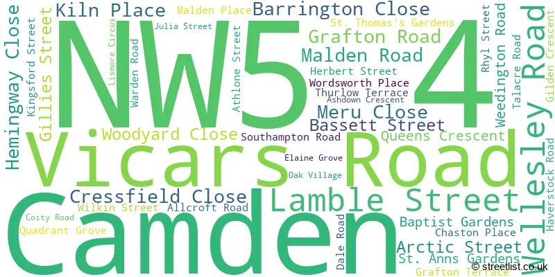
Official List of Streets
Camden (43 Streets)
Unofficial Streets or Alternative Spellings
House Prices in the NW5 4 Postcode Sector
| Type of Property | 2018 Average | 2018 Sales | 2017 Average | 2017 Sales | 2016 Average | 2016 Sales | 2015 Average | 2015 Sales |
|---|---|---|---|---|---|---|---|---|
| Detached | £0 | 0 | £0 | 0 | £0 | 0 | £0 | 0 |
| Semi-Detached | £0 | 0 | £0 | 0 | £0 | 0 | £0 | 0 |
| Terraced | £1,150,500 | 8 | £1,197,778 | 9 | £946,000 | 8 | £1,127,545 | 11 |
| Flats | £499,487 | 38 | £519,093 | 43 | £545,642 | 61 | £490,329 | 53 |
Important Postcodes NW5 4 in the Postcode Sector
NW5 4AX is the postcode for Carlton Primary School, 196 Grafton Road, and MAIN BUILDING, Carlton Primary School, 196 Grafton Road
NW5 4HH is the postcode for London Borough of Camden, Queens Crescent Branch Library, 165 Queens Crescent
NW5 4JS is the postcode for St DominicG��s Catholic Primary School, Southampton Road, and St. Dominics Primary School, Southampton Road
NW5 4NU is the postcode for 170, Weedington Road
NW5 4PA is the postcode for London Borough of Camden, 115 Wellesley Road
NW5 4PN is the postcode for Wellesley Road Home for Older People, 1 Wellesley Road
NW5 4SA is the postcode for Hawkridge, Warden Road, and HAWKRIDGE ANNEX, Hawkridge, Warden Road
| The NW5 4 Sector is within these Local Authorities |
|
|---|---|
| The NW5 4 Sector is within these Counties |
|
| The NW5 4 Sector is within these Water Company Areas |
|
Tourist Attractions within the NW5 4 Postcode Area
We found 1 visitor attractions within the NW5 postcode area
| Kentish Town City Farm |
|---|
| Farms |
| Farm / Rare Breeds / Farm Animals |
| View Kentish Town City Farm on Google Maps |