Given that each sector allows for 400 unique postcode combinations. Letters C, I, K, M, O and V are not allowed in the last two letters of a postcode. With 176 postcodes already in use, this leaves 224 units available.
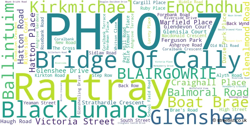
The largest settlement in the PH10 7 postal code is Rattray followed by Bridge Of Cally, and Kirkmichael.
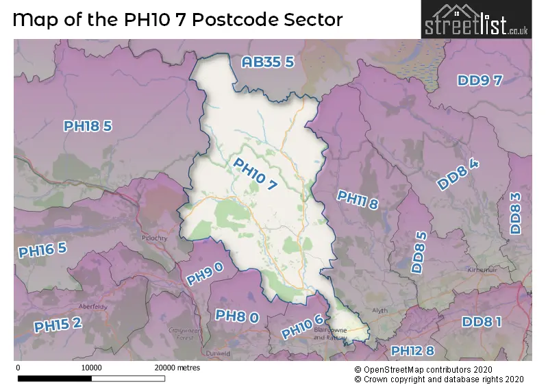
The PH10 7 Postcode shares a border with PH18 5 (Blair Atholl, Calvine, Bridge Of Tilt), PH9 0 (Ballinluig, Strathtay, Logierait), PH10 6 (BLAIRGOWRIE, Kinloch), PH11 8 (Alyth, Glenisla, Kilry), PH13 9 (Coupar Angus, Burrelton, Kettins), PH16 5 (PITLOCHRY, Kinloch Rannoch, Killiecrankie), PH8 0 (DUNKELD, Birnam, Amulree) and AB35 5 (BALLATER, Braemar, Crathie).
The sector is within the post town of BLAIRGOWRIE.
PH10 7 is a postcode sector within the PH10 postcode district which is within the PH Perth postcode area.
The Royal Mail delivery office for the PH10 7 postal sector is the Blairgowrie Delivery Office.
The area of the PH10 7 postcode sector is 187.30 square miles which is 485.10 square kilometres or 119,870.48 square acres.

Map of the PH10 7 Postcode Sector
Explore the PH10 7 postcode sector by using our free interactive map.
| P | H | 1 | 0 | - | 7 | X | X |
| P | H | 1 | 0 | Space | 7 | Letter | Letter |
Official List of Streets
Rattray (61 Streets)
Kirkmichael (4 Streets)
BLAIRGOWRIE (1 Streets)
Unofficial Streets or Alternative Spellings
Weather Forecast for PH10 7
Press Button to Show Forecast for Creag Leacach
| Time Period | Icon | Description | Temperature | Rain Probability | Wind |
|---|---|---|---|---|---|
| 06:00 to 09:00 | Fog | 2.0°C (feels like -3.0°C) | 27.00% | SSE 16 mph | |
| 09:00 to 12:00 | Heavy rain | 3.0°C (feels like -2.0°C) | 78.00% | SE 20 mph | |
| 12:00 to 15:00 | Drizzle | 5.0°C (feels like 0.0°C) | 45.00% | SE 22 mph | |
| 15:00 to 18:00 | Partly cloudy (day) | 6.0°C (feels like 1.0°C) | 11.00% | SE 22 mph | |
| 18:00 to 21:00 | Partly cloudy (day) | 5.0°C (feels like 0.0°C) | 7.00% | ESE 20 mph | |
| 21:00 to 00:00 | Cloudy | 3.0°C (feels like -2.0°C) | 13.00% | ESE 16 mph |
Press Button to Show Forecast for Creag Leacach
| Time Period | Icon | Description | Temperature | Rain Probability | Wind |
|---|---|---|---|---|---|
| 00:00 to 03:00 | Cloudy | 3.0°C (feels like -1.0°C) | 13.00% | E 13 mph | |
| 03:00 to 06:00 | Light rain | 3.0°C (feels like -1.0°C) | 45.00% | ENE 11 mph | |
| 06:00 to 09:00 | Mist | 3.0°C (feels like -1.0°C) | 22.00% | E 11 mph | |
| 09:00 to 12:00 | Cloudy | 5.0°C (feels like 2.0°C) | 13.00% | ESE 11 mph | |
| 12:00 to 15:00 | Cloudy | 8.0°C (feels like 5.0°C) | 13.00% | SE 11 mph | |
| 15:00 to 18:00 | Cloudy | 9.0°C (feels like 7.0°C) | 10.00% | ESE 9 mph | |
| 18:00 to 21:00 | Cloudy | 8.0°C (feels like 6.0°C) | 9.00% | E 9 mph | |
| 21:00 to 00:00 | Mist | 5.0°C (feels like 2.0°C) | 14.00% | NE 9 mph |
Press Button to Show Forecast for Creag Leacach
| Time Period | Icon | Description | Temperature | Rain Probability | Wind |
|---|---|---|---|---|---|
| 00:00 to 03:00 | Mist | 5.0°C (feels like 2.0°C) | 14.00% | NNE 11 mph | |
| 03:00 to 06:00 | Mist | 4.0°C (feels like 1.0°C) | 15.00% | NNE 11 mph | |
| 06:00 to 09:00 | Mist | 5.0°C (feels like 1.0°C) | 13.00% | NNE 13 mph | |
| 09:00 to 12:00 | Mist | 7.0°C (feels like 3.0°C) | 13.00% | NE 16 mph | |
| 12:00 to 15:00 | Cloudy | 9.0°C (feels like 6.0°C) | 4.00% | NE 13 mph | |
| 15:00 to 18:00 | Partly cloudy (day) | 10.0°C (feels like 8.0°C) | 2.00% | NE 11 mph | |
| 18:00 to 21:00 | Partly cloudy (day) | 8.0°C (feels like 5.0°C) | 1.00% | NE 11 mph | |
| 21:00 to 00:00 | Mist | 5.0°C (feels like 1.0°C) | 12.00% | NE 11 mph |
| The PH10 7 Sector is within these Local Authorities | |
|---|---|
| The PH10 7 Sector is within these Counties | |
| The PH10 7 Sector is within these Water Company Areas |