The PO20 8 postcode sector is within the county of West Sussex.
Did you know? According to the 2021 Census, the PO20 8 postcode sector is home to a bustling 7,616 residents!
Given that each sector allows for 400 unique postcode combinations. Letters C, I, K, M, O and V are not allowed in the last two letters of a postcode. With 232 postcodes already in use, this leaves 168 units available.
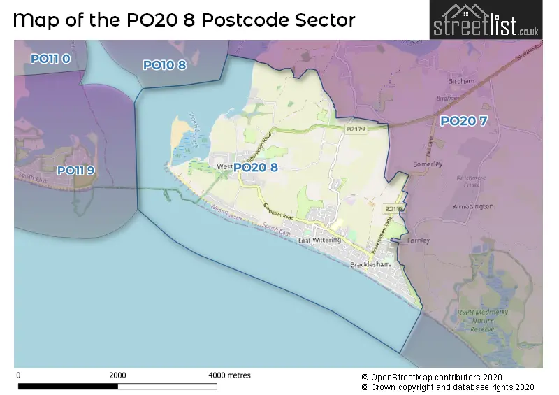
The largest settlement in the PO20 8 postal code is West Wittering followed by Bracklesham Bay, and East Wittering.
The PO20 8 Postcode shares a border with PO20 7 (Birdham, Sidlesham, CHICHESTER).
The sector is within the post town of CHICHESTER.
PO20 8 is a postcode sector within the PO20 postcode district which is within the PO Portsmouth postcode area.
The Royal Mail delivery office for the PO20 8 postal sector is the Chichester Delivery Office.
The area of the PO20 8 postcode sector is 4.61 square miles which is 11.94 square kilometres or 2,950.51 square acres.

Map of the PO20 8 Postcode Sector
Explore the PO20 8 postcode sector by using our free interactive map.
| P | O | 2 | 0 | - | 8 | X | X |
| P | O | 2 | 0 | Space | 8 | Letter | Letter |
Official List of Streets
West Wittering (64 Streets)
Bracklesham Bay (52 Streets)
East Wittering (46 Streets)
Unofficial Streets or Alternative Spellings
Schools and Places of Education Within the PO20 8 Postcode Sector
East Wittering Community Primary School
Community school
Stocks Lane, Chichester, West Sussex, PO20 8NH
Head: Mrs Justine Brooks
Ofsted Rating: Good
Inspection: 2023-03-22 (441 days ago)
Website: Visit East Wittering Community Primary School Website
Phone: 01243672208
Number of Pupils: 294
West Wittering Parochial Church of England School
Voluntary controlled school
Pound Road, Chichester, West Sussex, PO20 8AJ
Head: Mr Nicholas Matthews
Ofsted Rating: Good
Inspection: 2022-10-19 (595 days ago)
Website: Visit West Wittering Parochial Church of England School Website
Phone: 01243513015
Number of Pupils: 102
House Prices in the PO20 8 Postcode Sector
| Type of Property | 2018 Average | 2018 Sales | 2017 Average | 2017 Sales | 2016 Average | 2016 Sales | 2015 Average | 2015 Sales |
|---|---|---|---|---|---|---|---|---|
| Detached | £595,592 | 106 | £661,144 | 82 | £573,009 | 94 | £520,285 | 111 |
| Semi-Detached | £325,956 | 35 | £337,982 | 38 | £340,892 | 38 | £270,517 | 47 |
| Terraced | £315,458 | 12 | £253,341 | 16 | £321,718 | 20 | £231,312 | 23 |
| Flats | £237,611 | 36 | £249,490 | 29 | £209,219 | 36 | £193,427 | 26 |
Important Postcodes PO20 8 in the Postcode Sector
PO20 8AJ is the postcode for West Wittering Parochial School, Pound Road
PO20 8BH is the postcode for Medical Centre, Cakeham Road, and Medical Centre, Cakeham Road, East Wittering
PO20 8NH is the postcode for MAIN BUILDING, East Wittering County Primary School, Stocks Lane
| The PO20 8 Sector is within these Local Authorities |
|
|---|---|
| The PO20 8 Sector is within these Counties |
|
| The PO20 8 Sector is within these Water Company Areas |
|