The RH2 9 postcode sector is within the county of Surrey.
Did you know? According to the 2021 Census, the RH2 9 postcode sector is home to a bustling 4,503 residents!
Given that each sector allows for 400 unique postcode combinations. Letters C, I, K, M, O and V are not allowed in the last two letters of a postcode. With 162 postcodes already in use, this leaves 238 units available.
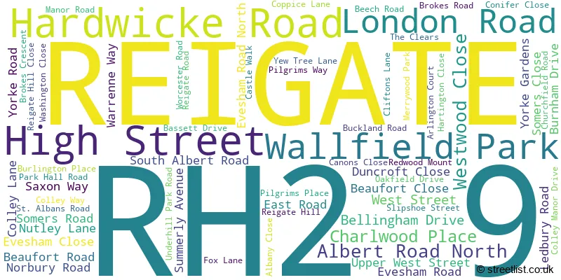
The largest settlements in the RH2 9 postal code are REIGATE and BUCKLAND.
The RH2 9 Postcode shares a border with RH2 0 (REIGATE), RH2 7 (REIGATE), KT20 7 (WALTON ON THE HILL, TADWORTH, LOWER KINGSWOOD), RH2 8 (REIGATE, Leigh, Sidlow), RH3 7 (Brockham, BETCHWORTH, BUCKLAND) and KT20 6 (KINGSWOOD, LOWER KINGSWOOD, BURGH HEATH).
The sector is within the post town of REIGATE.
RH2 9 is a postcode sector within the RH2 postcode district which is within the RH Redhill postcode area.
The Royal Mail delivery office for the RH2 9 postal sector is the Reigate Delivery Office.
The area of the RH2 9 postcode sector is 1.80 square miles which is 4.67 square kilometres or 1,154.86 square acres.
The RH2 9 postcode sector is crossed by the M25 motorway.

Map of the RH2 9 Postcode Sector
Explore the RH2 9 postcode sector by using our free interactive map.
| R | H | 2 | - | 9 | X | X |
| R | H | 2 | Space | 9 | Letter | Letter |
Official List of Streets
REIGATE (64 Streets)
Unofficial Streets or Alternative Spellings
REIGATE
ARLINGTON COURT BELL STREET CASTLEFIELD ROAD CHURCH STREET FRITHS DRIVE HOLMESDALE ROAD PARK LANE RAGLAN ROAD RUSHWORTH ROAD WRAY LANEMerstham
GATTON BOTTOM BEAUFORT MUSE BREWERY YARD CAGE YARD CHESTERFIELD PARK COLLEY MANOR LANE FORT LANE HOWARD PLACE SOMERS PLACE THE LANE WEST WOOD CLOSELower Kingswood
MARGERY WOOD LANELeigh
FLANCHFORD ROADBuckland
REIGATE ROAD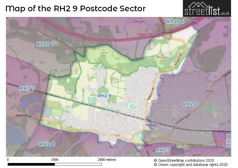
House Prices in the RH2 9 Postcode Sector
| Type of Property | 2018 Average | 2018 Sales | 2017 Average | 2017 Sales | 2016 Average | 2016 Sales | 2015 Average | 2015 Sales |
|---|---|---|---|---|---|---|---|---|
| Detached | £1,024,011 | 23 | £1,143,190 | 26 | £1,326,381 | 15 | £1,095,084 | 18 |
| Semi-Detached | £730,059 | 17 | £665,654 | 13 | £601,130 | 15 | £584,552 | 24 |
| Terraced | £474,000 | 17 | £526,319 | 29 | £510,250 | 20 | £500,374 | 27 |
| Flats | £288,740 | 26 | £366,101 | 42 | £297,905 | 54 | £279,138 | 44 |
Important Postcodes RH2 9 in the Postcode Sector
RH2 9HG is the postcode for Doctors Surgery, The Wall House, Yorke Road
RH2 9LH is the postcode for Park Hall Resource Centre, 1 Park Hall Road
| The RH2 9 Sector is within these Local Authorities |
|
|---|---|
| The RH2 9 Sector is within these Counties |
|
| The RH2 9 Sector is within these Water Company Areas |
|