The RH4 3 postcode sector is within the county of Surrey.
Did you know? According to the 2021 Census, the RH4 3 postcode sector is home to a bustling 5,498 residents!
Given that each sector allows for 400 unique postcode combinations. Letters C, I, K, M, O and V are not allowed in the last two letters of a postcode. With 186 postcodes already in use, this leaves 214 units available.
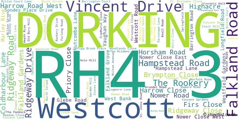
The largest settlements in the RH4 3 postal code are DORKING and Westcott.
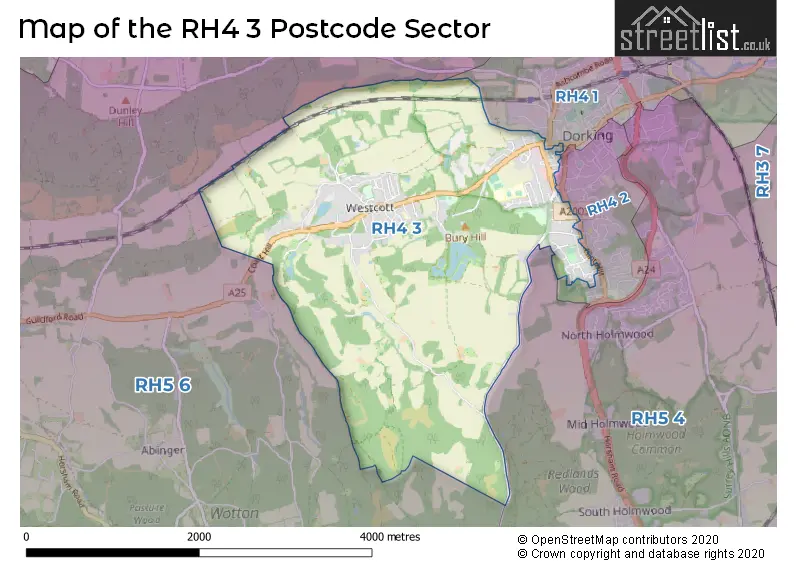
The RH4 3 Postcode shares a border with RH4 2 (DORKING), RH4 1 (DORKING, Pixham), RH5 4 (Beare Green, North Holmwood, DORKING) and RH5 6 (Holmbury St. Mary, Abinger Hammer, Mickleham).
The sector is within the post town of DORKING.
RH4 3 is a postcode sector within the RH4 postcode district which is within the RH Redhill postcode area.
The Royal Mail delivery office for the RH4 3 postal sector is the Dorking Delivery Office.
The area of the RH4 3 postcode sector is 4.85 square miles which is 12.56 square kilometres or 3,103.47 square acres.

Map of the RH4 3 Postcode Sector
Explore the RH4 3 postcode sector by using our free interactive map.
| R | H | 4 | - | 3 | X | X |
| R | H | 4 | Space | 3 | Letter | Letter |
Official List of Streets
DORKING (48 Streets)
Westcott (40 Streets)
Unofficial Streets or Alternative Spellings
DORKING
CLIFTONVILLE FLINT HILL HARROW ROAD EAST ORCHARD ROAD SOUTH STREET TOLLGATE ROAD TOWER HILL ROAD WEST STREET BOAR HILL BROOMHURST COURT BW 111 BW 123 BW 125 BW 126 BW 129 BW 571 EBBSHAM CLOSE FP 114 FP 115 FP 116 FP 117 FP 124 FP 127 FP 129 FP 163 FP 600 FP 602 FP102 FP103 FP572 HANOVER COURT JUNCTION MEWS JUNCTION PLACE CUT-THROUGH LINCE LANE BW 109 MCPHERSONS MOUNT MILTON COURT LANE (BW 110) MILTON WAY MILTONCOURT LANE PILGRIMS WAY PLEDGES YARD RIVER BANK SONDES FARM SONDES PLACE ST JOHNS COURT SUMMER LIGHTNING SUN ROW THE COURTYARD THE POUND THE STRUGGLE WOLVENS LANESchools and Places of Education Within the RH4 3 Postcode Sector
St Joseph's Catholic Primary School
Voluntary aided school
Norfolk Road, Dorking, Surrey, RH4 3JA
Head: Miss Carolyn Scrutton
Ofsted Rating: Good
Inspection: 2023-03-29 (421 days ago)
Website: Visit St Joseph's Catholic Primary School Website
Phone: 01306883934
Number of Pupils: 175
Surrey Hills All Saints Primary School
Academy sponsor led
School Lane, Dorking, , RH4 3QF
Head: Mrs Jacky Fyson
Ofsted Rating: Requires improvement
Inspection: 2023-03-22 (428 days ago)
Website: Visit Surrey Hills All Saints Primary School Website
Phone: 01306881136
Number of Pupils: 153
The Priory CofE Voluntary Aided School
Voluntary aided school
West Bank, Dorking, Surrey, RH4 3DG
Head: Mrs Jo Trimnell
Ofsted Rating: Good
Inspection: 2019-03-13 (1898 days ago)
Website: Visit The Priory CofE Voluntary Aided School Website
Phone: 01306887337
Number of Pupils: 645
House Prices in the RH4 3 Postcode Sector
| Type of Property | 2018 Average | 2018 Sales | 2017 Average | 2017 Sales | 2016 Average | 2016 Sales | 2015 Average | 2015 Sales |
|---|---|---|---|---|---|---|---|---|
| Detached | £748,240 | 25 | £822,682 | 36 | £966,757 | 23 | £798,462 | 26 |
| Semi-Detached | £541,831 | 26 | £534,815 | 27 | £595,998 | 27 | £547,346 | 31 |
| Terraced | £479,813 | 16 | £463,517 | 13 | £494,607 | 28 | £364,170 | 22 |
| Flats | £384,552 | 15 | £274,389 | 18 | £301,300 | 30 | £229,357 | 28 |
Important Postcodes RH4 3 in the Postcode Sector
RH4 3DF is the postcode for Powell Corderoy Primary School, Longfield Road
RH4 3DG is the postcode for DOME BUILDING, The Priory School, West Bank, The Priory School, West Bank, and MAIN BUILDING, The Priory School, West Bank
RH4 3JA is the postcode for St. Josephs RC Primary School, Norfolk Road
RH4 3QF is the postcode for Surrey Hills Primary C of E School, School Lane, Westcott, and Surrey Hills Primary C of E School, School Lane
| The RH4 3 Sector is within these Local Authorities |
|
|---|---|
| The RH4 3 Sector is within these Counties |
|
| The RH4 3 Sector is within these Water Company Areas |
|