The RH5 6 postcode sector is within the county of Surrey.
Did you know? According to the 2021 Census, the RH5 6 postcode sector is home to a bustling 3,970 residents!
Given that each sector allows for 400 unique postcode combinations. Letters C, I, K, M, O and V are not allowed in the last two letters of a postcode. With 194 postcodes already in use, this leaves 206 units available.
The largest settlement in the RH5 6 postal code is Holmbury St. Mary followed by Abinger Hammer, and Mickleham.
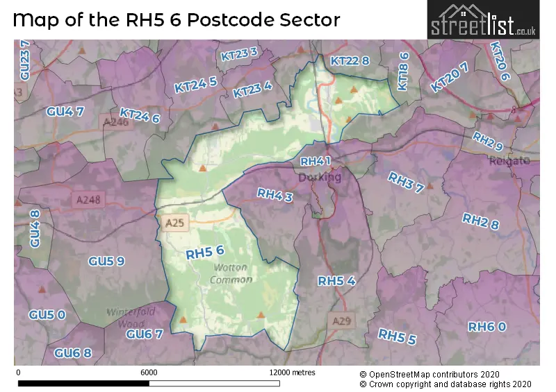
The RH5 6 Postcode shares a border with GU5 9 (Albury, Shere, Gomshall), KT20 7 (WALTON ON THE HILL, TADWORTH, LOWER KINGSWOOD), KT22 9 (FETCHAM), RH4 1 (DORKING, Pixham), RH4 3 (DORKING, Westcott), RH5 4 (Beare Green, North Holmwood, DORKING), RH5 5 (Newdigate, Capel, Ockley), GU6 7 (CRANLEIGH, Ewhurst), KT22 8 (LEATHERHEAD, ASHTEAD), KT18 6 (EPSOM , HEADLEY , ASHTEAD ), KT23 4 (Great Bookham, Little Bookham, BOOKHAM) and KT24 5 (Effingham, East Horsley, EFFINGHAM JUNCTION).
The sector is within the post town of DORKING.
RH5 6 is a postcode sector within the RH5 postcode district which is within the RH Redhill postcode area.
The Royal Mail delivery office for the RH5 6 postal sector is the Dorking Delivery Office.
The area of the RH5 6 postcode sector is 22.90 square miles which is 59.32 square kilometres or 14,658.09 square acres.
Waterways within the RH5 6 postcode sector include the River Mole, Tillingbourne.

Map of the RH5 6 Postcode Sector
Explore the RH5 6 postcode sector by using our free interactive map.
| R | H | 5 | - | 6 | X | X |
| R | H | 5 | Space | 6 | Letter | Letter |
Official List of Streets
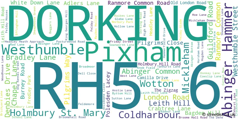
Abinger Common (11 Streets)
Abinger Hammer (20 Streets)
Westhumble (9 Streets)
Coldharbour (2 Streets)
DORKING (9 Streets)
Wotton (5 Streets)
Mickleham (13 Streets)
Holmbury St. Mary (10 Streets)
Ranmore Common (4 Streets)
Pixham (1 Streets)
Unofficial Streets or Alternative Spellings
LEATHERHEAD
DORKING ROADFetcham
YOUNG STREETDORKING
COLDHARBOUR LANE RANMORE ROADAbinger Hammer
RAIKES HOLLOWWesthumble
BAGDEN HILLGreat Bookham
CHAPEL LANE POLESDEN ROADEffingham
BEECH AVENUE HIGH BARN ROADEwhurst
HOLMBURY ROADWestcott
COAST HILLEast Horsley
CROCKNORTH ROAD HONEYSUCKLE BOTTOMSchools and Places of Education Within the RH5 6 Postcode Sector
St Michael's CofE Aided Infant School
Voluntary aided school
School Lane, Dorking, Surrey, RH5 6EW
Head: Mrs Paula Bliss/ Mrs Nicola Cleather
Ofsted Rating: Good
Inspection: 2022-04-26 (732 days ago)
Website: Visit St Michael's CofE Aided Infant School Website
Phone: 01372373717
Number of Pupils: 59
House Prices in the RH5 6 Postcode Sector
| Type of Property | 2018 Average | 2018 Sales | 2017 Average | 2017 Sales | 2016 Average | 2016 Sales | 2015 Average | 2015 Sales |
|---|---|---|---|---|---|---|---|---|
| Detached | £933,722 | 27 | £1,122,599 | 24 | £1,034,769 | 26 | £1,005,398 | 27 |
| Semi-Detached | £621,313 | 8 | £624,000 | 6 | £599,629 | 14 | £548,337 | 19 |
| Terraced | £688,333 | 3 | £652,500 | 2 | £363,846 | 6 | £490,000 | 3 |
| Flats | £418,500 | 1 | £365,000 | 3 | £198,500 | 3 | £540,000 | 1 |
Important Postcodes RH5 6 in the Postcode Sector
RH5 6DQ is the postcode for High Ashurst Outdoor Education Centre, High Ashurst, Headley Lane
RH5 6EW is the postcode for ST MICHAEL'S C OF E (A) INFANT SCHOOL, Mickleham School, School Lane
RH5 6HZ is the postcode for Surrey Hills School, Abinger Lane
RH5 6NT is the postcode for Ariel House, Mullard Space Science Laboratory, Holmbury House, THE "NU" BUILDING, Mullard Space Science Laboratory, Holmbury House, MAIN BUILDING, Mullard Space Science Laboratory, Holmbury House, and Stable Block, Mullard Space Science Laboratory, Holmbury House
| The RH5 6 Sector is within these Local Authorities |
|
|---|---|
| The RH5 6 Sector is within these Counties |
|
| The RH5 6 Sector is within these Water Company Areas |
|
Tourist Attractions within the RH5 6 Postcode Area
We found 2 visitor attractions within the RH5 postcode area
| Leith Hill Place |
|---|
| Historic Properties |
| Historic House / House and Garden / Palace |
| View Leith Hill Place on Google Maps |
| Polesden Lacey |
| Historic Properties |
| Historic House / House and Garden / Palace |
| View Polesden Lacey on Google Maps |