The S25 1 postcode sector is within the county of South Yorkshire.
Did you know? According to the 2021 Census, the S25 1 postcode sector is home to a bustling 1,157 residents!
Given that each sector allows for 400 unique postcode combinations. Letters C, I, K, M, O and V are not allowed in the last two letters of a postcode. With 36 postcodes already in use, this leaves 364 units available.
The S25 1 postal code covers the settlement of Laughton.
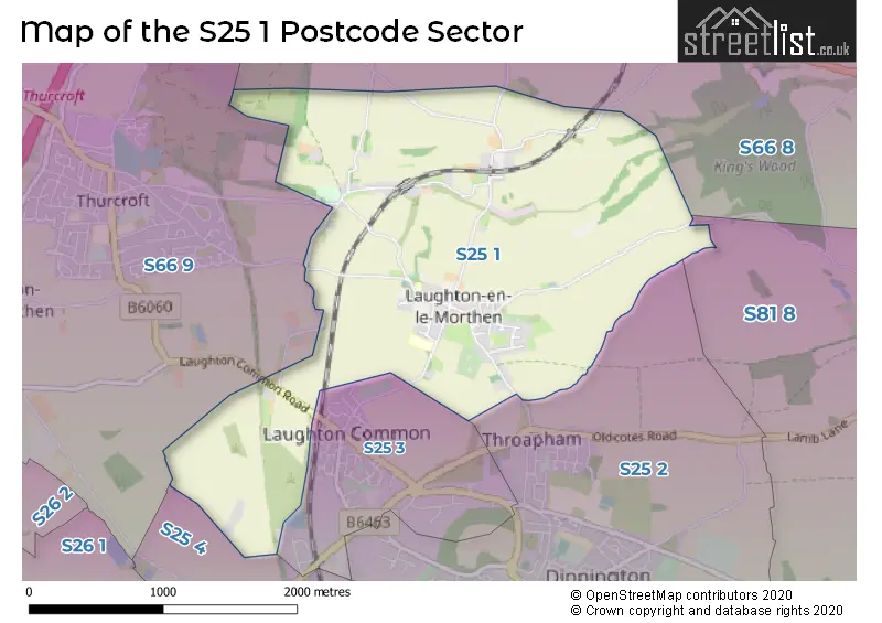
The S25 1 Postcode shares a border with S25 3 (Dinnington), S25 4 (North Anston), S66 8 (Maltby, Hellaby, Hooton Levitt), S66 9 (Thurcroft, Brampton-en-le-Morthen, Morthen), S25 2 (Dinnington) and S81 8 (Shireoaks, Gateford, Blyth).
The sector is within the post town of SHEFFIELD.
S25 1 is a postcode sector within the S25 postcode district which is within the S Sheffield postcode area.
The Royal Mail delivery office for the S25 1 postal sector is the Dinnington Delivery Office.
The area of the S25 1 postcode sector is 2.63 square miles which is 6.82 square kilometres or 1,685.75 square acres.

Map of the S25 1 Postcode Sector
Explore the S25 1 postcode sector by using our free interactive map.
| S | 2 | 5 | - | 1 | X | X |
| S | 2 | 5 | Space | 1 | Letter | Letter |
Official List of Streets
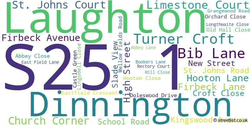
Laughton (30 Streets)
Dinnington (1 Streets)
Unofficial Streets or Alternative Spellings
Schools and Places of Education Within the S25 1 Postcode Sector
Laughton Junior and Infant School
Academy converter
School Road, Sheffield, South Yorkshire, S25 1YP
Head: Mrs Claire Hill
Ofsted Rating: Good
Inspection: 2023-01-26 (483 days ago)
Website: Visit Laughton Junior and Infant School Website
Phone: 01909550477
Number of Pupils: 224
House Prices in the S25 1 Postcode Sector
| Type of Property | 2018 Average | 2018 Sales | 2017 Average | 2017 Sales | 2016 Average | 2016 Sales | 2015 Average | 2015 Sales |
|---|---|---|---|---|---|---|---|---|
| Detached | £299,417 | 12 | £253,750 | 10 | £207,305 | 4 | £289,500 | 4 |
| Semi-Detached | £196,625 | 8 | £195,238 | 4 | £92,375 | 4 | £114,214 | 7 |
| Terraced | £98,333 | 6 | £101,917 | 6 | £104,281 | 8 | £101,988 | 4 |
| Flats | £62,500 | 1 | £147,000 | 1 | £0 | 0 | £0 | 0 |
Important Postcodes S25 1 in the Postcode Sector
S25 1YF is the postcode for Laughton All Saints C of E School, High Street
S25 1YP is the postcode for MAIN BUILDING, Laughton Junior & Infant School, School Road, NURSERY BUILDING, Laughton Junior & Infant School, School Road, and Laughton Junior & Infant School, School Road
| The S25 1 Sector is within these Local Authorities |
|
|---|---|
| The S25 1 Sector is within these Counties |
|
| The S25 1 Sector is within these Water Company Areas |
|