The SN25 4 postcode sector is within the county of Wiltshire.
Did you know? According to the 2021 Census, the SN25 4 postcode sector is home to a bustling 9,031 residents!
Given that each sector allows for 400 unique postcode combinations. Letters C, I, K, M, O and V are not allowed in the last two letters of a postcode. With 160 postcodes already in use, this leaves 240 units available.
The SN25 4 postal code covers the settlement of SWINDON.
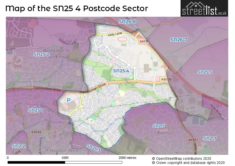
The SN25 4 Postcode shares a border with SN26 8 (Blunsdon), SN2 5 (SWINDON), SN25 1 (SWINDON, Haydon Wick), SN25 3 (SWINDON), SN26 7 (Blunsdon), SN25 2 (SWINDON, Tadpole Garden Village, Blunsdon) and SN25 5 (Groundwell Industrial Estate, Blunsdon, SWINDON).
The sector is within the post town of SWINDON.
SN25 4 is a postcode sector within the SN2 postcode district which is within the SN Swindon postcode area.
The Royal Mail delivery office for the SN25 4 postal sector is the unknown.
The area of the SN25 4 postcode sector is 0.97 square miles which is 2.51 square kilometres or 620.54 square acres.
The SN25 4 postcode sector is crossed by the A419 Major A road.

Map of the SN25 4 Postcode Sector
Explore the SN25 4 postcode sector by using our free interactive map.
| S | N | 2 | 5 | - | 4 | X | X |
| S | N | 2 | 5 | Space | 4 | Letter | Letter |
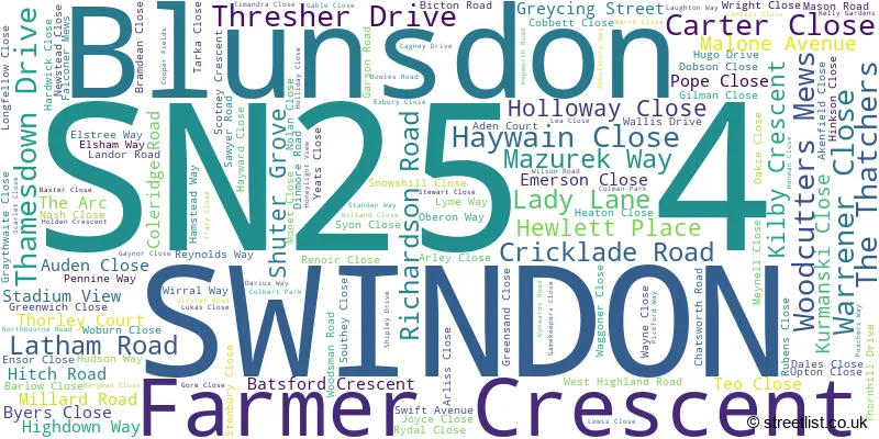
Official List of Streets
SWINDON (134 Streets)
Unofficial Streets or Alternative Spellings
SWINDON
CRICKLADE ROAD DIAMOND CRESCENT EMERALD CRESCENT IMBER WALK RUBY CLOSE RUSHMERE PATH ARKWRIGHT BOND PLACE DENCH CLOSE DESMOND CRESCENT DISTRICT CENTRE EALING WAY GARNET CRESCENT GROUNDWELL WEST JONES STREET LADY LANE SOUTH LLEWELYN ROAD MANOR FARM MOTOROLA OPAL ROAD ROBINSCROFT RUBEIS CLOSE SALZGITTER DRIVE SAPPHIRE ROAD SHEPPERTON WAY WESTFIELD WAY WYNWARDS CLOSEBlunsdon
ERMIN STREET TURNPIKE ROADGroundwell Industrial Estate
ARKWRIGHT ROADSchools and Places of Education Within the SN25 4 Postcode Sector
Abbey Meads Community Primary School
Academy converter
Hugo Drive, Swindon, Wiltshire, SN25 4GY
Head: Mr R M Buckley
Ofsted Rating: Good
Inspection: 2023-05-17 (382 days ago)
Website: Visit Abbey Meads Community Primary School Website
Phone: 01793723239
Number of Pupils: 491
House Prices in the SN25 4 Postcode Sector
| Type of Property | 2018 Average | 2018 Sales | 2017 Average | 2017 Sales | 2016 Average | 2016 Sales | 2015 Average | 2015 Sales |
|---|---|---|---|---|---|---|---|---|
| Detached | £324,838 | 86 | £313,442 | 127 | £310,990 | 84 | £293,922 | 120 |
| Semi-Detached | £256,270 | 64 | £231,898 | 52 | £231,779 | 86 | £218,919 | 54 |
| Terraced | £206,692 | 58 | £205,671 | 75 | £197,140 | 80 | £179,922 | 96 |
| Flats | £146,908 | 6 | £156,928 | 7 | £146,609 | 9 | £129,912 | 12 |
Important Postcodes SN25 4 in the Postcode Sector
SN25 4AN is the postcode for SEQOL & Swindon Borough Council, North Swindon District Centre, Swindon Primary Care Trust, Thamesdown Drive, North Swindon District Centre, and Swindon Borough Council, North Swindon District Centre Library, North Swindon District Centre, Thamesdown Drive
SN25 4GY is the postcode for Abbey Meads Community School, Hugo Drive, Abbey Meads, and Abbeymeads Community Primary School, Hugo Drive
SN25 4TA is the postcode for Catherine Waite Primary School, Elstree Way, and Catherine Wayte Primary School, Elstree Way, Abbey Meads
SN25 4YZ is the postcode for Abbeymeads Medical Practice, Abbeymeads Village Centre, Elstree Way
| The SN25 4 Sector is within these Local Authorities |
|
|---|---|
| The SN25 4 Sector is within these Counties |
|
| The SN25 4 Sector is within these Water Company Areas |
|