The SO30 postcode district is a postal district located in the SO Southampton postcode area with a population of 33,539 residents according to the 2021 England and Wales Census.
The area of the SO30 postcode district is 9.85 square miles which is 25.50 square kilometres or 6,301.47 acres.
Currently, the SO30 district has about 752 postcode units spread across 4 geographic postcode sectors.
Given that each sector allows for 400 unique postcode combinations, the district has a capacity of 1,600 postcodes. With 752 postcodes already in use, this leaves 848 units available.
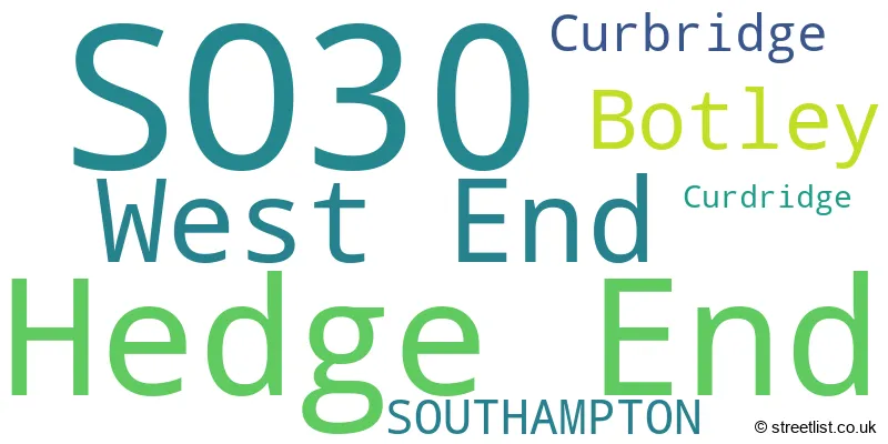
The largest settlement in the SO30 postal code is Hedge End followed by West End, and Botley.
The SO30 Postcode shares a border with SO18 (SOUTHAMPTON, West End), SO32 (Bishops Waltham, Botley, Swanmore), SO50 (EASTLEIGH, Bishopstoke, Fair Oak), SO19 (SOUTHAMPTON) and SO31 (Locks Heath, Bursledon, Warsash).
The primary settlement in the SO30 postcode district is Hedge End, located in the county of Hampshire, within England. Other significant settlements in this district include Botley, Curbridge, Curdridge, and West End. The post town for this district is Southampton.
For the district SO30, we have data on 5 postcode sectors. Here's a breakdown: The sector SO30 0, covers Hedge End in Hampshire. The sector SO30 2, covers Hedge End and Botley in Hampshire. The sector SO30 3, covers West End in Hampshire. The sector SO30 4, covers Hedge End in Hampshire. The sector SO30 9 is non-geographic. It's often designated for PO Boxes, large organisations, or special services.

Map of the SO30 Postcode District
Explore the SO30 postcode district by using our free interactive map.

When it comes to local government, postal geography often disregards political borders. However, for a breakdown in the SO30 District: the district mostly encompasses the Eastleigh District (B) (745 postcodes), and finally, the Winchester District (B) area (40 postcodes).
Recent House Sales in SO30
| Date | Price | Address |
|---|---|---|
| 29/09/2023 | £370,000 | Wainwright Gardens, Hedge End, Southampton, SO30 2NF |
| 22/09/2023 | £495,000 | Netley Firs Road, Hedge End, Southampton, SO30 4AZ |
| 15/09/2023 | £280,000 | Ambleside, Botley, Southampton, SO30 2NS |
| 14/09/2023 | £175,000 | Wilkins Road, Hedge End, Southampton, SO30 2LR |
| 13/09/2023 | £370,000 | Sherwood Avenue, Hedge End, Southampton, SO30 0JY |
| 08/09/2023 | £297,500 | Marsh Gardens, Hedge End, Southampton, SO30 2XN |
| 08/09/2023 | £339,950 | Long Close Road, Hedge End, Southampton, SO30 4GB |
| 04/09/2023 | £370,000 | Malvern Gardens, Hedge End, Southampton, SO30 2UJ |
| 31/08/2023 | £415,000 | Stanier Way, Hedge End, Southampton, SO30 2XE |
| 30/08/2023 | £268,000 | Coniston Gardens, Hedge End, Southampton, SO30 0LP |
Weather Forecast for SO30
Press Button to Show Forecast for Hedge End
| Time Period | Icon | Description | Temperature | Rain Probability | Wind |
|---|---|---|---|---|---|
| 06:00 to 09:00 | Cloudy | 6.0°C (feels like 3.0°C) | 8.00% | ENE 9 mph | |
| 09:00 to 12:00 | Cloudy | 8.0°C (feels like 5.0°C) | 12.00% | ENE 9 mph | |
| 12:00 to 15:00 | Overcast | 10.0°C (feels like 8.0°C) | 17.00% | E 9 mph | |
| 15:00 to 18:00 | Overcast | 10.0°C (feels like 9.0°C) | 17.00% | E 7 mph | |
| 18:00 to 21:00 | Cloudy | 10.0°C (feels like 9.0°C) | 12.00% | E 4 mph | |
| 21:00 to 00:00 | Cloudy | 7.0°C (feels like 5.0°C) | 12.00% | E 7 mph |
Press Button to Show Forecast for Hedge End
| Time Period | Icon | Description | Temperature | Rain Probability | Wind |
|---|---|---|---|---|---|
| 00:00 to 03:00 | Overcast | 6.0°C (feels like 4.0°C) | 16.00% | ENE 7 mph | |
| 03:00 to 06:00 | Light rain | 6.0°C (feels like 3.0°C) | 51.00% | ENE 9 mph | |
| 06:00 to 09:00 | Overcast | 6.0°C (feels like 3.0°C) | 20.00% | ENE 9 mph | |
| 09:00 to 12:00 | Cloudy | 9.0°C (feels like 7.0°C) | 15.00% | ENE 11 mph | |
| 12:00 to 15:00 | Overcast | 12.0°C (feels like 10.0°C) | 23.00% | E 11 mph | |
| 15:00 to 18:00 | Light rain | 12.0°C (feels like 10.0°C) | 52.00% | ENE 11 mph | |
| 18:00 to 21:00 | Heavy rain | 11.0°C (feels like 8.0°C) | 75.00% | ENE 11 mph | |
| 21:00 to 00:00 | Light rain | 10.0°C (feels like 7.0°C) | 53.00% | ENE 13 mph |
Press Button to Show Forecast for Hedge End
| Time Period | Icon | Description | Temperature | Rain Probability | Wind |
|---|---|---|---|---|---|
| 00:00 to 03:00 | Heavy rain | 9.0°C (feels like 6.0°C) | 73.00% | ENE 11 mph | |
| 03:00 to 06:00 | Heavy rain | 9.0°C (feels like 6.0°C) | 76.00% | E 9 mph | |
| 06:00 to 09:00 | Light rain | 9.0°C (feels like 7.0°C) | 46.00% | ESE 9 mph | |
| 09:00 to 12:00 | Light rain shower (day) | 11.0°C (feels like 9.0°C) | 42.00% | SSE 9 mph | |
| 12:00 to 15:00 | Heavy rain shower (day) | 12.0°C (feels like 10.0°C) | 56.00% | SW 11 mph | |
| 15:00 to 18:00 | Light rain shower (day) | 12.0°C (feels like 9.0°C) | 39.00% | WSW 13 mph | |
| 18:00 to 21:00 | Cloudy | 11.0°C (feels like 9.0°C) | 16.00% | WSW 11 mph | |
| 21:00 to 00:00 | Partly cloudy (night) | 9.0°C (feels like 7.0°C) | 8.00% | WSW 7 mph |
Where is the SO30 Postcode District?
The data shows that the postcode district for SO30 is located in SOUTHAMPTON. It is nearby towns such as EASTLEIGH, FAREHAM, WINCHESTER, and COWES. Additionally, the postcode district is approximately 65.04 miles away from the centre of London.
The district is within the post town of SOUTHAMPTON.
The sector has postcodes within the nation of England.
The SO30 Postcode District is covers the following regions.
- South Hampshire - Hampshire and Isle of Wight - South East (England)
- Central Hampshire - Hampshire and Isle of Wight - South East (England)
| Postcode Sector | Delivery Office |
|---|---|
| SO30 0 | Hedge End Delivery Office |
| SO30 2 | Hedge End Delivery Office |
| SO30 3 | Hedge End Delivery Office |
| SO30 4 | Hedge End Delivery Office |
| S | O | 3 | 0 | - | X | X | X |
| S | O | 3 | 0 | Space | Numeric | Letter | Letter |
Tourist Attractions within the Postcode Area
We found 1 visitor attractions within the SO30 postcode area
| Go Ape! Tree Top Adventure - Itchen Valley |
|---|
| Country Parks |
| Country Park |
| View Go Ape! Tree Top Adventure - Itchen Valley on Google Maps |
Current Monthly Rental Prices
| # Bedrooms | Min Price | Max Price | Avg Price |
|---|---|---|---|
| 1 | £600 | £950 | £720 |
| 2 | £1,150 | £1,200 | £1,175 |
| 3 | £1,850 | £1,850 | £1,850 |
| 4 | £1,550 | £1,550 | £1,550 |
Current House Prices
| # Bedrooms | Min Price | Max Price | Avg Price |
|---|---|---|---|
| 1 | £60,000 | £225,000 | £138,490 |
| 2 | £76,250 | £450,000 | £258,023 |
| 3 | £86,250 | £920,000 | £389,886 |
| 4 | £385,000 | £1,125,000 | £551,376 |
| 5 | £210,000 | £925,000 | £682,647 |
| 6 | £600,000 | £850,000 | £725,000 |
| 7 | £650,000 | £650,000 | £650,000 |
Estate Agents who Operate in the SO30 District
| Logo | Name | Brand Name | Address | Contact Number | Total Properties |
|---|---|---|---|---|---|
 | Hedge End | White & Guard Estate Agents | 13 St. Johns Centre Hedge End SO30 4QU | 01489 358569 | 24 |
 | Hedge End | Richmonds Property Services Ltd | Lankester House, 1 Freegrounds Road, Hedge End, Southampton, SO30 0HG | 01489 359861 | 23 |
 | West End | Pure Estate Agents | 85 High Street, West End, Southampton, SO30 3DS | 0238 001 5280 | 17 |
 | Hedge End | Leaders Sales | 1 Freegrounds Road, Hedge End, SO30 0HG | 01489 359976 | 17 |
 | West End | Pearsons | 62 High Street, West End, Southampton, SO30 3DT | 0238 047 7377 | 15 |
| Type of Property | 2018 Average | 2018 Sales | 2017 Average | 2017 Sales | 2016 Average | 2016 Sales | 2015 Average | 2015 Sales |
|---|---|---|---|---|---|---|---|---|
| Detached | £420,195 | 242 | £417,523 | 198 | £393,555 | 214 | £374,356 | 210 |
| Semi-Detached | £300,279 | 158 | £294,644 | 142 | £274,301 | 135 | £254,134 | 140 |
| Terraced | £248,392 | 163 | £254,092 | 178 | £233,979 | 154 | £220,134 | 188 |
| Flats | £178,232 | 117 | £165,582 | 105 | £164,856 | 97 | £145,581 | 147 |