The SY4 5 postcode sector stands on the Clwyd and Shropshire border.
Did you know? According to the 2021 Census, the SY4 5 postcode sector is home to a bustling 9,491 residents!
Given that each sector allows for 400 unique postcode combinations. Letters C, I, K, M, O and V are not allowed in the last two letters of a postcode. With 303 postcodes already in use, this leaves 97 units available.
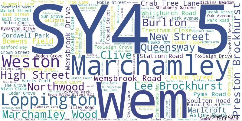
The largest settlement in the SY4 5 postal code is Wem followed by Burlton, and Weston.
The SY4 5 Postcode shares a border with TF9 3 (MARKET DRAYTON, Hodnet, Adderley), SY4 2 (Baschurch, Little Ness, Weston Lullingfields), SY4 3 (Bomere Heath, Harmer Hill, Myddle), SY4 4 (Shawbury, Hadnall, Uffington), SY12 0 (ELLESMERE, Cockshutt, Welshampton) and SY13 2 (Prees, Whixall, Higher Heath).
The sector is within the post town of SHREWSBURY.
SY4 5 is a postcode sector within the SY4 postcode district which is within the SY Shrewsbury postcode area.
The Royal Mail delivery office for the SY4 5 postal sector is the Shrewsbury Delivery Office and Wem Delivery Office.
The area of the SY4 5 postcode sector is 35.67 square miles which is 92.38 square kilometres or 22,828.62 square acres.

Map of the SY4 5 Postcode Sector
Explore the SY4 5 postcode sector by using our free interactive map.
| S | Y | 4 | - | 5 | X | X |
| S | Y | 4 | Space | 5 | Letter | Letter |
Official List of Streets
Wem (102 Streets)
Marchamley (7 Streets)
Lee Brockhurst (4 Streets)
Loppington (8 Streets)
Weston (5 Streets)
Burlton (3 Streets)
Northwood (3 Streets)
Unofficial Streets or Alternative Spellings
Grinshill
THE HILLWollerton
WOOD LANE 100 STEPS BELLSTONE TERRACE BLACKHURSTFORD BRIDGE BLAKE MEADOW CHAPEL LANE CROSEMERE CRESCENT DRAWWELL WALK FIMES WAY FREEMANS PLACE GARBETT CLOSE GROVE END CLOSE HORTON HALL BARNS HOUGH LANE MALTHOUSE COTTAGES MAYPOLE COURT MEADOW CLOSE NORTHWOOD ROAD PAPERMILL BRIDGE PRINCE WILLIAM COURT REEMANS PLACE ROSEMARIE COURT RYEBANK FARM BARNS SLEAP BRIDGE SYCAMORE DRIVE THE BUNGALOWS THE EASTLANDS THE PADDOCK THE PLANTATION THE TERRACE TILLEY BRIDGE TILLEY TERRACE VAUGHAN PLACE WEIR LANE WESTLANDSWem
MEADOW VIEW COURTPrees Green
WEM LANE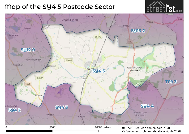
House Prices in the SY4 5 Postcode Sector
| Type of Property | 2018 Average | 2018 Sales | 2017 Average | 2017 Sales | 2016 Average | 2016 Sales | 2015 Average | 2015 Sales |
|---|---|---|---|---|---|---|---|---|
| Detached | £270,351 | 84 | £280,613 | 73 | £261,070 | 85 | £238,794 | 83 |
| Semi-Detached | £190,250 | 34 | £178,898 | 61 | £163,561 | 55 | £150,989 | 49 |
| Terraced | £154,287 | 19 | £156,008 | 45 | £145,188 | 36 | £121,014 | 32 |
| Flats | £75,916 | 6 | £88,000 | 1 | £86,083 | 6 | £74,313 | 8 |
Important Postcodes SY4 5 in the Postcode Sector
SY4 5AA is the postcode for Library & Learning Centre, High Street, Wem
SY4 5AF is the postcode for WEM MEDICAL PRACTICE, NEW STREET, WEM
SY4 5BX is the postcode for MAIN BUILDING, ST PETERS CE PRIMARY ACADEMY, SHRUBBERY GARDENS, MAIN BUILDING, St. Peters C of E (Controlled) Primary & Nursery School, Shrubbery Gardens, and St. Peters C of E (Controlled) Primary & Nursery School, Shrubbery Gardens
SY4 5DB is the postcode for North Shropshire District Council, Edinburgh House, New Street, and Shropshire Council, Edinburgh House
SY4 5JF is the postcode for Health Clinic, Morris Central Shopping Park, High Street
SY4 5NU is the postcode for Newtown C of E Primary School, Newtown, Wem
SY4 5PJ is the postcode for Woodlands School, Tilley Green, and Woodlands School, Tilley Green, Wem
SY4 5UB is the postcode for STANIER HALL, Thomas Adams School, Lowe Hill, OLD GRAMMAR SCHOOL, Thomas Adams School, Lowe Hill, MAIN BUILDING, Thomas Adams School, Lowe Hill, Thomas Adams School, Lowe Hill, and SIXTH FORM CENTRE, Thomas Adams School, Lowe Hill
| The SY4 5 Sector is within these Local Authorities |
|
|---|---|
| The SY4 5 Sector is within these Counties |
|
| The SY4 5 Sector is within these Water Company Areas |
|
Tourist Attractions within the SY4 5 Postcode Area
We found 2 visitor attractions within the SY4 postcode area
| THE MOAT SHED |
|---|
| Visitor Centres |
| Heritage / Visitor Centre |
| View THE MOAT SHED on Google Maps |
| Hawkstone Historic Park and Follies |
| Country Parks |
| Country Park |
| View Hawkstone Historic Park and Follies on Google Maps |