The TF11 postcode district is a postal district located in the TF Telford postcode area with a population of 12,608 residents according to the 2021 England and Wales Census.
The area of the TF11 postcode district is 49.14 square miles which is 127.28 square kilometres or 31,451.65 acres.
Currently, the TF11 district has about 451 postcode units spread across 2 geographic postcode sectors.
Given that each sector allows for 400 unique postcode combinations, the district has a capacity of 800 postcodes. With 451 postcodes already in use, this leaves 349 units available.
The largest settlement in the TF11 postal code is SHIFNAL followed by Weston-under-Lizard, and Sheriffhales.
The TF11 Postcode shares a border with WV15 (BRIDGNORTH, Alveley, Quatford), TF10 (NEWPORT, Edgmond, Lilleshall), TF2 (Donnington, Priorslee, St. Georges), TF3 (TELFORD, Stirchley, The Rock), TF7 (Madeley, TELFORD, Sutton Hill), TF8 (Ironbridge, Coalbrookdale, Jackfield), WV7 (Albrighton) and ST20 (Gnosall, Church Eaton, Woodseaves).
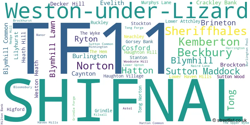
The TF11 postcode district in Shropshire, England primarily includes the settlement of Shifnal. It is the most significant settlement in the district. Other significant settlements in the TF11 district include Bloomsbury, Blymhill, Blymhill Common, Brineton, Brockhurst, Burlington, Burlington Pool, Cosford, Crackley Bank, Decker Hill, Gorsey Bank, Haughton Village, Heath Hill, Hilton Bank, Kilsall, Lilyhurst, Murphys Lane, Neachley, Ruckley, Sheriffhales, Stanton, Tong, Tong Forge, Tong Norton, Weston Heath, Weston-under-Lizard, and Woodcote Hill. The TF11 district is part of the county of Shropshire. The primary post town for the TF11 district is Shifnal.
For the district TF11, we have data on 2 postcode sectors. Here's a breakdown: The sector TF11 8, covers Shifnal in Shropshire. The sector TF11 9, covers Shifnal in Shropshire.

Map of the TF11 Postcode District
Explore the TF11 postcode district by using our free interactive map.

When it comes to local government, postal geography often disregards political borders. However, for a breakdown in the TF11 District: the district mostly encompasses the Shropshire (404 postcodes), and finally, the South Staffordshire District area (51 postcodes).
Recent House Sales in TF11
| Date | Price | Address |
|---|---|---|
| 13/09/2023 | £190,000 | Mountford Way, Shifnal, TF11 9QG |
| 08/09/2023 | £425,000 | West Way, Shifnal, TF11 8GR |
| 01/09/2023 | £375,000 | Edge Avenue, Shifnal, TF11 8FS |
| 29/08/2023 | £1,555,000 | Brockton, Shifnal, TF11 9LZ |
| 23/08/2023 | £184,950 | Cornwallis Drive, Shifnal, TF11 8UB |
| 18/08/2023 | £237,000 | Beech Drive, Shifnal, TF11 8HZ |
| 16/08/2023 | £585,000 | The Evergreens, Sheriffhales, Shifnal, TF11 8SB |
| 11/08/2023 | £380,000 | Sweet Briars Drive, Shifnal, TF11 8GJ |
| 08/08/2023 | £685,000 | Mill Lane, Kemberton, Shifnal, TF11 9LU |
| 02/08/2023 | £375,000 | Shrewsbury Road, Shifnal, TF11 8AJ |
Weather Forecast for TF11
Press Button to Show Forecast for Shifnal
| Time Period | Icon | Description | Temperature | Rain Probability | Wind |
|---|---|---|---|---|---|
| 03:00 to 06:00 | Cloudy | 3.0°C (feels like 1.0°C) | 9.00% | E 4 mph | |
| 06:00 to 09:00 | Cloudy | 3.0°C (feels like 1.0°C) | 6.00% | E 4 mph | |
| 09:00 to 12:00 | Cloudy | 6.0°C (feels like 4.0°C) | 5.00% | ENE 7 mph | |
| 12:00 to 15:00 | Overcast | 9.0°C (feels like 8.0°C) | 11.00% | E 4 mph | |
| 15:00 to 18:00 | Cloudy | 10.0°C (feels like 9.0°C) | 9.00% | NE 4 mph | |
| 18:00 to 21:00 | Cloudy | 9.0°C (feels like 8.0°C) | 9.00% | NE 4 mph | |
| 21:00 to 00:00 | Partly cloudy (night) | 5.0°C (feels like 3.0°C) | 7.00% | ENE 7 mph |
Press Button to Show Forecast for Shifnal
| Time Period | Icon | Description | Temperature | Rain Probability | Wind |
|---|---|---|---|---|---|
| 00:00 to 03:00 | Partly cloudy (night) | 4.0°C (feels like 1.0°C) | 7.00% | ENE 7 mph | |
| 03:00 to 06:00 | Cloudy | 3.0°C (feels like 0.0°C) | 11.00% | ENE 7 mph | |
| 06:00 to 09:00 | Cloudy | 4.0°C (feels like 1.0°C) | 11.00% | ENE 7 mph | |
| 09:00 to 12:00 | Cloudy | 8.0°C (feels like 5.0°C) | 14.00% | E 9 mph | |
| 12:00 to 15:00 | Overcast | 10.0°C (feels like 7.0°C) | 21.00% | E 9 mph | |
| 15:00 to 18:00 | Overcast | 10.0°C (feels like 8.0°C) | 22.00% | ENE 9 mph | |
| 18:00 to 21:00 | Cloudy | 10.0°C (feels like 8.0°C) | 18.00% | ENE 9 mph | |
| 21:00 to 00:00 | Cloudy | 7.0°C (feels like 5.0°C) | 20.00% | NE 9 mph |
Press Button to Show Forecast for Shifnal
| Time Period | Icon | Description | Temperature | Rain Probability | Wind |
|---|---|---|---|---|---|
| 00:00 to 03:00 | Cloudy | 6.0°C (feels like 3.0°C) | 21.00% | NE 9 mph | |
| 03:00 to 06:00 | Light rain | 6.0°C (feels like 3.0°C) | 51.00% | NNE 9 mph | |
| 06:00 to 09:00 | Heavy rain | 6.0°C (feels like 3.0°C) | 76.00% | NNE 11 mph | |
| 09:00 to 12:00 | Heavy rain | 8.0°C (feels like 5.0°C) | 77.00% | NNE 11 mph | |
| 12:00 to 15:00 | Light rain | 9.0°C (feels like 6.0°C) | 55.00% | N 11 mph | |
| 15:00 to 18:00 | Light rain | 10.0°C (feels like 7.0°C) | 54.00% | N 11 mph | |
| 18:00 to 21:00 | Light rain shower (day) | 9.0°C (feels like 8.0°C) | 35.00% | NNW 7 mph | |
| 21:00 to 00:00 | Clear night | 6.0°C (feels like 4.0°C) | 9.00% | WNW 7 mph |
Where is the TF11 Postcode District?
The postcode district TF11 is located in the town of Shifnal. It is situated near the following towns: Telford to the West, Broseley to the South West, Newport to the North, Wolverhampton to the South East, Bridgnorth to the South, Stafford to the North East, and Willenhall to the East. Additionally, Shifnal is approximately 123.76 miles away from the center of London.
The district is within the post town of SHIFNAL.
The sector has postcodes within the nation of England.
The TF11 Postcode District is covers the following regions.
- Shropshire CC - Shropshire and Staffordshire - West Midlands (England)
- Staffordshire CC - Shropshire and Staffordshire - West Midlands (England)
- Telford and Wrekin - Shropshire and Staffordshire - West Midlands (England)
| Postcode Sector | Delivery Office |
|---|---|
| TF11 8 | Tweedale Delivery Office |
| TF11 9 | Tweedale Delivery Office |
| T | F | 1 | 1 | - | X | X | X |
| T | F | 1 | 1 | Space | Numeric | Letter | Letter |
Tourist Attractions within the Postcode Area
We found 1 visitor attractions within the TF11 postcode area
| Royal Air Force (RAF) Museum Cosford |
|---|
| Museums & Art Galleries |
| Museum and / or Art Gallery |
| View Royal Air Force (RAF) Museum Cosford on Google Maps |
Current Monthly Rental Prices
| # Bedrooms | Min Price | Max Price | Avg Price |
|---|---|---|---|
| £600 | £600 | £600 | |
| 2 | £850 | £850 | £850 |
| 3 | £1,495 | £1,750 | £1,623 |
| 4 | £1,200 | £1,200 | £1,200 |
Current House Prices
| # Bedrooms | Min Price | Max Price | Avg Price |
|---|---|---|---|
| £235,000 | £300,000 | £267,500 | |
| 1 | £135,000 | £135,000 | £135,000 |
| 2 | £31,250 | £375,000 | £179,918 |
| 3 | £187,500 | £550,000 | £321,538 |
| 4 | £325,000 | £1,250,000 | £514,232 |
| 5 | £609,950 | £1,295,000 | £1,066,650 |
| 6 | £1,375,000 | £1,375,000 | £1,375,000 |
| 8 | £1,795,000 | £1,795,000 | £1,795,000 |
Estate Agents who Operate in the TF11 District
| Logo | Name | Brand Name | Address | Contact Number | Total Properties |
|---|---|---|---|---|---|
 | Shifnal | Fields Of Shifnal Ltd | 4 Broadway, Shifnal, TF11 8AZ | 01952 454794 | 13 |
 | Telford | Nick Tart Estate Agents | 16 High Street, Ironbridge, Telford, TF8 7AD | 01952 984238 | 7 |
 | Telford | D B Roberts & Partners | 56 Southwater Town Centre Telford TF3 4DE | 01952 458201 | 6 |
 | Tettenhall | Berriman Eaton | 15 High Street, Tettenhall, Wolverhampton, WV6 8QS | 01902 953057 | 5 |
 | Ironbridge | Nock Deighton, Land and New Homes | 24 High Street, Ironbridge, Telford, TF8 7AD | 01952 456798 | 4 |
| Type of Property | 2018 Average | 2018 Sales | 2017 Average | 2017 Sales | 2016 Average | 2016 Sales | 2015 Average | 2015 Sales |
|---|---|---|---|---|---|---|---|---|
| Detached | £327,664 | 194 | £340,185 | 204 | £320,807 | 155 | £309,594 | 93 |
| Semi-Detached | £208,829 | 86 | £208,948 | 89 | £194,160 | 88 | £183,228 | 54 |
| Terraced | £187,595 | 47 | £195,489 | 66 | £177,663 | 71 | £179,120 | 44 |
| Flats | £126,768 | 11 | £127,264 | 17 | £156,806 | 8 | £113,179 | 14 |