The TN5 6 postcode sector stands on the East Sussex and Kent border.
Did you know? According to the 2021 Census, the TN5 6 postcode sector is home to a bustling 4,898 residents!
Given that each sector allows for 400 unique postcode combinations. Letters C, I, K, M, O and V are not allowed in the last two letters of a postcode. With 234 postcodes already in use, this leaves 166 units available.
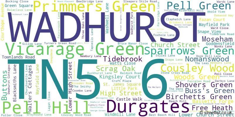
The largest settlement in the TN5 6 postal code is WADHURST followed by Sparrows Green, and Durgates.
The TN5 6 Postcode shares a border with TN20 6 (MAYFIELD, Five Ashes, Wellbrook), TN3 8 (Lamberhurst, Hook Green), TN3 9 (Groombridge, Frant, Eridge Green), TN5 7 (Ticehurst, Flimwell, Stonegate) and TN6 3 (CROWBOROUGH, Rotherfield, Mark Cross).
The sector is within the post town of WADHURST.
TN5 6 is a postcode sector within the TN5 postcode district which is within the TN Tonbridge postcode area.
The Royal Mail delivery office for the TN5 6 postal sector is the Tunbridge Wells Delivery Office.
The area of the TN5 6 postcode sector is 15.05 square miles which is 38.99 square kilometres or 9,634.91 square acres.

Map of the TN5 6 Postcode Sector
Explore the TN5 6 postcode sector by using our free interactive map.
| T | N | 5 | - | 6 | X | X |
| T | N | 5 | Space | 6 | Letter | Letter |
Official List of Streets
WADHURST (78 Streets)
Durgates (7 Streets)
Cousley Wood (2 Streets)
Pell Green (1 Streets)
Sparrows Green (10 Streets)
Primmers Green (1 Streets)
Unofficial Streets or Alternative Spellings
WADHURST
FAZAN COURT BARTLEY MILL ROAD BASSETTS LANE BEST BEECH LANE BIRD LANE BUTTONS LANE BUTTS LANE DURGATES FRANT ROAD GREAT DURGATES HOLMESDALE CLOSE HOOK HILL LOWER COUSLEY WOOD LANE MOSEHAM HILL PELL GREEN PIPERS CLOSE PRIMMERS GREEN RIVERHALL LANE SCRAG OAK LANE STONEGATE ROAD SWEETINGS LANE THE WALK TIDEBROOK UPPER WALLANDS LANE WENBAS LANE WOODS GREEN WYCK LANEHook Green
FREE HEATH ROADLamberhurst
BEWLBRIDGE LANE NEILLS ROADTicehurst
BIRCHETTS GREEN LANE HIGH STREETStonegate
BARDOWN ROADSparrows Green
SOUTHFIELDSMark Cross
WADHURST ROAD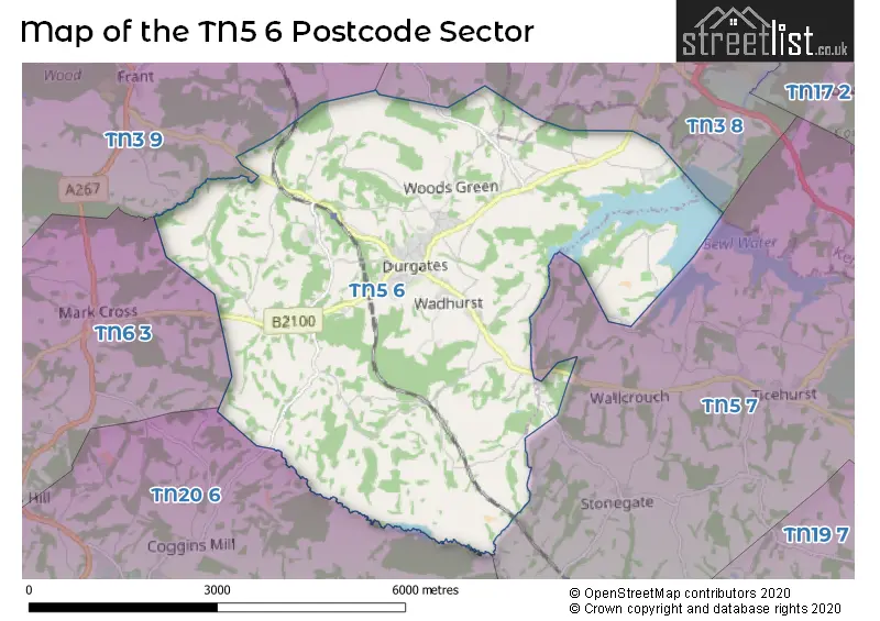
House Prices in the TN5 6 Postcode Sector
| Type of Property | 2018 Average | 2018 Sales | 2017 Average | 2017 Sales | 2016 Average | 2016 Sales | 2015 Average | 2015 Sales |
|---|---|---|---|---|---|---|---|---|
| Detached | £823,788 | 41 | £913,906 | 24 | £834,923 | 31 | £643,986 | 30 |
| Semi-Detached | £407,089 | 20 | £436,882 | 17 | £393,833 | 18 | £379,250 | 24 |
| Terraced | £333,233 | 18 | £380,950 | 11 | £314,000 | 27 | £359,973 | 20 |
| Flats | £424,871 | 12 | £500,403 | 20 | £216,833 | 12 | £207,194 | 9 |
Important Postcodes TN5 6 in the Postcode Sector
TN5 6AP is the postcode for East Sussex County Council, Wadhurst Library, High Street
TN5 6AX is the postcode for Uplands Youth & Childrens Centre, Lower High Street
TN5 6AZ is the postcode for Mark Recreation Ltd, Uplands Sports Centre, Lower High Street, GYMNASIUM, Uplands Community College, Lower High Street, and Uplands Community College, Lower High Street
TN5 6BJ is the postcode for Belmont Surgery, St. James Square
TN5 6SR is the postcode for Wadhurst C of E Primary School, Sparrows Green
TN5 6ST is the postcode for East Sussex Fire Brigade, Fire Station,
| The TN5 6 Sector is within these Local Authorities |
|
|---|---|
| The TN5 6 Sector is within these Counties |
|
| The TN5 6 Sector is within these Water Company Areas |
|