The TS29 postcode district is a postal district located in the TS Teeside postcode area with a population of 6,154 residents according to the 2021 England and Wales Census.
The area of the TS29 postcode district is 6.91 square miles which is 17.90 square kilometres or 4,422.21 acres.
Currently, the TS29 district has about 194 postcode units spread across 1 geographic postcode sectors.
Given that each sector allows for 400 unique postcode combinations, the district has a capacity of 400 postcodes. With 194 postcodes already in use, this leaves 206 units available.
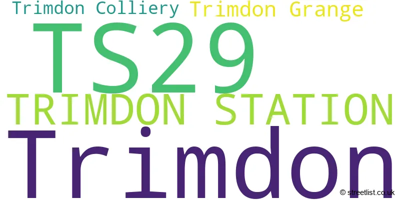
The largest settlement in the TS29 postal code is Trimdon followed by TRIMDON STATION, and Trimdon Grange.
The TS29 Postcode shares a border with DH6 (Bowburn, Coxhoe, Shotton Colliery), DL17 (FERRYHILL, Chilton, West Cornforth), TS21 (Sedgefield, Fishburn, Stillington) and TS28 (WINGATE, Station Town).
In the TS29 postcode district, the primary settlement is Trimdon Station, located in the county of Durham in England. Other significant settlements in this postcode district include Trimdon, Trimdon Colliery, and Trimdon Grange, which are all also located in the county of Durham. The most significant Postal Town in this postcode district is Trimdon Station.
For the district TS29, we have data on 1 postcode sectors. Here's a breakdown: The sector TS29 6, covers Trimdon and Trimdon Station and Trimdon Grange and Trimdon Colliery in Durham.
TS29 Postcode Sectors

Map of the TS29 Postcode District
Explore the TS29 postcode district by using our free interactive map.

When it comes to local government, postal geography often disregards political borders. However, for a breakdown in the TS29 District: the district mostly encompasses the County Durham area with a total of 194 postcodes.
Recent House Sales in TS29
| Date | Price | Address |
|---|---|---|
| 14/09/2023 | £99,950 | Myrtle Grove, Trimdon, Trimdon Station, TS29 6PZ |
| 04/09/2023 | £81,280 | Burn Oval, Trimdon, Trimdon Station, TS29 6PT |
| 01/09/2023 | £180,000 | Thornley Road, Trimdon Station, TS29 6DA |
| 18/08/2023 | £450,000 | Wingate Road, Trimdon Station, TS29 6AX |
| 18/08/2023 | £72,000 | Ropers Terrace, Trimdon Grange, Trimdon Station, TS29 6EZ |
| 18/08/2023 | £91,000 | Windsor Square, Trimdon, Trimdon Station, TS29 6JL |
| 10/08/2023 | £30,000 | Station Road East, Trimdon Station, TS29 6BS |
| 08/08/2023 | £29,000 | Wood View, Trimdon Station, TS29 6BG |
| 31/07/2023 | £57,000 | Hopper Terrace, Trimdon Grange, Trimdon Station, TS29 6HP |
| 28/07/2023 | £85,000 | Front Street North, Trimdon, Trimdon Station, TS29 6PG |
Weather Forecast for TS29
Press Button to Show Forecast for Shotton
| Time Period | Icon | Description | Temperature | Rain Probability | Wind |
|---|---|---|---|---|---|
| 00:00 to 03:00 | Clear night | 1.0°C (feels like 0.0°C) | 0.00% | E 2 mph | |
| 03:00 to 06:00 | Partly cloudy (night) | 1.0°C (feels like -1.0°C) | 1.00% | N 2 mph | |
| 06:00 to 09:00 | Partly cloudy (day) | 4.0°C (feels like 2.0°C) | 3.00% | N 4 mph | |
| 09:00 to 12:00 | Cloudy | 7.0°C (feels like 5.0°C) | 7.00% | ENE 9 mph | |
| 12:00 to 15:00 | Cloudy | 8.0°C (feels like 5.0°C) | 7.00% | ENE 9 mph | |
| 15:00 to 18:00 | Cloudy | 8.0°C (feels like 5.0°C) | 8.00% | ENE 9 mph | |
| 18:00 to 21:00 | Cloudy | 7.0°C (feels like 4.0°C) | 9.00% | ENE 9 mph | |
| 21:00 to 00:00 | Cloudy | 5.0°C (feels like 3.0°C) | 9.00% | ENE 7 mph |
Press Button to Show Forecast for Shotton
| Time Period | Icon | Description | Temperature | Rain Probability | Wind |
|---|---|---|---|---|---|
| 00:00 to 03:00 | Cloudy | 5.0°C (feels like 2.0°C) | 7.00% | NE 7 mph | |
| 03:00 to 06:00 | Cloudy | 5.0°C (feels like 2.0°C) | 7.00% | N 9 mph | |
| 06:00 to 09:00 | Cloudy | 6.0°C (feels like 2.0°C) | 15.00% | NNW 13 mph | |
| 09:00 to 12:00 | Light rain | 6.0°C (feels like 3.0°C) | 50.00% | NNW 13 mph | |
| 12:00 to 15:00 | Light rain | 7.0°C (feels like 4.0°C) | 48.00% | NNW 13 mph | |
| 15:00 to 18:00 | Light rain | 8.0°C (feels like 6.0°C) | 44.00% | NNW 11 mph | |
| 18:00 to 21:00 | Partly cloudy (day) | 9.0°C (feels like 7.0°C) | 7.00% | WNW 7 mph | |
| 21:00 to 00:00 | Clear night | 6.0°C (feels like 3.0°C) | 2.00% | SW 9 mph |
Press Button to Show Forecast for Shotton
| Time Period | Icon | Description | Temperature | Rain Probability | Wind |
|---|---|---|---|---|---|
| 00:00 to 03:00 | Clear night | 5.0°C (feels like 2.0°C) | 1.00% | SW 9 mph | |
| 03:00 to 06:00 | Clear night | 4.0°C (feels like 1.0°C) | 1.00% | SSW 7 mph | |
| 06:00 to 09:00 | Sunny day | 5.0°C (feels like 3.0°C) | 1.00% | S 9 mph | |
| 09:00 to 12:00 | Partly cloudy (day) | 10.0°C (feels like 7.0°C) | 1.00% | S 13 mph | |
| 12:00 to 15:00 | Cloudy | 13.0°C (feels like 10.0°C) | 6.00% | S 13 mph | |
| 15:00 to 18:00 | Cloudy | 13.0°C (feels like 11.0°C) | 7.00% | S 13 mph | |
| 18:00 to 21:00 | Partly cloudy (day) | 12.0°C (feels like 10.0°C) | 6.00% | SSE 11 mph | |
| 21:00 to 00:00 | Clear night | 9.0°C (feels like 7.0°C) | 3.00% | SSE 11 mph |
Press Button to Show Forecast for Shotton
| Time Period | Icon | Description | Temperature | Rain Probability | Wind |
|---|---|---|---|---|---|
| 00:00 to 03:00 | Clear night | 8.0°C (feels like 6.0°C) | 1.00% | SSE 9 mph | |
| 03:00 to 06:00 | Clear night | 6.0°C (feels like 4.0°C) | 3.00% | SE 7 mph | |
| 06:00 to 09:00 | Sunny day | 7.0°C (feels like 5.0°C) | 3.00% | SE 7 mph | |
| 09:00 to 12:00 | Partly cloudy (day) | 11.0°C (feels like 9.0°C) | 5.00% | ESE 9 mph | |
| 12:00 to 15:00 | Cloudy | 13.0°C (feels like 11.0°C) | 11.00% | E 11 mph | |
| 15:00 to 18:00 | Cloudy | 13.0°C (feels like 11.0°C) | 13.00% | E 11 mph | |
| 18:00 to 21:00 | Cloudy | 12.0°C (feels like 10.0°C) | 12.00% | E 9 mph | |
| 21:00 to 00:00 | Overcast | 9.0°C (feels like 8.0°C) | 13.00% | E 7 mph |
Where is the TS29 Postcode District?
The postcode district TS29 is located in Trimdon Station, a town in the northeast of England. Trimdon Station is surrounded by several nearby towns, including Wingate to the east (1.66 miles away), Ferryhill to the southwest (5.74 miles away), Peterlee to the northeast (6.18 miles away), Spennymoor to the west (7.41 miles away), Billingham to the southeast (8.31 miles away), Durham to the northwest (8.44 miles away), and Seaham to the north (8.81 miles away). In terms of distance from London, Trimdon Station is approximately 227.62 miles away.
The district is within the post town of TRIMDON STATION.
The sector has postcodes within the nation of England.
The TS29 Postcode District is in the Durham CC region of Tees Valley and Durham within the North East (England).
Postcode Sectors within the TS29 District
| Postcode Sector | Delivery Office |
|---|---|
| TS29 6 | Trimdelivery Officen Station Scale Payment Delivery Office |
| T | S | 2 | 9 | - | X | X | X |
| T | S | 2 | 9 | Space | Numeric | Letter | Letter |
Current Monthly Rental Prices
| # Bedrooms | Min Price | Max Price | Avg Price |
|---|---|---|---|
| 1 | £350 | £475 | £413 |
| 2 | £475 | £501 | £487 |
| 3 | £550 | £550 | £550 |
Current House Prices
| # Bedrooms | Min Price | Max Price | Avg Price |
|---|---|---|---|
| £59,950 | £200,000 | £129,975 | |
| 2 | £50,000 | £214,950 | £93,080 |
| 3 | £45,000 | £265,000 | £114,565 |
| 4 | £72,000 | £310,000 | £146,390 |
| 5 | £425,000 | £795,000 | £610,000 |
| 6 | £340,000 | £340,000 | £340,000 |
Estate Agents who Operate in the TS29 District
| Logo | Name | Brand Name | Address | Contact Number | Total Properties |
|---|---|---|---|---|---|
 | Sedgefield | Robinsons | 3, High Street, Sedgefield, TS21 2AU | 01740 618201 | 16 |
 | Sedgefield | Dowen | 41 Front Street, Sedgefield, TS21 3AT | 01740 617244 | 12 |
 | covering Teesside | Purplebricks | Suite 7 First Floor Cranmore Drive Shirley Solihull B90 4RZ | 020 3889 9090 | 3 |
 | Peterlee | Pattinson Estate Agents | 2 Yoden Way, Peterlee, SR8 1BP | 0191 625 0136 | 3 |
 | Middlesbrough | Rent UK Property Services | Suite 17B Cargo Fleet Offices Dormor Way Middlesbrough Road Middlesbrough TS6 6XJ | 01642 130014 | 2 |
| Type of Property | 2018 Average | 2018 Sales | 2017 Average | 2017 Sales | 2016 Average | 2016 Sales | 2015 Average | 2015 Sales |
|---|---|---|---|---|---|---|---|---|
| Detached | £154,188 | 16 | £171,038 | 13 | £157,460 | 12 | £153,387 | 15 |
| Semi-Detached | £68,514 | 39 | £76,376 | 41 | £79,442 | 26 | £65,106 | 26 |
| Terraced | £67,255 | 47 | £58,793 | 51 | £48,839 | 33 | £59,150 | 30 |
| Flats | £71,000 | 2 | £0 | 0 | £28,000 | 1 | £32,000 | 1 |