
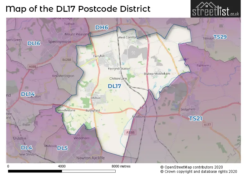
Map of the Postcode District
Explore the postcode district by using our interactive map.
Circles represent recorded crime; the larger the circle, the higher the crime rates.
Your support helps keep this site running!
If you enjoy using this website, consider buying me a coffee to help cover hosting costs.
The postcode district located in the DL Darlington postal area , DL17 has a population of 17,980 residents according to the 2021 England and Wales Census.
The area of the district is 20.56 square miles (53.26 square kilometers or 13,161.47 acres).
Where is the DL17 District?
To give you an idea where the district is located we have created the following table showing nearby towns.
Nearest Towns to DL17
| Town | Distance (miles) | Direction |
|---|---|---|
| Sedgefield | 3.42 | ESE |
| Spennymoor | 3.46 | WNW |
| Newton Aycliffe | 4.10 | SSW |
| Shildon | 5.27 | WSW |
| Bishop Auckland | 6.01 | W |
| Willington | 7.10 | WNW |
| Durham | 7.59 | NNW |
| Crook | 9.16 | WNW |
| Peterlee | 9.89 | NE |
| Darlington | 10.36 | S |
| Billingham | 10.40 | ESE |
| Hetton-le-Hole | 10.72 | NNE |
| Stockton-on-Tees | 11.50 | SE |
| Houghton-le-Spring | 12.10 | N |
| Tow Law | 12.57 | WNW |
| Hartlepool | 12.74 | E |
| Chester-le-Street | 13.02 | N |
| Thornaby-on-Tees | 13.17 | SE |
| Yarm | 13.33 | SSE |
The post town for this district is FERRYHILL.
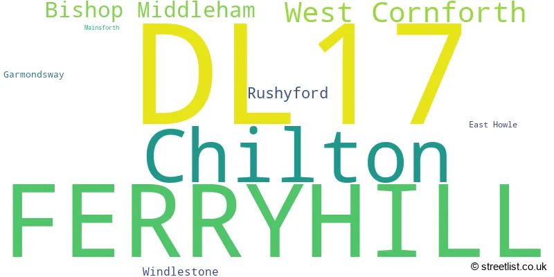
Postcode Information for District DL17 (Total Geographical Postcodes: 537)
| Location | Post Town | Sector | Number of Postcodes |
|---|---|---|---|
| FERRYHILL | FERRYHILL | DL17 8 | 203 |
| Chilton | FERRYHILL | DL17 0 | 118 |
| West Cornforth | FERRYHILL | DL17 9 | 80 |
| FERRYHILL | FERRYHILL | DL17 0 | 52 |
| Bishop Middleham | FERRYHILL | DL17 9 | 39 |
| Rushyford | FERRYHILL | DL17 0 | 18 |
| Windlestone | FERRYHILL | DL17 0 | 9 |
| FERRYHILL | FERRYHILL | DL17 9 | 7 |
| Garmondsway | FERRYHILL | DL17 9 | 5 |
| East Howle | FERRYHILL | DL17 8 | 4 |
| Mainsforth | FERRYHILL | DL17 9 | 2 |
Retail and Shopping in DL17
Street
Town
Locality
Number of Shops
Central Postcode
View on Google Maps
MARKET STREET
FERRYHILL
24
DL17 8JN
View on Google Maps
DARLINGTON ROAD
FERRYHILL
16
DL17 8JP
View on Google Maps
HIGH STREET
FERRYHILL
WEST CORNFORTH
15
DL17 9HR
View on Google Maps
DURHAM ROAD
FERRYHILL
CHILTON
12
DL17 0EX
View on Google Maps
MAIN STREET
FERRYHILL
11
DL17 8LA
View on Google Maps
PARKER TERRACE
FERRYHILL
11
DL17 8JY
View on Google Maps
HAIG TERRACE
FERRYHILL
6
DL17 8NR
View on Google Maps
| Street | Town | Locality | Number of Shops | Central Postcode | View on Google Maps |
|---|---|---|---|---|---|
| MARKET STREET | FERRYHILL | 24 | DL17 8JN | View on Google Maps | |
| DARLINGTON ROAD | FERRYHILL | 16 | DL17 8JP | View on Google Maps | |
| HIGH STREET | FERRYHILL | WEST CORNFORTH | 15 | DL17 9HR | View on Google Maps |
| DURHAM ROAD | FERRYHILL | CHILTON | 12 | DL17 0EX | View on Google Maps |
| MAIN STREET | FERRYHILL | 11 | DL17 8LA | View on Google Maps | |
| PARKER TERRACE | FERRYHILL | 11 | DL17 8JY | View on Google Maps | |
| HAIG TERRACE | FERRYHILL | 6 | DL17 8NR | View on Google Maps |
The primary settlement in the DL17 postcode district is Ferryhill, located in the county of Durham in England. Other significant settlements in the district include Chilton, Rushyford, Windlestone, East Howle, Bishop Middleham, Garmondsway, Mainsforth, and West Cornforth. The most significant post town in the district is Ferryhill.
When it comes to local government, postal geography often disregards political borders. However, this district intersects the following councils: the district mostly encompasses the County Durham area with a total of 534 postal codes.
The largest settlement in the DL17 postal code is FERRYHILL followed by Chilton, and West Cornforth.
The DL17 Postcode shares a border with DH6 (Bowburn, Coxhoe, Shotton Colliery), DL16 (SPENNYMOOR, Kirk Merrington, Byers Green), DL5 (NEWTON AYCLIFFE, Aycliffe Business Park, Heighington Village), TS29 (Trimdon, TRIMDON STATION, Trimdon Grange) and TS21 (Sedgefield, Fishburn, Stillington).


Schools in the Sector
Ferryhill Station Primary School
Phase: Primary
Address: Ferryhill Station , Ferryhill
Postcode: DL17 0DB
Headteacher: Mrs Joanne Sones (Head Teacher)
Ofsted Rating: Good
Windlestone School
Phase: Not applicable
Address: Chilton , Ferryhill
Postcode: DL17 0HP
Headteacher: Mr Tim Bennett (Headteacher)
Ofsted Rating: Special Measures
Chilton Primary School
Phase: Primary
Address: Chilton , Ferryhill
Postcode: DL17 0PT
Headteacher: Mrs Amanda Pybus-Coates (Headteacher)
Ofsted Rating: Good
Chilton Academy
Phase: Primary
Address: Chilton , Off New South View , Ferryhill
Postcode: DL17 0PT
Headteacher: Mrs Carrie Dodsworth (Headteacher)
Ofsted Rating: Good
The Woodlands
Phase: Not applicable
Address: Broom Road , Ferryhill
Postcode: DL17 8AN
Headteacher: Mrs Lesley Candler (Headteacher)
Ofsted Rating: Good
Broom Cottages Primary & Nursery School
Phase: Primary
Address: Broom Road , Ferryhill
Postcode: DL17 8AN
Headteacher: Mr Stuart Shields (Headteacher)
Ofsted Rating: Good
Dean Bank Primary and Nursery School
Phase: Primary
Address: Dean Bank , Ferryhill
Postcode: DL17 8PP
Headteacher: Mrs Pauline Northcott (Headteacher)
Ofsted Rating: Good
Cleves Cross Primary School
Phase: Primary
Address: Cleves Cross , Ferryhill
Postcode: DL17 8QY
Headteacher: Mrs Alison Lazenby (Headteacher)
Ofsted Rating: Outstanding
Ferryhill Business Enterprise College
Phase: Secondary
Address: Merrington Road , Ferryhill
Postcode: DL17 8RW
Headteacher: Mr Kevin Brennan (Headteacher)
Ofsted Rating: Good
Ferryhill School
Phase: Secondary
Address: Merrington Road , Ferryhill
Postcode: DL17 8RW
Headteacher: Mr Kevin Brennan (Headteacher)
Ofsted Rating: Good
St. Michael's C of E Primary School
Phase: Primary
Address: Front Street , Bishop Middleham , Ferryhill
Postcode: DL17 9AL
Headteacher: Mrs Lindsey Vollans (Headteacher)
Ofsted Rating: Outstanding
St Michael's Church of England Primary School
Phase: Primary
Address: Front Street , Bishop Middleham , Ferryhill
Postcode: DL17 9AL
Headteacher: Mrs Beth Dawson (Headteacher)
Ofsted Rating: Outstanding
West Cornforth Primary School
Phase: Primary
Address: High Street , West Cornforth , Ferryhill
Postcode: DL17 9HP
Headteacher: Mrs Kathryn Costello (Head Teacher)
Ofsted Rating: Outstanding
Stations in the Sector
No stations found in this postcode district.
Accessable Motorway Junctions
A1(M) J60
Average Driving Time from within the district: 5.63
Average Driving Distance: 3.70
Number of Postcodes that can access the Motorway Junction: 533
A1(M) J61
Average Driving Time from within the district: 6.65
Average Driving Distance: 5.01
Number of Postcodes that can access the Motorway Junction: 533
A1(M) J59
Average Driving Time from within the district: 9.74
Average Driving Distance: 7.79
Number of Postcodes that can access the Motorway Junction: 533
A1(M) J62
Average Driving Time from within the district: 10.99
Average Driving Distance: 9.50
Number of Postcodes that can access the Motorway Junction: 529
A1(M) J58
Average Driving Time from within the district: 12.02
Average Driving Distance: 10.16
Number of Postcodes that can access the Motorway Junction: 532
A1(M) J63
Average Driving Time from within the district: 18.55
Average Driving Distance: 14.11
Number of Postcodes that can access the Motorway Junction: 1
Weather Forecast for Ferryhill
| Time Period | Icon | Description | Temperature | Rain Probability | Wind |
|---|---|---|---|---|---|
| 12:00 to 15:00 | Sunny day | 13.0°C (feels like 10.0°C) | 0.00% | W 11 mph | |
| 15:00 to 18:00 | Sunny day | 12.0°C (feels like 11.0°C) | 0.00% | WSW 9 mph | |
| 18:00 to 21:00 | Clear night | 9.0°C (feels like 7.0°C) | 0.00% | SSW 7 mph | |
| 21:00 to 00:00 | Cloudy | 8.0°C (feels like 6.0°C) | 3.00% | S 7 mph |
| Time Period | Icon | Description | Temperature | Rain Probability | Wind |
|---|---|---|---|---|---|
| 00:00 to 03:00 | Partly cloudy (night) | 8.0°C (feels like 5.0°C) | 0.00% | S 9 mph | |
| 03:00 to 06:00 | Cloudy | 9.0°C (feels like 6.0°C) | 4.00% | SSW 9 mph | |
| 06:00 to 09:00 | Cloudy | 8.0°C (feels like 6.0°C) | 4.00% | SSW 9 mph | |
| 09:00 to 12:00 | Cloudy | 10.0°C (feels like 8.0°C) | 4.00% | SSW 11 mph | |
| 12:00 to 15:00 | Partly cloudy (day) | 13.0°C (feels like 11.0°C) | 0.00% | SW 13 mph | |
| 15:00 to 18:00 | Cloudy | 13.0°C (feels like 11.0°C) | 4.00% | SSW 11 mph | |
| 18:00 to 21:00 | Cloudy | 11.0°C (feels like 9.0°C) | 4.00% | S 9 mph | |
| 21:00 to 00:00 | Cloudy | 10.0°C (feels like 8.0°C) | 4.00% | S 11 mph |
| Time Period | Icon | Description | Temperature | Rain Probability | Wind |
|---|---|---|---|---|---|
| 00:00 to 03:00 | Cloudy | 10.0°C (feels like 8.0°C) | 5.00% | S 11 mph | |
| 03:00 to 06:00 | Cloudy | 10.0°C (feels like 7.0°C) | 4.00% | S 13 mph | |
| 06:00 to 09:00 | Cloudy | 9.0°C (feels like 7.0°C) | 5.00% | S 11 mph | |
| 09:00 to 12:00 | Cloudy | 10.0°C (feels like 7.0°C) | 5.00% | SSE 13 mph | |
| 12:00 to 15:00 | Cloudy | 12.0°C (feels like 9.0°C) | 5.00% | S 16 mph | |
| 15:00 to 18:00 | Sunny day | 13.0°C (feels like 11.0°C) | 2.00% | S 13 mph | |
| 18:00 to 21:00 | Cloudy | 12.0°C (feels like 10.0°C) | 6.00% | SSE 11 mph | |
| 21:00 to 00:00 | Cloudy | 12.0°C (feels like 10.0°C) | 8.00% | S 11 mph |
| Time Period | Icon | Description | Temperature | Rain Probability | Wind |
|---|---|---|---|---|---|
| 00:00 to 03:00 | Overcast | 12.0°C (feels like 10.0°C) | 18.00% | S 11 mph | |
| 03:00 to 06:00 | Overcast | 12.0°C (feels like 10.0°C) | 20.00% | S 11 mph | |
| 06:00 to 09:00 | Light rain shower (night) | 11.0°C (feels like 10.0°C) | 30.00% | S 9 mph | |
| 09:00 to 12:00 | Partly cloudy (day) | 12.0°C (feels like 10.0°C) | 8.00% | S 9 mph | |
| 12:00 to 15:00 | Cloudy | 13.0°C (feels like 11.0°C) | 15.00% | SSW 11 mph | |
| 15:00 to 18:00 | Partly cloudy (day) | 12.0°C (feels like 10.0°C) | 9.00% | S 9 mph | |
| 18:00 to 21:00 | Partly cloudy (night) | 9.0°C (feels like 7.0°C) | 5.00% | SE 9 mph | |
| 21:00 to 00:00 | Clear night | 9.0°C (feels like 7.0°C) | 5.00% | SW 7 mph |
| Time Period | Icon | Description | Temperature | Rain Probability | Wind |
|---|---|---|---|---|---|
| 00:00 to 03:00 | Clear night | 8.0°C (feels like 6.0°C) | 5.00% | WSW 7 mph | |
| 03:00 to 06:00 | Cloudy | 8.0°C (feels like 6.0°C) | 7.00% | SW 7 mph | |
| 06:00 to 09:00 | Cloudy | 8.0°C (feels like 6.0°C) | 7.00% | SSW 9 mph | |
| 09:00 to 12:00 | Cloudy | 10.0°C (feels like 7.0°C) | 6.00% | SW 11 mph | |
| 12:00 to 15:00 | Cloudy | 11.0°C (feels like 9.0°C) | 11.00% | SW 13 mph | |
| 15:00 to 18:00 | Cloudy | 11.0°C (feels like 9.0°C) | 11.00% | SW 13 mph | |
| 18:00 to 21:00 | Clear night | 9.0°C (feels like 7.0°C) | 6.00% | SW 11 mph | |
| 21:00 to 00:00 | Clear night | 8.0°C (feels like 6.0°C) | 3.00% | WSW 11 mph |
| Postal Sector | Delivery Office |
|---|---|
| DL17 0 | Spennymoor Delivery Office |
| DL17 8 | Spennymoor Delivery Office |
| DL17 9 | Spennymoor Delivery Office |
| D | L | 1 | 7 | - | X | X | X |
| D | L | 1 | 7 | Space | Numeric | Letter | Letter |
Street List for the DL17 District
Current Monthly Rental Prices
| # Bedrooms | Min Price | Max Price | Avg Price |
|---|---|---|---|
| 1 | £390 | £390 | £390 |
| 2 | £400 | £550 | £468 |
| 3 | £425 | £850 | £572 |
| 4 | £850 | £850 | £850 |
Current House Prices
| # Bedrooms | Min Price | Max Price | Avg Price |
|---|---|---|---|
| £130,000 | £294,950 | £188,738 | |
| 1 | £69,950 | £80,000 | £74,975 |
| 2 | £18,000 | £179,950 | £81,515 |
| 3 | £35,000 | £650,000 | £151,267 |
| 4 | £55,000 | £675,000 | £269,263 |
| 5 | £195,000 | £795,000 | £438,333 |
Estate Agents
| Logo | Name | Brand Name | Address | Contact Number |
|---|---|---|---|---|
 | Ferryhill | Peter Clark Property Services | 1, Parker Terrace, Ferryhill, DL17 8JY | 01740 618165 |
 | Spennymoor | Robinsons | 11 Cheapside Spennymoor DL16 6QE | 01388 311630 |
 | Sedgefield | Robinsons | 3, High Street, Sedgefield, TS21 2AU | 01740 618201 |
 | Middlesbrough | Rent UK Property Services | Suite 17B Cargo Fleet Offices Dormor Way Middlesbrough Road Middlesbrough TS6 6XJ | 01642 130014 |
 | Darlington | Vickers & Barrass | Darlington Farmers Auction Mart Humbleton Park, West Auckland Road, Darlington, DL2 2YH | 01325 808664 |
Yearly House Price Averages for the District
| Type of Property | 2018 Average | 2018 Sales | 2017 Average | 2017 Sales | 2016 Average | 2016 Sales | 2015 Average | 2015 Sales |
|---|---|---|---|---|---|---|---|---|
| Detached | £189,037 | 78 | £184,634 | 45 | £255,970 | 60 | £206,258 | 50 |
| Semi-Detached | £93,370 | 113 | £88,568 | 105 | £87,216 | 77 | £84,753 | 98 |
| Terraced | £50,446 | 200 | £40,783 | 194 | £50,520 | 183 | £50,805 | 146 |
| Flats | £60,028 | 2 | £31,000 | 1 | £40,000 | 2 | £0 | 0 |