The UB9 4 postcode sector stands on the Buckinghamshire and Greater London border.
Did you know? According to the 2021 Census, the UB9 4 postcode sector is home to a bustling 2,635 residents!
Given that each sector allows for 400 unique postcode combinations. Letters C, I, K, M, O and V are not allowed in the last two letters of a postcode. With 78 postcodes already in use, this leaves 322 units available.
The largest settlements in the UB9 4 postal code are NEW DENHAM and DENHAM .
The UB9 4 Postcode shares a border with SL9 7 (GERRARDS CROSS, DENHAM, FULMER), UB8 1 (UXBRIDGE ), SL0 0 (IVER HEATH , IVER , FULMER ), UB8 2 (UXBRIDGE , COWLEY ), UB9 5 (DENHAM , DENHAM GREEN , DENHAM GARDEN VILLAGE ) and UB10 8 (ICKENHAM ).
The sector is within the post town of UXBRIDGE.
UB9 4 is a postcode sector within the UB9 postcode district which is within the UB Uxbridge postcode area.
The Royal Mail delivery office for the UB9 4 postal sector is the Uxbridge Delivery Office.
The area of the UB9 4 postcode sector is 2.75 square miles which is 7.13 square kilometres or 1,761.26 square acres.
The UB9 4 postcode sector is crossed by the M40 motorway.
The UB9 4 postcode sector is crossed by the M25 motorway.
The UB9 4 postcode sector is crossed by the A40 Major A road.
Waterways within the UB9 4 postcode sector include the Grand Union Canal, River Missbourne, River Colne.

Map of the UB9 4 Postcode Sector
Explore the UB9 4 postcode sector by using our free interactive map.
| U | B | 9 | - | 4 | X | X |
| U | B | 9 | Space | 4 | Letter | Letter |
Official List of Streets
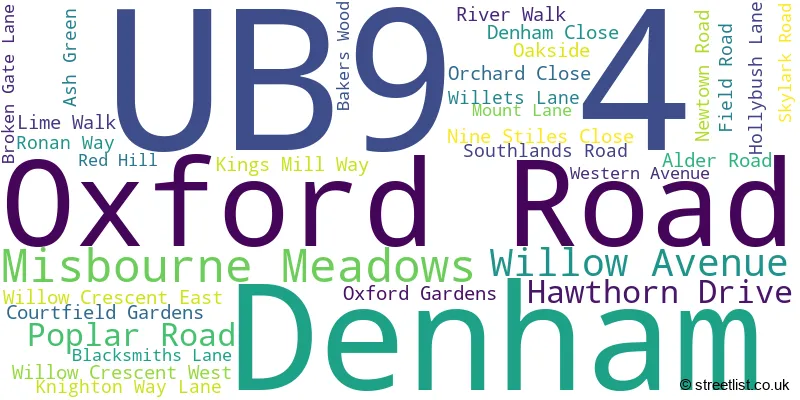
Denham (31 Streets)
Unofficial Streets or Alternative Spellings
Ealing
WESTERN AVENUEDenham
BRONSDON WAY CHEAPSIDE LANE DENHAM AVENUE DENHAM COURT DRIVE DENHAM WAY FORD END NORTH ORBITAL ROAD OLD MILL ROAD DENHAM ROAD DENHAM ROUNDABOUT FROGGY LANE HIGH BRIDGE IMPASSABLE KNIGHTON-WAY LANE MOAT PLACEIVER
SOUTHLANDS ROADChalfont St. Peter
AMERSHAM ROADGERRARDS CROSS
PINSTONE WAY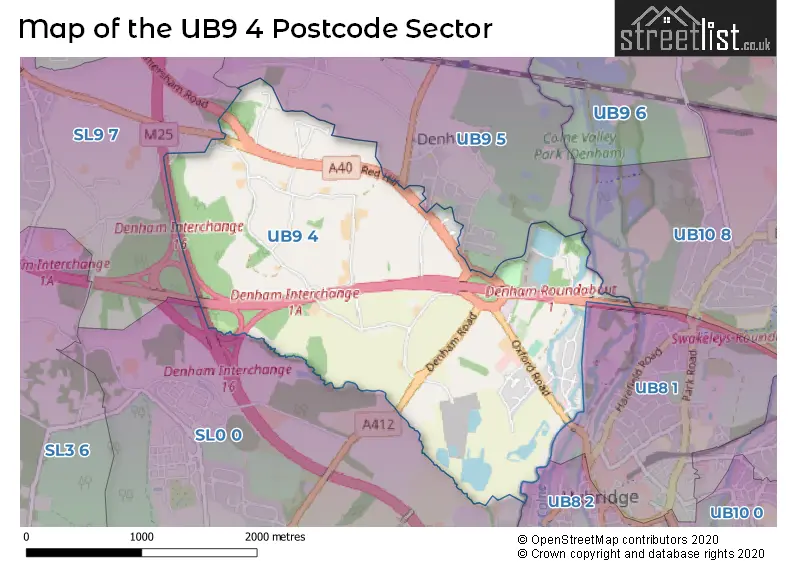
House Prices in the UB9 4 Postcode Sector
| Type of Property | 2018 Average | 2018 Sales | 2017 Average | 2017 Sales | 2016 Average | 2016 Sales | 2015 Average | 2015 Sales |
|---|---|---|---|---|---|---|---|---|
| Detached | £753,444 | 9 | £940,833 | 6 | £749,367 | 15 | £638,802 | 18 |
| Semi-Detached | £452,556 | 18 | £449,231 | 13 | £512,786 | 7 | £452,827 | 13 |
| Terraced | £398,500 | 4 | £447,125 | 4 | £378,750 | 4 | £404,278 | 7 |
| Flats | £310,790 | 5 | £384,417 | 12 | £345,845 | 10 | £271,842 | 13 |
Important Postcodes UB9 4 in the Postcode Sector
UB9 4LH is the postcode for CAPSWOOD 1, Buckinghamshire Council, Council Offices, Oxford Road, Capswood Business Centre, CAPSWOOD 2, Buckinghamshire Council, Council Offices, Oxford Road, Capswood Business Centre, CAPSWOOD 2, South Bucks District Council, Council Offices, Oxford Road, Capswood Business Centre, and CAPSWOOD 1, South Bucks District Council, Council Offices, Oxford Road, Capswood Business Centre
| The UB9 4 Sector is within these Local Authorities |
|
|---|---|
| The UB9 4 Sector is within these Counties |
|
| The UB9 4 Sector is within these Water Company Areas |
|