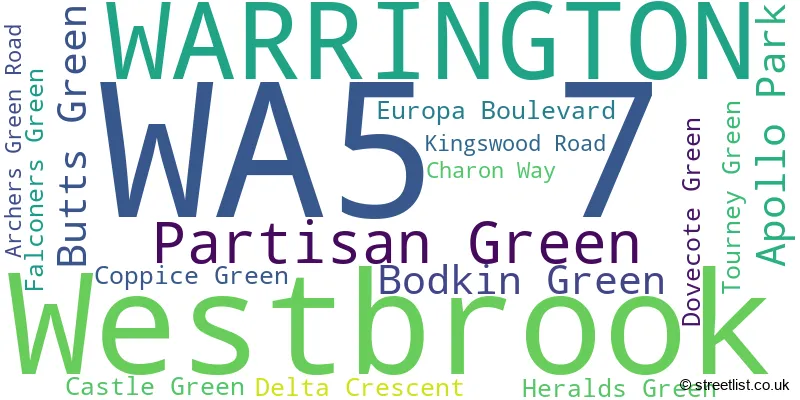
The WA5 7 postcode sector stands on the Cheshire and Merseyside border.
Did you know? According to the 2021 Census, the WA5 7 postcode sector is home to a bustling 1,911 residents!
Given that each sector allows for 400 unique postcode combinations. Letters C, I, K, M, O and V are not allowed in the last two letters of a postcode. With 49 postcodes already in use, this leaves 351 units available.
The WA5 7 postal code covers the settlement of Westbrook.
The WA5 7 Postcode shares a border with WA5 0 (WARRINGTON, Bewsey), WA5 8 (Great Sankey, Old Hall, Westbrook), WA5 9 (Callands, Old Hall), WA8 3 (WIDNES, Bold Heath), WA2 8 (WARRINGTON, Winwick, Winwick Quay), WA5 3 (Great Sankey), WA5 4 (Burtonwood, Collins Green) and WA9 4 (Clock Face, ST. HELENS, Sutton Manor).
The sector is within the post town of WARRINGTON.
WA5 7 is a postcode sector within the WA5 postcode district which is within the WA Warrington postcode area.
The Royal Mail delivery office for the WA5 7 postal sector is the Warrington Delivery Office.
The area of the WA5 7 postcode sector is 1.11 square miles which is 2.87 square kilometres or 709.61 square acres.
The WA5 7 postcode sector is crossed by the M62 motorway.
Waterways within the WA5 7 postcode sector include the Sankey Brook.

Map of the WA5 7 Postcode Sector
Explore the WA5 7 postcode sector by using our free interactive map.
| W | A | 5 | - | 7 | X | X |
| W | A | 5 | Space | 7 | Letter | Letter |
Official List of Streets
Westbrook (15 Streets)
WARRINGTON (1 Streets)
Unofficial Streets or Alternative Spellings
Great Sankey
ALFA WAY CATALINA APPROACH CROMWELL AVENUE SKYLINE DRIVEWestbrook
CARINA PARK HYDRA CLOSE LUNA GROVE TUCANA CLOSE VELA CLOSE VOLANS DRIVE BORSODI BOULEVARD BP ISLAND BURTONWOOD ROUNDABOUT CALLANDS ROAD ROUNDABOUT EASTER COURT EUROPA BOULEVARD ROUNDABOUT FAIRCHILD ROAD FORTRESS BOULEVARD GEMINI TRADE PARK IKEA ROUNDABOUT TAURUS PARK TORNADO DRIVE TRANQUILITY SQUARE TRANQUILTY SQUARE WESTBROOK WAY WHITTLE AVENUE WHITTLE AVENUE ROUNDABOUTOld Hall
WESTBROOK CRESCENTBurtonwood
BURTONWOOD ROAD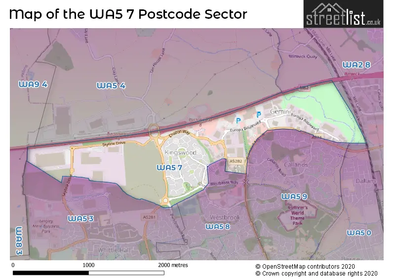
House Prices in the WA5 7 Postcode Sector
| Type of Property | 2018 Average | 2018 Sales | 2017 Average | 2017 Sales | 2016 Average | 2016 Sales | 2015 Average | 2015 Sales |
|---|---|---|---|---|---|---|---|---|
| Detached | £295,906 | 17 | £262,887 | 23 | £255,435 | 41 | £246,591 | 41 |
| Semi-Detached | £180,500 | 2 | £243,400 | 5 | £192,544 | 9 | £222,926 | 7 |
| Terraced | £139,667 | 3 | £176,167 | 3 | £207,854 | 7 | £188,575 | 6 |
| Flats | £116,150 | 3 | £125,000 | 2 | £118,988 | 4 | £127,240 | 5 |
| The WA5 7 Sector is within these Local Authorities |
|
|---|---|
| The WA5 7 Sector is within these Counties |
|
| The WA5 7 Sector is within these Water Company Areas |
|