The WA5 8 postcode sector is within the county of Cheshire.
Did you know? According to the 2021 Census, the WA5 8 postcode sector is home to a bustling 8,300 residents!
Given that each sector allows for 400 unique postcode combinations. Letters C, I, K, M, O and V are not allowed in the last two letters of a postcode. With 115 postcodes already in use, this leaves 285 units available.
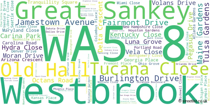
The largest settlement in the WA5 8 postal code is Great Sankey followed by Old Hall, and Westbrook.
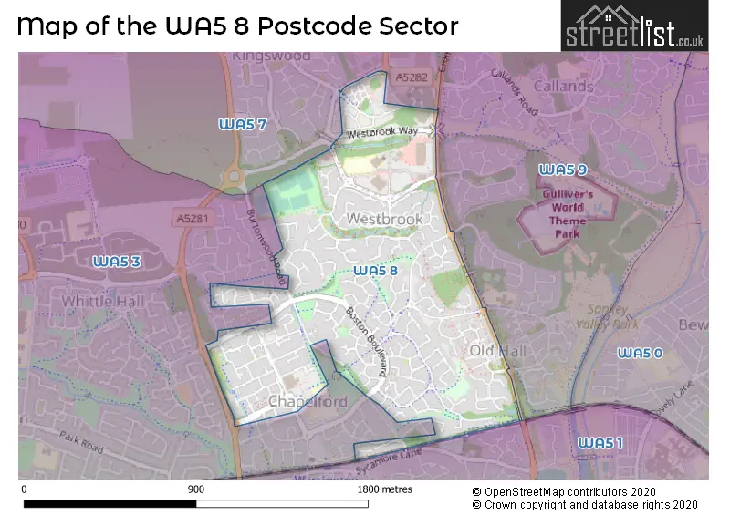
The WA5 8 Postcode shares a border with WA5 9 (Callands, Old Hall), WA5 1 (Great Sankey, WARRINGTON), WA5 3 (Great Sankey) and WA5 7 (Westbrook).
The sector is within the post town of WARRINGTON.
WA5 8 is a postcode sector within the WA5 postcode district which is within the WA Warrington postcode area.
The Royal Mail delivery office for the WA5 8 postal sector is the Warrington Delivery Office.
The area of the WA5 8 postcode sector is 0.68 square miles which is 1.75 square kilometres or 433.46 square acres.

Map of the WA5 8 Postcode Sector
Explore the WA5 8 postcode sector by using our free interactive map.
| W | A | 5 | - | 8 | X | X |
| W | A | 5 | Space | 8 | Letter | Letter |
Official List of Streets
Great Sankey (67 Streets)
Westbrook (16 Streets)
Unofficial Streets or Alternative Spellings
Great Sankey
AUGUSTA GROVE BRUNSWICK CLOSE CHELTENHAM CLOSE CROMWELL AVENUE FARMLEIGH GARDENS NEWARK DRIVE ROCKFORD GARDENS THE LEES UNION SQUAREOld Hall
OLD HALL ROAD SHACKLETON CLOSE CHAPELFORD ROUNDABOUT GLENDALE WALK GOLDENDALE WALK IDAHO WALK LEXINGTON WALK OAKLAHOMA BOULEVARD PINEHURST WALK SOMMERVILLE WALK SUNSET BOULEVARD TWENTY ACRE ROAD WEBSTER COURT WESTBROOK WAY WESTBROOK WAY ROUNDABOUT WHITTLE AVENUEBurtonwood
BURTONWOOD ROADSchools and Places of Education Within the WA5 8 Postcode Sector
St Philip (Westbrook) CofE Aided Primary School
Voluntary aided school
Westbrook Centre, Warrington, Cheshire, WA5 8UE
Head: Mr Paul Stanley
Ofsted Rating: Good
Inspection: 2023-04-19 (400 days ago)
Website: Visit St Philip (Westbrook) CofE Aided Primary School Website
Phone: 01925445391
Number of Pupils: 606
House Prices in the WA5 8 Postcode Sector
| Type of Property | 2018 Average | 2018 Sales | 2017 Average | 2017 Sales | 2016 Average | 2016 Sales | 2015 Average | 2015 Sales |
|---|---|---|---|---|---|---|---|---|
| Detached | £314,082 | 56 | £287,899 | 120 | £284,660 | 113 | £265,385 | 54 |
| Semi-Detached | £183,202 | 33 | £180,589 | 37 | £159,482 | 24 | £154,100 | 22 |
| Terraced | £169,732 | 36 | £173,104 | 44 | £171,716 | 46 | £163,189 | 50 |
| Flats | £132,821 | 14 | £116,260 | 21 | £111,883 | 15 | £107,659 | 11 |
Important Postcodes WA5 8 in the Postcode Sector
WA5 8UE is the postcode for St. Philip Westbrook C of E Aided Primary School, Westbrook Centre, Westbrook, and St. Philip Westbrook C of E Aided Primary School, Westbrook Centre
WA5 8UF is the postcode for Westbrook Medical Centre, 301-302 Westbrook Centre
| The WA5 8 Sector is within these Local Authorities |
|
|---|---|
| The WA5 8 Sector is within these Counties |
|
| The WA5 8 Sector is within these Water Company Areas |
|