The WN6 7 postcode sector is within the county of Greater Manchester.
Did you know? According to the 2021 Census, the WN6 7 postcode sector is home to a bustling 9,755 residents!
Given that each sector allows for 400 unique postcode combinations. Letters C, I, K, M, O and V are not allowed in the last two letters of a postcode. With 213 postcodes already in use, this leaves 187 units available.
The WN6 7 postal code covers the settlement of WIGAN.
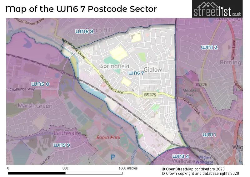
The WN6 7 Postcode shares a border with WN3 4 (Ince, WIGAN), WN5 0 (WIGAN, Orrell, Martland Park), WN1 1 (WIGAN), WN1 2 (WIGAN, Standish, Haigh) and WN6 8 (Shevington, WIGAN, Standish Lower Ground).
The sector is within the post town of WIGAN.
WN6 7 is a postcode sector within the WN6 postcode district which is within the WN Wigan postcode area.
The Royal Mail delivery office for the WN6 7 postal sector is the Wigan Delivery Office.
The area of the WN6 7 postcode sector is 0.72 square miles which is 1.85 square kilometres or 457.87 square acres.
Waterways within the WN6 7 postcode sector include the Leeds and Liverpool Canal, River Douglas.

Map of the WN6 7 Postcode Sector
Explore the WN6 7 postcode sector by using our free interactive map.
| W | N | 6 | - | 7 | X | X |
| W | N | 6 | Space | 7 | Letter | Letter |
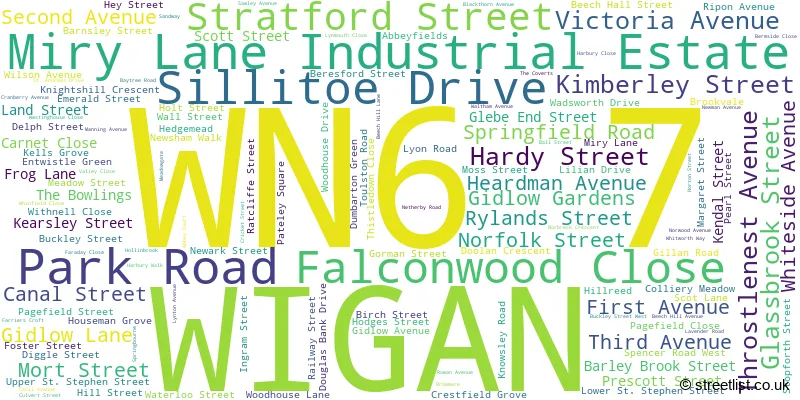
Official List of Streets
WIGAN (128 Streets)
Miry Lane Industrial Estate (3 Streets)
Unofficial Streets or Alternative Spellings
WIGAN
EASTWELL ROAD GUILDFORD CRESCENT HAZEL AVENUE MAPLE GROVE ROSE AVENUE SEDGEFIELD DRIVE SPENCER ROAD THICKNESSE AVENUE WALKDEN AVENUE WELLFIELD ROAD WILLOW ROAD BOLLARDS BROWNMERE CLOVER STREET CORAL STREET DERMSIDE CLOSE DIAMOND STREET FOSTERS BUILDINGS PENKETH STREET SHAFTSBURY STREET THROSTLE NEST AVENUE WEST STREETStandish Lower Ground
WIGAN LOWER ROADSchools and Places of Education Within the WN6 7 Postcode Sector
Beech Hill Community Primary School
Community school
Netherby Road, Wigan, Lancashire, WN6 7PT
Head: Mrs Michelle McCarthy
Ofsted Rating: Good
Inspection: 2022-10-05 (596 days ago)
Website: Visit Beech Hill Community Primary School Website
Phone: 01942243582
Number of Pupils: 305
Sacred Heart Catholic Primary School
Voluntary aided school
Springfield Road, WIGAN, Lancashire, WN6 7RH
Head: Mrs Samantha Stirrup
Ofsted Rating: Good
Inspection: 2023-03-31 (419 days ago)
Website: Visit Sacred Heart Catholic Primary School Website
Phone: 01942231478
Number of Pupils: 421
St John Fisher Catholic High School
Voluntary aided school
Baytree Road, Wigan, Lancashire, WN6 7RN
Head: Mrs Alison Rigby
Ofsted Rating: Good
Inspection: 2021-11-11 (924 days ago)
Website: Visit St John Fisher Catholic High School Website
Phone: 01942510715
Number of Pupils: 999
Wigan St Andrew's CofE Junior and Infant School
Voluntary aided school
Mort Street, Wigan, Lancashire, WN6 7AU
Head: Mrs Lindsey Taylor-Heaton
Ofsted Rating: Good
Inspection: 2023-02-15 (463 days ago)
Website: Visit Wigan St Andrew's CofE Junior and Infant School Website
Phone: 01942244354
Number of Pupils: 204
House Prices in the WN6 7 Postcode Sector
| Type of Property | 2018 Average | 2018 Sales | 2017 Average | 2017 Sales | 2016 Average | 2016 Sales | 2015 Average | 2015 Sales |
|---|---|---|---|---|---|---|---|---|
| Detached | £155,820 | 23 | £153,713 | 14 | £154,050 | 14 | £155,308 | 12 |
| Semi-Detached | £131,806 | 56 | £127,036 | 53 | £127,966 | 37 | £129,250 | 34 |
| Terraced | £96,780 | 102 | £100,072 | 117 | £90,560 | 123 | £92,540 | 95 |
| Flats | £349,000 | 2 | £73,000 | 1 | £0 | 0 | £83,000 | 2 |
Important Postcodes WN6 7 in the Postcode Sector
WN6 7AU is the postcode for Wigan St. Andrews C of E Junior & Infant School, Mort Street
WN6 7HX is the postcode for Ashton Leigh & Wigan NHS, Lorenzo Training Centre, Beech Hall Street
WN6 7LB is the postcode for Wigan Health Centre, Frog Lane, and Boston House Health Centre, Boston House
WN6 7PD is the postcode for Beech Hill Medical Practice, 278 Gidlow Lane
WN6 7PT is the postcode for Beech Hill Primary School, Netherby Road, and MAIN BUILDING, Beech Hill Primary School, Netherby Road
WN6 7RH is the postcode for INFANTS BLOCK, Sacred Heart RC School, Springfield Road, JUNIOR BLOCK, Sacred Heart RC School, Springfield Road, and Sacred Heart RC School, Springfield Road
WN6 7RN is the postcode for St. John Fisher RC High School, Baytree Road, BLOCK C, D & E, St. John Fisher RC High School, Baytree Road, O'BRIEN BUILDING, St. John Fisher RC High School, Baytree Road, and BLOCK A, St. John Fisher RC High School, Baytree Road
| The WN6 7 Sector is within these Local Authorities |
|
|---|---|
| The WN6 7 Sector is within these Counties |
|
| The WN6 7 Sector is within these Water Company Areas |
|