The WS12 0 postcode sector is within the county of Staffordshire.
Did you know? According to the 2021 Census, the WS12 0 postcode sector is home to a bustling 3,201 residents!
Given that each sector allows for 400 unique postcode combinations. Letters C, I, K, M, O and V are not allowed in the last two letters of a postcode. With 74 postcodes already in use, this leaves 326 units available.
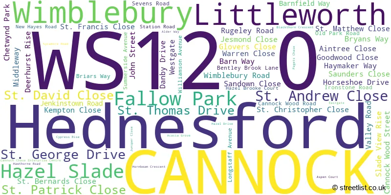
The largest settlement in the WS12 0 postal code is CANNOCK followed by Hednesford, and Hazel Slade.
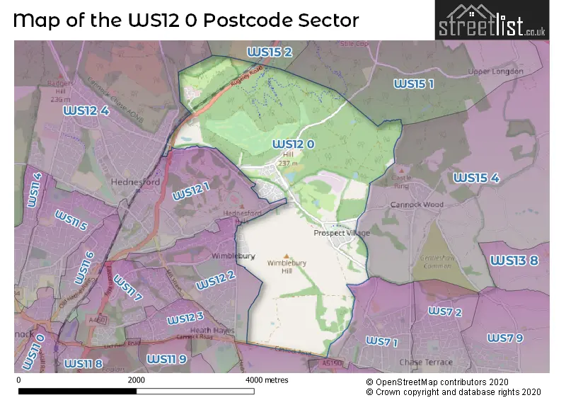
The WS12 0 Postcode shares a border with WS7 1 (BURNTWOOD, Chase Terrace), WS12 1 (Hednesford, CANNOCK), WS12 2 (CANNOCK, Hednesford, Heath Hayes), WS15 1 (Brereton, RUGELEY, Hawksyard), WS15 2 (RUGELEY), WS12 4 (Hednesford, CANNOCK, Huntington), WS15 4 (RUGELEY, Armitage, Handsacre), WS7 3 (BURNTWOOD, Chasetown, Burntwood Business Park) and WS11 9 (Norton Canes, CANNOCK).
The sector is within the post town of CANNOCK.
WS12 0 is a postcode sector within the WS12 postcode district which is within the WS Walsall postcode area.
The Royal Mail delivery office for the WS12 0 postal sector is the unknown.
The area of the WS12 0 postcode sector is 4.24 square miles which is 10.99 square kilometres or 2,714.87 square acres.

Map of the WS12 0 Postcode Sector
Explore the WS12 0 postcode sector by using our free interactive map.
| W | S | 1 | 2 | - | 0 | X | X |
| W | S | 1 | 2 | Space | 0 | Letter | Letter |
Official List of Streets
CANNOCK (43 Streets)
Littleworth (1 Streets)
Hednesford (12 Streets)
Wimblebury (3 Streets)
Hazel Slade (2 Streets)
Schools and Places of Education Within the WS12 0 Postcode Sector
Hazel Slade Primary Academy
Academy converter
Cannock Wood Street, Cannock, Staffordshire, WS12 0PN
Head: Mrs Katie Challinor
Ofsted Rating: Good
Inspection: 2022-09-14 (620 days ago)
Website: Visit Hazel Slade Primary Academy Website
Phone: 01543227115
Number of Pupils: 209
House Prices in the WS12 0 Postcode Sector
| Type of Property | 2018 Average | 2018 Sales | 2017 Average | 2017 Sales | 2016 Average | 2016 Sales | 2015 Average | 2015 Sales |
|---|---|---|---|---|---|---|---|---|
| Detached | £332,689 | 14 | £313,339 | 22 | £289,306 | 27 | £231,538 | 26 |
| Semi-Detached | £166,800 | 14 | £138,667 | 12 | £141,719 | 18 | £122,938 | 17 |
| Terraced | £166,000 | 7 | £131,417 | 6 | £128,356 | 9 | £113,750 | 4 |
| Flats | £75,500 | 2 | £84,000 | 1 | £0 | 0 | £0 | 0 |
Important Postcodes WS12 0 in the Postcode Sector
WS12 0PN is the postcode for Hazel Slade C P School, Cannock Wood Street
| The WS12 0 Sector is within these Local Authorities |
|
|---|---|
| The WS12 0 Sector is within these Counties |
|
| The WS12 0 Sector is within these Water Company Areas |
|