Map of John Porter Place
| Postcodes | ||
|---|---|---|
| Icon | Postcodes for John Porter Place | |
| Walking Distances | ||
| Distance Info | Green Circle = 10 Minutes Walk (800 metres) | |
About John Porter Place
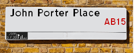
John Porter Place is a street located in Aberdeen. It uses the postcode AB15 8LF. The street has a length of approximately 74 metres.
John Porter Place is located within the Aberdeen City Council's jurisdiction. They provide various services, like refuse collection, and manage council tax collection. It's situated in the (pseudo) Scotland region of the UK.
John Porter Place is located within the county of City of Aberdeen, situated in the (pseudo) Scotland region of the UK. It's 398.27 miles North from central London., 2.96 miles West from Aberdeen, 55.7 miles North East from Dundee and 80.4 miles East from Inverness.
John Porter Place is within the Post Town of ABERDEEN

Do you know why this road is called John Porter Place?
What's it like to live here?
Ask the community a question about John Porter Place.
Do you have any questions, memories to share or know any facts about John Porter Place? We'd love to know more.
Also on streetlist.co.uk, can you help?
Swing Swang Lane
28th April 2024
I am trying to find out why the lane is named Swing Swang?
It has been known known this since at least 1905 when hedge making contents used to be held here.
Swing Swang is often used to describe a fairground ride. I remember Swing Boats. Were they a bit like this or is Swing Swang another name for swings?
Swing Swangs are also mentioned in connection to orchards. Or were orchards just good places to have swings?
Estate Agents near John Porter Place
| Name | Address | Website |
|---|---|---|
| Savills | 37 Albyn Place Aberdeen AB10 1YN | Visit Website |
| Stonehouse Lettings | Osborne House 27-30 Carden Place Aberdeen AB10 1UP | Visit Website |
| Savills Rural Lettings | 5 Queens Terrace, Aberdeen, AB10 1XL | Visit Website |
We have found 1 postcode for John Porter Place
Location Details
| John Porter Place | |
|---|---|

| |
| Latitude | 57.133632 |
| Longitude | -2.171091 |
| OS Easting (X): | 389644 |
| OS Northing (Y): | 804739 |
| OS Grid Reference: | NJ896047 |
Neighbourhood Policing |
| Police Force: Scotland |
| Find a Local Neighbourhood Watch Scheme |
Frequently asked Questions for John Porter Place
What Council (Local Authority) is John Porter Place in?
John Porter Place is located within the local authority area of Aberdeen City Council which is a Scottish unitary authority.
What Parish Council is John Porter Place in?
John Porter Place is in an unparished area.
What Electoral Ward is John Porter Place in?
John Porter Place is located within the ward of Lower Deeside.
What County is John Porter Place in?
John Porter Place is located within the ceremonial county of City of Aberdeen.
What Constituency is John Porter Place in?
John Porter Place is located within the constituency of Aberdeen South.
What Part of the UK is John Porter Place in?
John Porter Place is located within the historic nation of Scotland.
What County Council area is John Porter Place in?
John Porter Place is not in a County Council area.
What Police Force area is John Porter Place in?
John Porter Place is located within the Scotland Police area.
Roads that have a Junction with John Porter Place
| Street | Junction Type |
|---|---|
| John Porter Wynd | junction |
Sunset and Sunrise times for John Porter Place , AB15 8LF
| Sunrise | 04:53 |
|---|---|
| Sunset | 21:16 |
Latest Weather Conditions for John Porter Place, AB15 8LF
| Observed at Weather Station: | Aberdeen Airport 11 May 2024 at 08:00 (5.13 miles away) |
|---|---|
| Current Weather: | Partly cloudy (day) |
| Temperature and Humidity: | 16.3°C (71.1%) |
| Wind Direction and Speed: | N (5 mph) |
Population Statistics
| ONS Area Code | S00090389 |
|---|---|
| ONS Area Name | Rural Workers and Families |
| LSOA Code: | S01006547 |
|---|---|
| LSOA Name: | Hazlehead - 01 |
| SOA Code: | 5c |
| SOA Name: | |
| MSOA Code: | S02001243 |
| MSOA Name: | Hazlehead |
Nearest Supermarkets
| Sainsburys Aberdeen North Deeside Road Local |
|---|
| 345 North Deeside Road, Cults, Aberdeen, Scotland, AB15 9SX |
| Distance: 1.12 Miles |
| Directions from John Porter Place to Sainsburys Aberdeen North Deeside Road Local |
| Sainsburys Aberdeen North Deeside Road Local |
|---|
| 345 North Deeside Road, Cults, Aberdeen, Scotland, AB15 9SX |
| 01224 862 659 |
| Distance: 1.12 Miles |
| Directions from John Porter Place to Sainsburys Aberdeen North Deeside Road Local |
| Tesco Aberdeen Woodend Superstore |
|---|
| Rousay Dr, Aberdeen, AB15 6LT |
| 0345 671 9557 |
| Distance: 1.14 Miles |
| Directions from John Porter Place to Tesco Aberdeen Woodend Superstore |
| Tesco Aberdeen North Dees Express |
|---|
| 393 North Deeside Rd, Cults, Aberdeen, AB15 9SX |
| 0345 671 9314 |
| Distance: 1.16 Miles |
| Directions from John Porter Place to Tesco Aberdeen North Dees Express |
Telephone Information
| Area Code |
|---|
| Area Code: 01224 - Aberdeen |
Local Government
| Local Council Details |
|---|
| Within the area of Aberdeen City |
| Visit the Council's Website |
| Aberdeen City Council Customer Service Centre, Ground Floor, Marischal College, Broad Street, Aberdeen &AB10 1AB |
| Telephone Number: 0845 608 0910 |
| Local Member of Parliament |
|---|
| Within the Westminster Parliamentary Constituency of Aberdeen South |
| The Member of Parliament is Stephen Flynn |
| Details for the MP Stephen Flynn on parliament.uk |
| Details for the MP Stephen Flynn on theyworkforyou.com |
| In the 2019 General Election Stephen Flynn won with a majority of 3,990 the result was SNP gain from Con. The total electorate was 65,719 |
| Wards, Parish Councils and County Councils |
|---|
| Ward: Lower Deeside Ward |
| Ceremonial County: City of Aberdeen |
Nearest Schools
Scotland Primary Schools
Airyhall School
Address: Airyhall School, Countesswells Road, Aberdeen, AB15 8AD
Distance: 0.81 miles
Contact: 01224 498050
Nearest Hospitals
| Name | Address | Postcode | Distance | Map |
|---|---|---|---|---|
| Woodend General Hospital | Aberdeen | AB15 6XS | 1.52 Km | View Directions |
| Maidencraig House | Woodend Hospital, Eday Road | AB15 6XS | 1.52 Km | View Directions |
| 375 Great Western Lodge | 375 Great Western Road, Aberdeen | AB10 6NU | 2.58 Km | View Directions |
Nearest Dentists
Dentists near John Porter Place
| Name | Address | Postcode | Distance | Map |
|---|---|---|---|---|
| PRIMARY CARE DENTAL SERVICES | Westholme,woodend Hospital, Queens Road, Aberdeen | AB156LS | 1.52 Km | View Directions |
| MYDENTIST | 21 Springfield Road, Aberdeen | AB157RJ | 1.56 Km | View Directions |
| CULTS DENTAL PRACTICE | 383 North Deeside Road, Cults Aberdeen | AB159SX | 1.85 Km | View Directions |
Nearest GP Surgeries
Doctors near John Porter Place
HOSPITAL AT HOME
Address: DAY HOSPITAL, WOODEND HOSPITAL, ABERDEEN, AB15 6XS
Distance: 0.95 miles
Contact: tel: 01224 556055
OPHTHALMIC PRESCRIBING
Address: PRIMARY CARE CONTRACTS TEAM, WESTHOLME, WOODEND HOSPITAL, EDAY ROAD, ABERDEEN, AB15 6LS
Distance: 0.95 miles
Contact: tel: 01224 556502
DIABETIC NURSE SERVICE
Address: NURSING DIRECTORATE, GRAMPIAN HEALTH, SUMMERFIELD HOUSE, 2 EDAY ROAD, ABERDEEN, AB15 6RE
Distance: 1.11 miles
Contact: tel: 01224 558427
NHS GRAMPIAN HEART FAILURE NURSING SERVICE
Address: NURSING DIRECTORATE, SUMMERFIELD HOUSE, 2 EDAY ROAD, ABERDEEN, AB15 6RE
Distance: 1.11 miles
Contact: tel: 01330 827230
CULTS MEDICAL GROUP
Address: SOUTH AVENUE, CULTS, ABERDEEN, ABERDEENSHIRE, AB15 9LQ
Distance: 1.33 miles
Contact: tel: 03453 371140
HAMILTON MEDICAL GROUP
Address: 4 QUEENS ROAD, ABERDEEN, ABERDEENSHIRE, AB15 4ZT
Distance: 1.63 miles
Contact: tel: 01224 562888
Nearest Dispensing Chemists
Pharmacies near John Porter Place
| Name | Address | Postcode | Telephone | Map | Distance in Km |
|---|---|---|---|---|---|
| L Rowlands & Co (Retail) Ltd | 381a North Deeside Road, Cults, Aberdeen, | AB15 9SX | 01224 861624 | View Directions | |
| Lloyds Pharmacy Ltd | 359 North Deeside Road, Cults, Aberdeen, | AB15 9SX | 01224 867566 | View Directions | |
| Boots The Chemists Ltd | 475 Gt Western Road, Aberdeen | AB10 6NN | 01224 310158 | View Directions |
Nearest Opticians
Opticians near John Porter Place
ASDA OPTICIANS (BRIDGE OF DEE)
Address: ASDA STORES LTD, GARTHDEE ROAD, BRIDGE OF DEE, ABERDEEN, ABERDEENSHIRE, AB10 7QA
Distance: 1.89 miles
Contact: :
OPTIMAX LASER EYE CLINIC
Address: 2 GOLDEN SQUARE, ABERDEEN, ABERDEENSHIRE, AB10 1RD
Distance: 2.65 miles
Contact: :
VISION EXPRESS (ABERDEEN)
Address: UNIT 32, BON ACCORD CENTRE, GEORGE STREET, ABERDEEN, ABERDEENSHIRE, AB25 1HZ
Distance: 2.87 miles
Contact: :
BOOTS OPTICIANS (ABERDEEN - BON ACCORD CENTRE)
Address: BON ACCORD CENTRE, GEORGE STREET, ABERDEEN, ABERDEENSHIRE, AB25 1HZ
Distance: 2.87 miles
Contact: :
ABERDEEN DOMICILIARY SPECSAVERS LIMITED
Address: 56-58 UNION STREET, ABERDEEN, ABERDEENSHIRE, AB10 1BB
Distance: 2.93 miles
Contact: :
COSTCO WHOLESALE UK LTD - MANDELA WAY
Address: COSTCO, ENDEAVOUR DRIVE, ARNHALL BUSINESS PARK, WESTHILL, ABERDEENSHIRE, AB32 6UF
Distance: 4.16 miles
Contact: :
Transport
Nearest Rail Stations
Aberdeen Station is 2.84 miles away.
Address: Aberdeen station, Guild Street, Union Square, Aberdeen, AB11 6LX
Aberdeen is situated on the Aberdeen to Inverness line|Glasgow to Aberdeen line|Edinburgh to Aberdeen line and is managed by ScotRail.
Aberdeen Station is staffed on a part time basis.
Dyce Station is 5.04 miles away.
Address: Dyce station, Station Road, Dyce, Aberdeenshire, AB21 7EQ
Dyce is situated on the Aberdeen to Inverness line|Edinburgh to Aberdeen line and is managed by ScotRail.
Dyce Station is an unstaffed station.