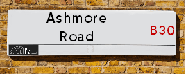
Map of Ashmore Road
| Postcodes | ||
|---|---|---|
| Icon | Postcodes for Ashmore Road | |
| Walking Distances | ||
| Distance Info | Green Circle = 10 Minutes Walk (800 metres) | |
About Ashmore Road
Ashmore Road is a street located in the city of Birmingham. The street has a length of approximately 269 metres.
Ashmore Road is located within the Birmingham District (B) Council's jurisdiction. They provide various services, like refuse collection, and manage council tax collection. It's situated in the West Midlands region of the UK.
Ashmore Road has been assigned the Unique Street Reference Number of 2703768 in the National Street Gazetteer.
Ashmore Road is located within the county of West Midlands, situated in the West Midlands region of the UK. It's 100.5 miles North West from central London., 4.29 miles South from Birmingham, 17.85 miles West from Coventry and 19.92 miles North East from Worcester.

Do you know why this road is called Ashmore Road?
What's it like to live here?
Ask the community a question about Ashmore Road.
Do you have any questions, memories to share or know any facts about Ashmore Road? We'd love to know more.
Also on streetlist.co.uk, can you help?
Swing Swang Lane
28th April 2024
I am trying to find out why the lane is named Swing Swang?
It has been known known this since at least 1905 when hedge making contents used to be held here.
Swing Swang is often used to describe a fairground ride. I remember Swing Boats. Were they a bit like this or is Swing Swang another name for swings?
Swing Swangs are also mentioned in connection to orchards. Or were orchards just good places to have swings?
Estate Agents near Ashmore Road
| Name | Address | Website |
|---|---|---|
| Leaders Lettings | 1880 Pershore Road, Kings Norton, Birmingham, B30 3AS | Visit Website |
| Leaders Sales | 1880 Pershore Road, Kings Norton, Birmingham, B30 3AS | Visit Website |
| Rice Chamberlains LLP | 243 Mary Vale Road, Birmingham, B30 1PN | Visit Website |
Location Details
| Ashmore Road | |
|---|---|

| |
| Latitude | 52.419876 |
| Longitude | -1.930882 |
| OS Easting (X): | 404700 |
| OS Northing (Y): | 280253 |
| OS Grid Reference: | SP047803 |
Neighbourhood Policing |
| Police Force: West Midlands |
 View Neighbourhood Crime and Policing View Neighbourhood Crime and Policing |
| Find a Local Neighbourhood Watch Scheme |
Frequently asked Questions for Ashmore Road
What Council (Local Authority) is Ashmore Road in?
Ashmore Road is located within the local authority area of Birmingham Council which is a Metropolitan District.
What Parish Council is Ashmore Road in?
Ashmore Road is in an unparished area.
What Electoral Ward is Ashmore Road in?
Ashmore Road is located within the ward of Bournville & Cotteridge.
What County is Ashmore Road in?
Ashmore Road is located within the ceremonial county of West Midlands.
What Constituency is Ashmore Road in?
Ashmore Road is located within the constituency of Birmingham &Selly Oak.
What Part of the UK is Ashmore Road in?
Ashmore Road is located within the West Midlands (England) region of the United Kingdom.
What County Council area is Ashmore Road in?
Ashmore Road is located within the West Midlands Council area.
What Police Force area is Ashmore Road in?
Ashmore Road is located within the West Midlands Police area.
Roads that have a Junction with Ashmore Road
| Street | Junction Type |
|---|---|
| Franklin Road | junction |
| Midland Road | junction |
| Woodfall Avenue | junction |
Sunset and Sunrise times for Ashmore Road
| Sunrise | 05:10 |
|---|---|
| Sunset | 20:57 |
Latest Weather Conditions for Ashmore Road
| Observed at Weather Station: | Coleshill 14 May 2024 at 15:00 (11.00 miles away) |
|---|---|
| Current Weather: | Overcast |
| Temperature and Humidity: | 15.9°C (74.2%) |
| Wind Direction and Speed: | SE (10 mph) |
Population Statistics
| ONS Area Code | E00045431 & E00045422 |
|---|---|
| ONS Area Name | Multi-Ethnic Professionals with Families & Families in Terraces and Flats |
| Average Age | 40.69 & 36.72 |
| Area Population | 1513.00 & 1606.00 |
| Male Population | 698.00 & 780.00 (47%) |
| Female Population | 815.00 & 826.00 (53%) |
| Benefit Claimants | 6 & 23 (1%) |
| LSOA Code: | E01008956 &E01008960 |
|---|---|
| LSOA Name: | Birmingham 112D &Birmingham 116B |
| SOA Code: | 3c &3d |
| SOA Name: | |
| MSOA Code: | E02001938 &E02001942 |
| MSOA Name: | Birmingham 112 &Birmingham 116 |
Nearest Supermarkets
| Tesco Birmingham Bournville Esso Express |
|---|
| Linden Rd, Birmingham, B30 1PA |
| 0345 675 6997 |
| Distance: 0.24 Miles |
| Directions from Ashmore Road to Tesco Birmingham Bournville Esso Express |
| Iceland Northfield G |
|---|
| Unit 12 Grosvenor Centre, Northfield, Birmingham, B31 2JU |
| 01214780890 |
| Distance: 1.58 Miles |
| Directions from Ashmore Road to Iceland Northfield G |
| Iceland Selly Oak Food Warehouse |
|---|
| BATTERY RETAIL PARK, BIRMINGHAM, , B29 6SJ |
| 01214727636 |
| Distance: 1.58 Miles |
| Directions from Ashmore Road to Iceland Selly Oak Food Warehouse |
| Tesco Kings Heath Express |
|---|
| 281-289 Alcester Rd South, Birmingham, B14 6EB |
| 0345 674 6533 |
| Distance: 1.66 Miles |
| Directions from Ashmore Road to Tesco Kings Heath Express |
Telephone Information
| Area Code |
|---|
| Area Code: 0121 - Birmingham |
| Area Code: 01527 - Redditch |
| Area Code: 01384 - Dudley |
| Area Code: 01564 - Lapworth |
Broadband Information
| Speed | Average Speed | Median Speed | Maximum Speed | Next-generation access (NGA) | Number of Connections |
|---|---|---|---|---|---|
| Greater than 2 Mbps | >=30 | >=30 | >=30 | Y | 24 |
Local Government
| Local Council Details |
|---|
| Within the area of Birmingham |
| Visit the Council's Website |
| Council House, Victoria Square, Birmingham &B1 1BB |
| Send email |
| Telephone Number: 0121 303 1111 |
| Local Member of Parliament |
|---|
| Within the Westminster Parliamentary Constituency of Birmingham &Selly Oak |
| The Member of Parliament is Stephen McCabe |
| Details for the MP Stephen McCabe on parliament.uk |
| Details for the MP Stephen McCabe on theyworkforyou.com |
| In the 2019 General Election Stephen McCabe won with a majority of 12,414 the result was Lab hold. The total electorate was 82,665 |
| Wards, Parish Councils and County Councils |
|---|
| Ward: Bournville & Cotteridge Ward |
| Ceremonial County: West Midlands |
Nearest Schools
England Primary Schools
Bells Farm Primary School
Address: Bells Farm Primary School, Bells Farm Close, Druids Heath, Birmingham, West Midlands, B14 5QP
Distance: 1.35 miles
Contact: 01216758666
Stirchley Primary School
Address: Stirchley Primary School, Pershore Road, Birmingham, West Midlands, B30 2JL
Distance: 0.54 miles
Contact:
Broadmeadow Infant School
Address: Broadmeadow Infant School, Monyhull Hall Road, Kings Norton, Birmingham, West Midlands, B30 3QJ
Distance: 1.13 miles
Contact: 01214644266
Broadmeadow Junior School
Address: Broadmeadow Junior School, Monyhull Hall Road, Kings Norton, Birmingham, West Midlands, B30 3QJ
Distance: 1.13 miles
Contact: 01214641717
Cotteridge Primary School
Address: Cotteridge Primary School, Breedon Road, Cotteridge, Birmingham, West Midlands, B30 2HT
Distance: 0.24 miles
Contact: 01214642865
Kings Norton Junior and Infant School
Address: Kings Norton Junior and Infant School, Pershore Road South, Kings Norton, Birmingham, West Midlands, B30 3EU
Distance: 0.71 miles
Contact:
Bournville Infant School
Address: Bournville Infant School, Linden Road, Birmingham, West Midlands, B30 1JY
Distance: 0.71 miles
Contact:
Bournville Village Primary
Address: Bournville Village Primary, Linden Road, Bournville, Birmingham, West Midlands, B30 1JY
Distance: 0.71 miles
Contact: 01216759098
St Francis Church of England Aided Primary School and Nursery
Address: St Francis Church of England Aided Primary School and Nursery, Teazel Avenue, Bournville, Birmingham, West Midlands, B30 1LZ
Distance: 0.65 miles
Contact:
St Mary's Church of England Primary School
Address: St Mary's Church of England Primary School, Lodge Hill Road, Selly Oak, Birmingham, West Midlands, B29 6NU
Distance: 1.43 miles
Contact: 01216751729
St Laurence Church Infant School
Address: St Laurence Church Infant School, Bunbury Road, Northfield, Birmingham, West Midlands, B31 2DJ
Distance: 1.43 miles
Contact: 01214642888
St Laurence Church Junior School
Address: St Laurence Church Junior School, Bunbury Road, Northfield, Birmingham, West Midlands, B31 2DJ
Distance: 1.43 miles
Contact: 01214646499
Stirchley Primary School
Address: Stirchley Primary School, Pershore Road, Stirchley, Birmingham, West Midlands, B30 2JL
Distance: 0.54 miles
Contact: 01214582989
St Paul's Catholic Primary School
Address: St Paul's Catholic Primary School, Sisefield Road, Kings Norton, Birmingham, West Midlands, B38 9JB
Distance: 1.42 miles
Contact: 01214641546
Hawkesley Church Primary Academy
Address: Hawkesley Church Primary Academy, 376 Shannon Road, Kings Norton, Birmingham, West Midlands, B38 9TR
Distance: 1.80 miles
Contact: 01214596467
St Joseph's Catholic Primary School
Address: St Joseph's Catholic Primary School, Selly Oak Road, Kings Norton, Birmingham, West Midlands, B30 1HN
Distance: 0.25 miles
Contact: 01214582458
Fairway Primary Academy
Address: Fairway Primary Academy, Muirfield Gardens, Kings Norton, Birmingham, West Midlands, B38 8XQ
Distance: 1.25 miles
Contact: 01214643200
St Francis Church of England Aided Primary School and Nursery
Address: St Francis Church of England Aided Primary School and Nursery, Teazel Avenue, Bournville, Birmingham, West Midlands, B30 1LZ
Distance: 0.65 miles
Contact: 01214595548
Wychall Primary School
Address: Wychall Primary School, Middle Field Road, Northfield, Birmingham, West Midlands, B31 3EH
Distance: 1.19 miles
Contact: 01214644255
England Secondary Schools
St Thomas Aquinas Catholic School
Address: St Thomas Aquinas Catholic School, Wychall Lane, Kings Norton, Birmingham, West Midlands, B38 8AP
Distance: 1.00 miles
Contact:
Dame Elizabeth Cadbury Technology College
Address: Dame Elizabeth Cadbury Technology College, Woodbrooke Road, Bournville, Birmingham, West Midlands, B30 1UL
Distance: 0.75 miles
Contact:
King's Norton Boys' School
Address: King's Norton Boys' School, Northfield Road, King's Norton, Birmingham, West Midlands, B30 1DY
Distance: 0.49 miles
Contact: 01216280010
Ark Kings Academy
Address: Ark Kings Academy, Shannon Road, Kings Norton, Birmingham, West Midlands, B38 9DE
Distance: 1.50 miles
Contact: 01214594451
Kings Norton Girls' School
Address: Kings Norton Girls' School, Selly Oak Road, Kings Norton, Birmingham, West Midlands, B30 1HW
Distance: 0.19 miles
Contact: 01216751305
St Thomas Aquinas Catholic School
Address: St Thomas Aquinas Catholic School, Wychall Lane, Kings Norton, Birmingham, West Midlands, B38 8AP
Distance: 1.00 miles
Contact: 01214644643
The University of Birmingham School
Address: The University of Birmingham School, Weoley Park Road, Selly Oak, Birmingham, B29 6QU
Distance: 1.35 miles
Contact: 01217965000
Bournville School
Address: Bournville School, Hay Green Lane, Birmingham, West Midlands, B30 1SH
Distance: 0.94 miles
Contact: 01214753881
Dame Elizabeth Cadbury School
Address: Dame Elizabeth Cadbury School, Woodbrooke Road, Bournville, Birmingham, West Midlands, B30 1UL
Distance: 0.75 miles
Contact: 01214644040
England Higher Schools
Fircroft College of Adult Education
Address: Fircroft College of Adult Education, 1018 Bristol Road, Selly Oak, Birmingham, West Midlands, B29 6LH
Distance: 1.10 miles
Contact: 01214720116
Nearest Hospitals
| Name | Address | Postcode | Distance | Map |
|---|
Nearest Dentists
Dentists near Ashmore Road
| Name | Address | Postcode | Distance | Map |
|---|
Nearest GP Surgeries
Doctors near Ashmore Road
NORTHWOOD MEDICAL CENTRE
Address: 10-12 MIDDLETON HALL ROAD, KINGS NORTON, BIRMINGHAM, WEST MIDLANDS, B30 1BY
Distance: 0.32 miles
Contact: tel: 0121 4581342
ASH TREE MEDICAL CENTRE
Address: 1536-1538 PERSHORE ROAD, STIRCHLEY, BIRMINGHAM, WEST MIDLANDS, B30 2NW
Distance: 0.50 miles
Contact: :
WYCHALL LANE SURGERY
Address: 11 WYCHALL LANE, KINGS NORTON, BIRMINGHAM, WEST MIDLANDS, B38 8TE
Distance: 0.71 miles
Contact: tel: 0121 6282345
BOURNVILLE SURGERY
Address: 41B SYCAMORE ROAD, BOURNVILLE, BIRMINGHAM, WEST MIDLANDS, B30 2AA
Distance: 0.78 miles
Contact: tel: 0121 4727231
BOURNVILLE SURGERY
Address: 41B SYCAMORE ROAD, BOURNVILLE, BIRMINGHAM, B30 2AA
Distance: 0.78 miles
Contact: :
KINGS NORTON SURGERY
Address: 66 REDDITCH ROAD, KINGS NORTON, BIRMINGHAM, WEST MIDLANDS, B38 8QS
Distance: 1.06 miles
Contact: tel: 0121 4582550
Nearest Dispensing Chemists
Pharmacies near Ashmore Road
| Name | Address | Postcode | Telephone | Map | Distance in Km |
|---|
Nearest Opticians
Opticians near Ashmore Road
EYECARE MOBILE OPTICIANS
Address: 16 WATFORD ROAD, BIRMINGHAM, WEST MIDLANDS, B30 1JA
Distance: 0.23 miles
Contact: :
EYEWORLD OPTICAL SERVICES
Address: 1863 PERSHORE ROAD, KINGS NORTON, BIRMINGHAM, WEST MIDLANDS, B30 3DJ
Distance: 0.25 miles
Contact: :
KINGS PHARMACY AND OPTICIANS
Address: 1-3 PERSHORE ROAD SOUTH, COTTERIDGE, BIRMINGHAM, WEST MIDLANDS, B30 3EE
Distance: 0.27 miles
Contact: :
SCRIVENS OPTICIANS (COTTERIDGE)
Address: 37 PERSHORE ROAD SOUTH, BIRMINGHAM, WEST MIDLANDS, B30 3EG
Distance: 0.33 miles
Contact: :
MAGINNIS OPTICIANS - STIRCHLEY
Address: 1379 PERSHORE ROAD, STIRCHLEY, BIRMINGHAM, WEST MIDLANDS, B30 2JR
Distance: 0.64 miles
Contact: :
J & D MASON OPTICIANS (KINGS NORTON)
Address: 2 THE GREEN, KINGS NORTON, BIRMINGHAM, WEST MIDLANDS, B38 8SD
Distance: 0.90 miles
Contact: tel: 0121 451 3485
Transport
Nearest Rail Stations
Kings Norton Station is 0.46 miles away.
Address: Kings Norton station, Pershore Road South, Kings Norton, West Midlands, B30 3EG
Kings Norton is situated on the Bristol to Brimingham Line.
Kings Norton Station is staffed on a part time basis.
Bournville Station is 0.52 miles away.
Address: Bournville station, Bournville Lane, Bournville, West Midlands, B30 1LG
Bournville is situated on the Bristol to Brimingham Line.
Bournville Station is staffed on a part time basis.