Map of Stoney Lane
| Postcodes | ||
|---|---|---|
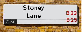
| Icon | Postcodes for Stoney Lane | |
| Walking Distances | ||
| Distance Info | Green Circle = 10 Minutes Walk (800 metres) | |
About Stoney Lane
Stoney Lane is a street located in the city of Birmingham. The street has a length of approximately 2,023 metres.
Stoney Lane is located within the Birmingham District (B) Council's jurisdiction. They provide various services, like refuse collection, and manage council tax collection. It's situated in the West Midlands region of the UK.
Stoney Lane has been assigned the Unique Street Reference Numbers of 2706407, 2759106, 2706402 and 2735939 in the National Street Gazetteer.
Stoney Lane is located within the county of West Midlands, situated in the West Midlands region of the UK. It's 98.86 miles North West from central London., 3.95 miles East from Birmingham, 13.4 miles West from Coventry and 25.97 miles North East from Worcester.

Do you know why this road is called Stoney Lane?
What's it like to live here?
Ask the community a question about Stoney Lane.
Do you have any questions, memories to share or know any facts about Stoney Lane? We'd love to know more.
Also on streetlist.co.uk, can you help?
Swing Swang Lane
28th April 2024
I am trying to find out why the lane is named Swing Swang?
It has been known known this since at least 1905 when hedge making contents used to be held here.
Swing Swang is often used to describe a fairground ride. I remember Swing Boats. Were they a bit like this or is Swing Swang another name for swings?
Swing Swangs are also mentioned in connection to orchards. Or were orchards just good places to have swings?
Estate Agents near Stoney Lane
| Name | Address | Website |
|---|---|---|
| Reeds Rains | 124 Church Road, Yardley, Birmingham, B25 8UT | Visit Website |
| Reeds Rains Lettings | 124 Church Road, Yardley, Birmingham, B25 8UT | Visit Website |
| Partridge Homes | 167-169 Church Road, Yardley, Birmingham, B25 8UR | Visit Website |
Location Details
| Stoney Lane | |
|---|---|

| |
| Latitude | 52.471405 |
| Longitude | -1.808558 |
| OS Easting (X): | 413002 |
| OS Northing (Y): | 285999 |
| OS Grid Reference: | SP130860 |
Neighbourhood Policing |
| Police Force: West Midlands |
 View Neighbourhood Crime and Policing View Neighbourhood Crime and Policing |
| Find a Local Neighbourhood Watch Scheme |
Frequently asked Questions for Stoney Lane
What Council (Local Authority) is Stoney Lane in?
Stoney Lane is located within the local authority area of Birmingham Council which is a Metropolitan District.
What Parish Council is Stoney Lane in?
Stoney Lane is in an unparished area.
What Electoral Ward is Stoney Lane in?
Stoney Lane is located within the ward of Yardley West & Stechford &Yardley East.
What County is Stoney Lane in?
Stoney Lane is located within the ceremonial county of West Midlands.
What Constituency is Stoney Lane in?
Stoney Lane is located within the constituency of Birmingham &Yardley.
What Part of the UK is Stoney Lane in?
Stoney Lane is located within the West Midlands (England) region of the United Kingdom.
What County Council area is Stoney Lane in?
Stoney Lane is located within the West Midlands Council area.
What Police Force area is Stoney Lane in?
Stoney Lane is located within the West Midlands Police area.
Roads that have a Junction with Stoney Lane
| Street | Junction Type |
|---|---|
| Church Road (A4040) | roundabout |
| Rockingham Road | junction |
| Foliot Fields | junction |
| Church Road | junction |
| Foliot Fields | junction |
| Gayhurst Drive | junction |
| Malthouse Grove | junction |
| Blakesley Road | junction |
| Blakesley Road | junction |
| St Edburghs Road | junction |
| Seacroft Avenue | junction |
| Vicarage Road | junction |
| Alcombe Grove | junction |
| Bordesley Green East | junction |
| Station Road (A4040) | pseudo node |
Sunset and Sunrise times for Stoney Lane
| Sunrise | 05:16 |
|---|---|
| Sunset | 20:51 |
Latest Weather Conditions for Stoney Lane
| Observed at Weather Station: | Coleshill 10 May 2024 at 21:00 (5.07 miles away) |
|---|---|
| Current Weather: | Clear night |
| Temperature and Humidity: | 16.3°C (75.5%) |
| Wind Direction and Speed: | ESE (2 mph) |
Population Statistics
| ONS Area Code | E00045118, E00045103, E00048155, E00048167 & E00048175 |
|---|---|
| ONS Area Name | Achieving Minorities & Private Renting Young Families |
| Average Age | 37.86, 36.51, 43.47, 42.15 & 38.94 |
| Area Population | 1599.00, 1686.00, 1564.00, 1608.00 & 1640.00 |
| Male Population | 778.00, 847.00, 763.00, 794.00 & 827.00 (50%) |
| Female Population | 821.00, 839.00, 801.00, 814.00 & 813.00 (50%) |
| Benefit Claimants | 54, 65, 45, 37 & 16 (3%) |
| LSOA Code: | E01008881, E01008897, E01009515, E01009518 &E01009521 |
|---|---|
| LSOA Name: | Birmingham 067A, Birmingham 067B, Birmingham 067C, Birmingham 067D &Birmingham 067E |
| SOA Code: | 7a &3b |
| SOA Name: | |
| MSOA Code: | E02001893 |
| MSOA Name: | Birmingham 067 |
Nearest Supermarkets
| Iceland Yardley |
|---|
| 128 Church Road, Yardley, Birmingham, B25 8UT |
| 01217840079 |
| Distance: 0.23 Miles |
| Directions from Stoney Lane to Iceland Yardley |
| Tesco Yardley Extra |
|---|
| Swan Shopping Centre, Coventry Rd, Birmingham, B26 1AD |
| 0345 671 9465 |
| Distance: 0.65 Miles |
| Directions from Stoney Lane to Tesco Yardley Extra |
| Asda Sheldon |
|---|
| 105 Kelynmead Road, Sheldon, Birmingham, B33 8LF |
| 0121 600 4600 |
| Distance: 0.87 Miles |
| Directions from Stoney Lane to Asda Sheldon |
| Iceland Stechford Food Warehouse |
|---|
| Unit E, Stechford Retail Park, Birmingham, B33 9AN |
| 01217842668 |
| Distance: 1.06 Miles |
| Directions from Stoney Lane to Iceland Stechford Food Warehouse |
Telephone Information
| Area Code |
|---|
| Area Code: 0121 - Birmingham |
| Area Code: 01675 - Coleshill |
| Area Code: 01676 - Meriden |
Broadband Information
| Speed | Average Speed | Median Speed | Maximum Speed | Next-generation access (NGA) | Number of Connections |
|---|---|---|---|---|---|
| Less than 2 Mbps | 24.1 | 20 | >=30 | Y | 40 |
Local Government
| Local Council Details |
|---|
| Within the area of Birmingham |
| Visit the Council's Website |
| Council House, Victoria Square, Birmingham &B1 1BB |
| Send email |
| Telephone Number: 0121 303 1111 |
| Local Member of Parliament |
|---|
| Within the Westminster Parliamentary Constituency of Birmingham &Yardley |
| The Member of Parliament is Jess Phillips |
| Details for the MP Jess Phillips on parliament.uk |
| Details for the MP Jess Phillips on theyworkforyou.com |
| In the 2019 General Election Jess Phillips won with a majority of 10,659 the result was Lab hold. The total electorate was 74,704 |
| Wards, Parish Councils and County Councils |
|---|
| Ward: Yardley West & Stechford &Yardley East Ward |
| Ceremonial County: West Midlands |
Nearest Schools
England Primary Schools
Lyndon Green Junior School
Address: Lyndon Green Junior School, Wensley Road, Sheldon, Birmingham, West Midlands, B26 1LU
Distance: 0.92 miles
Contact: 01216752983
The Oval Primary School
Address: The Oval Primary School, Whittington Oval, Yardley, Birmingham, West Midlands, B33 8JG
Distance: 0.87 miles
Contact:
Lyndon Green Infant School
Address: Lyndon Green Infant School, Wychwood Cresent, Sheldon, Birmingham, West Midlands, B26 1LZ
Distance: 0.99 miles
Contact: 01216753543
Gilbertstone Primary School
Address: Gilbertstone Primary School, Clay Lane, Birmingham, West Midlands, B26 1EH
Distance: 1.16 miles
Contact: 01214644664
Colebourne Primary School
Address: Colebourne Primary School, Stechford Road, Hodge Hill, Birmingham, West Midlands, B34 6BJ
Distance: 1.49 miles
Contact: 01216758500
Cottesbrooke Junior School
Address: Cottesbrooke Junior School, Cedars Avenue, Birmingham, West Midlands, B27 6JL
Distance: 1.35 miles
Contact:
St Cuthbert's RC Junior and Infant (NC) School
Address: St Cuthbert's RC Junior and Infant (NC) School, Gumbleberrys Close, Off Cotterills Lane, Stechford, Birmingham, West Midlands, B8 2PS
Distance: 1.15 miles
Contact: 01216752205
Corpus Christi Catholic Primary School
Address: Corpus Christi Catholic Primary School, Lyttelton Road, Stechford, Birmingham, West Midlands, B33 8BL
Distance: 0.66 miles
Contact: 01216752784
Blakesley Hall Primary School
Address: Blakesley Hall Primary School, Yardley Green Road, Stechford, Birmingham, West Midlands, B33 8TH
Distance: 0.44 miles
Contact: 01217832148
Stechford Primary School
Address: Stechford Primary School, Albert Road, Stechford, Birmingham, B33 8SJ
Distance: 0.60 miles
Contact: 01214643245
Thornton Primary School
Address: Thornton Primary School, Thornton Road, Ward End, Birmingham, West Midlands, B8 2LQ
Distance: 1.60 miles
Contact: 01213270824
St Bernadette's Catholic Primary School
Address: St Bernadette's Catholic Primary School, Hobmoor Road, Yardley, Birmingham, West Midlands, B25 8QL
Distance: 0.76 miles
Contact: 01217837232
St Benedict's Primary School
Address: St Benedict's Primary School, St Benedict's Road, Birmingham, West Midlands, B10 9DP
Distance: 1.58 miles
Contact: 01214646420
Redhill Primary School
Address: Redhill Primary School, Redhill Road, Hay Mills, Birmingham, West Midlands, B25 8HQ
Distance: 1.25 miles
Contact: 01214646322
Holy Family Catholic Primary School
Address: Holy Family Catholic Primary School, Coventry Road, Small Heath, Birmingham, West Midlands, B10 0HT
Distance: 1.63 miles
Contact: 01216752670
Bordesley Green Primary School
Address: Bordesley Green Primary School, Marchmont Road, Birmingham, West Midlands, B9 5XX
Distance: 1.35 miles
Contact: 01217721601
Our Lady's Catholic Primary School
Address: Our Lady's Catholic Primary School, East Meadway, Tile Cross, Birmingham, West Midlands, B33 0AU
Distance: 1.83 miles
Contact:
Gossey Lane Academy
Address: Gossey Lane Academy, Gossey Lane, Kitts Green, Birmingham, West Midlands, B33 0DS
Distance: 1.43 miles
Contact: 01214642909
Gossey Lane Junior Infant and Nursery School
Address: Gossey Lane Junior Infant and Nursery School, Gossey Lane, Kitts Green, Birmingham, West Midlands, B33 0DS
Distance: 1.43 miles
Contact:
Oasis Academy Blakenhale Junior
Address: Oasis Academy Blakenhale Junior, Homestead Road, Garretts Green, Birmingham, West Midlands, B33 0XG
Distance: 1.09 miles
Contact: 01217833960
Oasis Academy Blakenhale Infants
Address: Oasis Academy Blakenhale Infants, Blakenhale Road, Garrett's Green, Birmingham, West Midlands, B33 0XD
Distance: 1.05 miles
Contact: 01217833960
Lea Forest Primary Academy
Address: Lea Forest Primary Academy, Hurstcroft Road, Kitts Green, Birmingham, B33 9RD
Distance: 1.24 miles
Contact: 01216753985
Audley Primary School
Address: Audley Primary School, Audley Road, Stechford, Birmingham, West Midlands, B33 9HY
Distance: 1.28 miles
Contact: 01214643139
Audley Primary School
Address: Audley Primary School, Audley Road, Stechford, Birmingham, West Midlands, B33 9HY
Distance: 1.28 miles
Contact:
The Oval School
Address: The Oval School, Whittington Oval, Yardley, Birmingham, West Midlands, B33 8JG
Distance: 0.87 miles
Contact: 01214643248
Yardley Primary School
Address: Yardley Primary School, Harvey Road, Yardley, Birmingham, West Midlands, B26 1TD
Distance: 0.48 miles
Contact: 01214643235
Cottesbrooke Infant and Nursery School
Address: Cottesbrooke Infant and Nursery School, Yardley Road, Acocks Green, Birmingham, West Midlands, B27 6LG
Distance: 1.38 miles
Contact: 01217062742
Oasis Academy Hobmoor
Address: Oasis Academy Hobmoor, Wash Lane, Yardley, Birmingham, West Midlands, B25 8FD
Distance: 0.55 miles
Contact: 01216753269
Alston Primary School
Address: Alston Primary School, Alston Road, Bordesley Green East, Birmingham, West Midlands, B9 5UN
Distance: 1.13 miles
Contact: 01214641569
Cedars Academy
Address: Cedars Academy, Cedars Avenue, Birmingham, West Midlands, B27 6JL
Distance: 1.35 miles
Contact: 01214643178
Acocks Green Primary School
Address: Acocks Green Primary School, Westley Road, Acocks Green, Birmingham, West Midlands, B27 7UQ
Distance: 1.90 miles
Contact:
England Secondary Schools
Starbank School
Address: Starbank School, Starbank Road, Birmingham, West Midlands, B10 9LR
Distance: 1.02 miles
Contact:
King Edward VI Sheldon Heath Academy
Address: King Edward VI Sheldon Heath Academy, Sheldon Heath Road, Sheldon, Birmingham, West Midlands, B26 2RZ
Distance: 1.27 miles
Contact: 01216472471
Cockshut Hill School
Address: Cockshut Hill School, Cockshut Hill, Yardley, Birmingham, West Midlands, B26 2HX
Distance: 0.82 miles
Contact: 01212895900
Cockshut Hill Technology College
Address: Cockshut Hill Technology College, Cockshut Hill, Yardley, Birmingham, West Midlands, B26 2HX
Distance: 0.82 miles
Contact:
Washwood Heath Academy
Address: Washwood Heath Academy, Burney Lane, Stechford, Birmingham, West Midlands, B8 2AS
Distance: 1.41 miles
Contact: 01216757272
Starbank School
Address: Starbank School, Hob Moor Road, Birmingham, B10 9BT
Distance: 1.06 miles
Contact: 01214642638
Saltley Academy
Address: Saltley Academy, Belchers Lane, Bordesley Green, Birmingham, West Midlands, B9 5RX
Distance: 1.31 miles
Contact: 01215666555
Ark Victoria Academy
Address: Ark Victoria Academy, Talbot Way, Small Heath, Birmingham, West Midlands, B10 0HJ
Distance: 1.66 miles
Contact: 01213934459
Waverley School
Address: Waverley School, Yardley Green Road, Bordesley Green, Birmingham, West Midlands, B9 5QA
Distance: 1.03 miles
Contact: 01215666600
Waverley Studio College
Address: Waverley Studio College, 470 Belchers Lane, Bordesley Green, Birmingham, West Midlands, B9 5SX
Distance: 1.19 miles
Contact: 01215666622
Eden Boys' Leadership Academy, Birmingham East
Address: Eden Boys' Leadership Academy, Birmingham East, 441 Alum Rock Road, Birmingham, West Midlands, B8 3DT
Distance: 1.82 miles
Contact: 01216577200
Nearest Hospitals
| Name | Address | Postcode | Distance | Map |
|---|
Nearest Dentists
Dentists near Stoney Lane
| Name | Address | Postcode | Distance | Map |
|---|
Nearest GP Surgeries
Doctors near Stoney Lane
HOBMOOR ROAD SURGERY
Address: 533 HOB MOOR ROAD, YARDLEY, BIRMINGHAM, WEST MIDLANDS, B25 8TH
Distance: 0.35 miles
Contact: tel: 01217 832181
ROWLANDS ROAD SURGERY
Address: 15 ROWLANDS ROAD, SOUTH YARDLEY, BIRMINGHAM, WEST MIDLANDS, B26 1AT
Distance: 0.57 miles
Contact: tel: 0121 7066623
IRIDIUM MEDICAL PRACTICE - COVID LOCAL VACCINATION SERVICE 3
Address: 299 BORDESLEY GREEN EAST, STECHFORD, BIRMINGHAM, B33 8TA
Distance: 0.59 miles
Contact: :
IRIDIUM MEDICAL PRACTICE - COVID LOCAL VACCINATION SERVICE
Address: 299 BORDESLEY GREEN EAST, STECHFORD, BIRMINGHAM, B33 8TA
Distance: 0.59 miles
Contact: :
IRIDIUM MEDICAL PRACTICE
Address: 299 BORDESLEY GREEN EAST, STECHFORD, BIRMINGHAM, WEST MIDLANDS, B33 8TA
Distance: 0.59 miles
Contact: tel: 01212 033000
THE SWAN MEDICAL CENTRE
Address: 4 WILLARD RD, SOUTH YARDLEY, BIRMINGHAM, WEST MIDLANDS, B25 8AA
Distance: 0.72 miles
Contact: tel: 0121 7060337
Nearest Dispensing Chemists
Pharmacies near Stoney Lane
| Name | Address | Postcode | Telephone | Map | Distance in Km |
|---|
Nearest Opticians
Opticians near Stoney Lane
J ELLIS OPTICIANS
Address: 146 CHURCH ROAD, YARDLEY, BIRMINGHAM, WEST MIDLANDS, B25 8UT
Distance: 0.23 miles
Contact: :
SPECSAVERS (YARDLEY)
Address: 3 SWAN CENTRE, 20 CHURCH ROAD, YARDLEY, BIRMINGHAM, WEST MIDLANDS, B25 8UJ
Distance: 0.64 miles
Contact: :
KRYSTAL VISION
Address: 1566 SWAN SHOPPING CENTRE, COVENTRY ROAD, YARDLEY, BIRMINGHAM, WEST MIDLANDS, B26 1AD
Distance: 0.64 miles
Contact: :
YARDLEY
Address: SWAN SHOPPING CENTRE, COVENTRY ROAD, YARDLEY, BIRMINGHAM, WEST MIDLANDS, B26 1AD
Distance: 0.64 miles
Contact: :
SPARK OPTICS STECHFORD LTD
Address: 149 STATION ROAD, STECHFORD, BIRMINGHAM, B33 8BA
Distance: 0.89 miles
Contact: :
BOOTS OPTICIANS (YARDLEY)
Address: 1321-1323 COVENTRY ROAD, YARDLEY, BIRMINGHAM, WEST MIDLANDS, B25 8LP
Distance: 0.90 miles
Contact: :
Transport
Nearest Rail Stations
Stechford Station is 0.93 miles away.
Address: Stechford station, Victoria Road, Stechford, West Midlands, B33 8AJ
Stechford is situated on the Rugby�Birmingham�Stafford line|West Coast Main Line.
Stechford Station is staffed on a part time basis.
Lea Hall Station is 1.14 miles away.
Address: Lea Hall station, Lea Hall Road, Lea Hall, West Midlands, B33 8JU
Lea Hall is situated on the Rugby�Birmingham�Stafford line|West Coast Main Line.
Lea Hall Station is staffed on a part time basis.