Map of Church Lane
| Postcodes | ||
|---|---|---|
| Icon | Postcodes for Church Lane | |
| Walking Distances | ||
| Distance Info | Green Circle = 10 Minutes Walk (800 metres) | |
About Church Lane
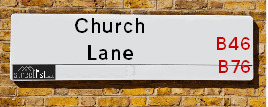
Church Lane is a street located in the village of Lea Marston. It uses the postcode B76 0BJ. The street has a length of approximately 732 metres.
Church Lane is located within the North Warwickshire District (B) Council's jurisdiction. They provide various services, like refuse collection, and manage council tax collection. It's situated in the West Midlands region of the UK.
Church Lane has been assigned the Unique Street Reference Number of 28400177 and 28401415 in the National Street Gazetteer.
Church Lane is located within the county of Warwickshire, situated in the West Midlands region of the UK. It's 98.71 miles North West from central London., 9.26 miles North East from Birmingham, 12.03 miles North West from Coventry and 24.99 miles West from Leicester.

Do you know why this road is called Church Lane?
What's it like to live here?
Ask the community a question about Church Lane.
Do you have any questions, memories to share or know any facts about Church Lane? We'd love to know more.
Also on streetlist.co.uk, can you help?
Swing Swang Lane
28th April 2024
I am trying to find out why the lane is named Swing Swang?
It has been known known this since at least 1905 when hedge making contents used to be held here.
Swing Swang is often used to describe a fairground ride. I remember Swing Boats. Were they a bit like this or is Swing Swang another name for swings?
Swing Swangs are also mentioned in connection to orchards. Or were orchards just good places to have swings?
Estate Agents near Church Lane
| Name | Address | Website |
|---|---|---|
| Chambers Property | Albion Terrace, Water Orton, Birmingham, B46 1ST | Visit Website |
| First Choice Property Centre | Wynn House, 60 High Street, Coleshill,B46 1AZ | Visit Website |
| Waters & Co. | 81 High Street, Coleshill, Birmingham, B46 3AG | Visit Website |
We have found 1 postcode for Church Lane
Location Details
| Church Lane | |
|---|---|

| |
| Latitude | 52.535691 |
| Longitude | -1.701991 |
| OS Easting (X): | 420211 |
| OS Northing (Y): | 293174 |
| OS Grid Reference: | SP202932 |
Neighbourhood Policing |
| Police Force: Warwickshire |
 View Neighbourhood Crime and Policing View Neighbourhood Crime and Policing |
| Find a Local Neighbourhood Watch Scheme |
Frequently asked Questions for Church Lane
What Council (Local Authority) is Church Lane in?
Church Lane is located within the local authority area of North Warwickshire Council which is a District Council.
What Parish Council is Church Lane in?
Church Lane is located within the area of Lea Marston Parish Council.
What Electoral Ward is Church Lane in?
Church Lane is located within the ward of Curdworth.
What County is Church Lane in?
Church Lane is located within the ceremonial county of Warwickshire.
What Constituency is Church Lane in?
Church Lane is located within the constituency of North Warwickshire.
What Part of the UK is Church Lane in?
Church Lane is located within the West Midlands (England) region of the United Kingdom.
What County Council area is Church Lane in?
Church Lane is located within the Warwickshire Council area.
What Police Force area is Church Lane in?
Church Lane is located within the Warwickshire Police area.
Roads that have a Junction with Church Lane
| Street | Junction Type |
|---|---|
| Hams Lane | junction |
| Birmingham Road | junction |
| The Green | junction |
| Birmingham Road | junction |
Sunset and Sunrise times for Church Lane , B76 0BJ
| Sunrise | 05:12 |
|---|---|
| Sunset | 20:54 |
Latest Weather Conditions for Church Lane, B76 0BJ
| Observed at Weather Station: | Coleshill 12 May 2024 at 19:00 (3.89 miles away) |
|---|---|
| Current Weather: | Overcast |
| Temperature and Humidity: | 18.5°C (82.6%) |
| Wind Direction and Speed: | SSW (7 mph) |
Population Statistics
| ONS Area Code | E00168279 |
|---|---|
| ONS Area Name | Rural White-Collar Workers |
| Average Age | 46.63 |
| Area Population | 1617.00 |
| Male Population | 815.00 (50%) |
| Female Population | 802.00 (50%) |
| Benefit Claimants | 15 (1%) |
| LSOA Code: | E01031024 |
|---|---|
| LSOA Name: | North Warwickshire 004B |
| SOA Code: | 2b |
| SOA Name: | |
| MSOA Code: | E02006471 |
| MSOA Name: | North Warwickshire 004 |
Nearest Supermarkets
| Tesco Water Orton Express |
|---|
| 8 Station Buildings, Birmingham Rd, Birmingham, B46 1SR |
| 0345 026 9273 |
| Distance: 2.06 Miles |
| Directions from Church Lane to Tesco Water Orton Express |
| Morrisons Coleshill |
|---|
| Park Road, Coleshill B46 1AS |
| 01675 462256 |
| Distance: 2.55 Miles |
| Directions from Church Lane to Morrisons Coleshill |
| Tesco Castle Bromwich Green Ln Express |
|---|
| 136-140 Green Ln, Castle Bromwich, Birmingham, B36 0BX |
| 0345 026 9107 |
| Distance: 3.15 Miles |
| Directions from Church Lane to Tesco Castle Bromwich Green Ln Express |
| Asda Minworth |
|---|
| Walmley Ash Road, Sutton Coldfield, B76 1XL |
| 0121 313 7100 |
| Distance: 3.33 Miles |
| Directions from Church Lane to Asda Minworth |
Telephone Information
| Area Code |
|---|
| Area Code: 01675 - Coleshill |
| Area Code: 01827 - Tamworth |
| Area Code: 01676 - Meriden |
| Area Code: 0121 - Birmingham |
Broadband Information
| Speed | Average Speed | Median Speed | Maximum Speed | Next-generation access (NGA) | Number of Connections |
|---|---|---|---|---|---|
| Less than 2 Mbps | 2.4 | 2.7 | 3.4 | N | 14 |
Local Government
| Local Council Details |
|---|
| Within the area of North Warwickshire |
| Visit the Council's Website |
| South Street, Atherstone, Warwickshire &CV9 1DE |
| Send email |
| Telephone Number: 01827 715 341 |
| Local Member of Parliament |
|---|
| Within the Westminster Parliamentary Constituency of North Warwickshire |
| The Member of Parliament is Craig Tracey |
| Details for the MP Craig Tracey on parliament.uk |
| Details for the MP Craig Tracey on theyworkforyou.com |
| In the 2019 General Election Craig Tracey won with a majority of 17,956 the result was Con hold. The total electorate was 70,271 |
| Wards, Parish Councils and County Councils |
|---|
| Ward: Curdworth Ward |
| Ceremonial County: Warwickshire |
Nearest Schools
Nearest Hospitals
| Name | Address | Postcode | Distance | Map |
|---|
Nearest Dentists
Dentists near Church Lane
| Name | Address | Postcode | Distance | Map |
|---|
Nearest GP Surgeries
Doctors near Church Lane
PEAR TREE SURGERY
Address: 28 MEADOW CLOSE, KINGSBURY, TAMWORTH, STAFFORDSHIRE, B78 2NR
Distance: 2.14 miles
Contact: tel: 01827 872755
SATIS HOUSE
Address: 10 BIRMINGHAM ROAD, WATER ORTON, BIRMINGHAM, WEST MIDLANDS, B46 1TH
Distance: 2.29 miles
Contact: tel: 0121 7767572
HAZELWOOD PRACTICE - COVID LOCAL VACCINATION SERVICE
Address: 27 PARKFIELD ROAD, COLESHILL, BIRMINGHAM, B46 3LD
Distance: 2.68 miles
Contact: :
HAZELWOOD GROUP PRACTICE
Address: 27 PARKFIELD ROAD, COLESHILL, BIRMINGHAM, WEST MIDLANDS, B46 3LD
Distance: 2.68 miles
Contact: tel: 01675 463165
GREEN LANE SURGERY
Address: SMITHS WOOD MEDICAL CTR, BURTONS WAY, SMITHS WOOD, BIRMINGHAM, WEST MIDLANDS, B36 0SZ
Distance: 2.95 miles
Contact: tel: 0121 7495115
ARRAN MEDICAL CENTRE
Address: BURTONS WAY, BIRMINGHAM, WEST MIDLANDS, B36 0SZ
Distance: 2.95 miles
Contact: tel: 0121 7704043
Nearest Dispensing Chemists
Pharmacies near Church Lane
| Name | Address | Postcode | Telephone | Map | Distance in Km |
|---|
Nearest Opticians
Opticians near Church Lane
SCRIVENS OPTICIANS (COLESHILL)
Address: 91 HIGH STREET, COLESHILL, BIRMINGHAM, WEST MIDLANDS, B46 3AG
Distance: 2.48 miles
Contact: :
4977 MINWORTH
Address: ASDA STORES LTD, WALMLEY ASH ROAD, MINWORTH, SUTTON COLDFIELD, WEST MIDLANDS, B76 1XL
Distance: 3.27 miles
Contact: :
COVENTRY 2 DOMICILIARY SPECSAVERS LIMITED
Address: 165 MERIDEN DRIVE, BIRMINGHAM, B37 6BT
Distance: 3.41 miles
Contact: :
I M HADFIELD OPTOMETRISTS - KINGSHURST
Address: 20 THE PARADE, KINGSHURST, BIRMINGHAM, WEST MIDLANDS, B37 6BA
Distance: 3.54 miles
Contact: :
COOK OPTICIANS
Address: 6 HURST LANE, CASTLE BROMWICH, BIRMINGHAM, WEST MIDLANDS, B34 7HR
Distance: 3.61 miles
Contact: :
COMPLETE COMMUNITY CARE OPTICIANS (SUTTON)
Address: OAK HOUSE, 9 NEW LEASOW, SUTTON COLDFIELD, WEST MIDLANDS, B76 1YL
Distance: 3.64 miles
Contact: :
Transport
Nearest Rail Stations
Coleshill Parkway Station is 1.35 miles away.
Address: Coleshill Parkway station, Station Road, Coleshill, Warwickshire, B46 1JZ
Coleshill Parkway is situated on the Birmingham to Peterborough Line.
Coleshill Parkway Station is staffed on a part time basis.
Directions from Church Lane to Coleshill Parkway Rail Station
Water Orton Station is 2.09 miles away.
Address: Water Orton station, Marsh Lane, Water Orton, Warwickshire, B46 1NE
Water Orton is situated on the Birmingham to Peterborough Line|Birmingham to Nottingham Line.
Water Orton Station is an unstaffed station.