Map of Clancey Way
| Postcodes | ||
|---|---|---|
| Icon | Postcodes for Clancey Way | |
| Walking Distances | ||
| Distance Info | Green Circle = 10 Minutes Walk (800 metres) | |
About Clancey Way
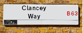
Clancey Way is a street located in the town of Halesowen. It uses the postcode B63 3UX. The street has a length of approximately 183 metres.
Clancey Way is located within the Dudley District (B) Council's jurisdiction. They provide various services, like refuse collection, and manage council tax collection. It's situated in the West Midlands region of the UK.
Clancey Way has been assigned the Unique Street Reference Number of 11406060 in the National Street Gazetteer.
Clancey Way is located within the county of West Midlands, situated in the West Midlands region of the UK. It's 106.91 miles North West from central London., 7.32 miles West from Birmingham, 19.55 miles North from Worcester and 24.05 miles West from Coventry.

Do you know why this road is called Clancey Way?
What's it like to live here?
Ask the community a question about Clancey Way.
Do you have any questions, memories to share or know any facts about Clancey Way? We'd love to know more.
Also on streetlist.co.uk, can you help?
Swing Swang Lane
28th April 2024
I am trying to find out why the lane is named Swing Swang?
It has been known known this since at least 1905 when hedge making contents used to be held here.
Swing Swang is often used to describe a fairground ride. I remember Swing Boats. Were they a bit like this or is Swing Swang another name for swings?
Swing Swangs are also mentioned in connection to orchards. Or were orchards just good places to have swings?
Estate Agents near Clancey Way
| Name | Address | Website |
|---|---|---|
| Complete Property Services | 24 Upper High Street, Cradley Heath,B64 5HX | Visit Website |
| A P Morgan Estate Agents | High Street, Halesowen, B63 3BG | Visit Website |
| Dixons | 77 High Street, Halesowen, W Midlands B63 3BQ |
We have found 1 postcode for Clancey Way
Location Details
| Clancey Way | |
|---|---|

| |
| Latitude | 52.460470 |
| Longitude | -2.071879 |
| OS Easting (X): | 395116 |
| OS Northing (Y): | 284768 |
| OS Grid Reference: | SO951848 |
Neighbourhood Policing |
| Police Force: West Midlands |
 View Neighbourhood Crime and Policing View Neighbourhood Crime and Policing |
| Find a Local Neighbourhood Watch Scheme |
Frequently asked Questions for Clancey Way
What Council (Local Authority) is Clancey Way in?
Clancey Way is located within the local authority area of Dudley Council which is a Metropolitan District.
What Parish Council is Clancey Way in?
Clancey Way is in an unparished area.
What Electoral Ward is Clancey Way in?
Clancey Way is located within the ward of Belle Vale.
What County is Clancey Way in?
Clancey Way is located within the ceremonial county of West Midlands.
What Constituency is Clancey Way in?
Clancey Way is located within the constituency of Halesowen and Rowley Regis.
What Part of the UK is Clancey Way in?
Clancey Way is located within the West Midlands (England) region of the United Kingdom.
What County Council area is Clancey Way in?
Clancey Way is located within the West Midlands Council area.
What Police Force area is Clancey Way in?
Clancey Way is located within the West Midlands Police area.
Roads that have a Junction with Clancey Way
| Street | Junction Type |
|---|---|
| Belle Vale | junction |
Sunset and Sunrise times for Clancey Way , B63 3UX
| Sunrise | 05:13 |
|---|---|
| Sunset | 20:55 |
Latest Weather Conditions for Clancey Way, B63 3UX
| Observed at Weather Station: | Coleshill 12 May 2024 at 08:00 (16.17 miles away) |
|---|---|
| Current Weather: | Partly cloudy (day) |
| Temperature and Humidity: | 15.3°C (80.6%) |
| Wind Direction and Speed: | ENE (5 mph) |
Population Statistics
| ONS Area Code | E00049890 |
|---|---|
| ONS Area Name | Multi-Ethnic Professionals with Families |
| Average Age | 34.08 |
| Area Population | 1844.00 |
| Male Population | 901.00 (49%) |
| Female Population | 943.00 (51%) |
| Benefit Claimants | 40 (2%) |
| LSOA Code: | E01009863 |
|---|---|
| LSOA Name: | Dudley 033E |
| SOA Code: | 3d |
| SOA Name: | |
| MSOA Code: | E02002032 |
| MSOA Name: | Dudley 033 |
Nearest Supermarkets
| Tesco Stourbridge Rd Express |
|---|
| 175 Stourbridge Rd, Halesowen, B63 3UD |
| 0345 675 7004 |
| Distance: 0.65 Miles |
| Directions from Clancey Way to Tesco Stourbridge Rd Express |
| Iceland Cradley Heath |
|---|
| 74/75 High Street, Cradley Heath, West Midlands, B64 5HA |
| 01384564016 |
| Distance: 0.9 Miles |
| Directions from Clancey Way to Iceland Cradley Heath |
| Tesco Dudley Rd Express |
|---|
| Coombs Rd, Dudley Rd, Halesowen, B62 8AA |
| 0345 026 9044 |
| Distance: 0.94 Miles |
| Directions from Clancey Way to Tesco Dudley Rd Express |
| Tesco Cradley Heath Extra |
|---|
| Foxoak St, Cradley Heath, B64 5DF |
| 0345 677 9890 |
| Distance: 0.96 Miles |
| Directions from Clancey Way to Tesco Cradley Heath Extra |
Telephone Information
| Area Code |
|---|
| Area Code: 01384 - Dudley |
| Area Code: 0121 - Birmingham |
| Area Code: 01562 - Kidderminster |
| Area Code: 01902 - Wolverhampton |
Broadband Information
| Speed | Average Speed | Median Speed | Maximum Speed | Next-generation access (NGA) | Number of Connections |
|---|---|---|---|---|---|
| Less than 2 Mbps | 10.1 | 11.5 | 16.9 | N | 40 |
Local Government
| Local Council Details |
|---|
| Within the area of Dudley |
| Visit the Council's Website |
| Council House, Priory Road, Dudley, West Midlands &DY1 1HF |
| Send email |
| Telephone Number: 01384 812 345 |
| Local Member of Parliament |
|---|
| Within the Westminster Parliamentary Constituency of Halesowen and Rowley Regis |
| The Member of Parliament is James Morris |
| Details for the MP James Morris on parliament.uk |
| Details for the MP James Morris on theyworkforyou.com |
| In the 2019 General Election James Morris won with a majority of 12,074 the result was Con hold. The total electorate was 68,300 |
| Wards, Parish Councils and County Councils |
|---|
| Ward: Belle Vale Ward |
| Ceremonial County: West Midlands |
Nearest Schools
England Secondary Schools
Leasowes High School
Address: Leasowes High School, Kent Road, Halesowen, West Midlands, B62 8PJ
Distance: 1.89 miles
Contact: 01384686606
Leasowes High School
Address: Leasowes High School, Kent Road, Halesowen, West Midlands, B62 8PJ
Distance: 1.89 miles
Contact:
Ormiston Forge Academy
Address: Ormiston Forge Academy, Wrights Lane, Cradley Heath, West Midlands, B64 6QU
Distance: 1.24 miles
Contact: 01384566598
The Earls High School
Address: The Earls High School, Furnace Lane, Halesowen, West Midlands, B63 3SL
Distance: 1.03 miles
Contact: 01384816105
The Earls High School
Address: The Earls High School, Furnace Lane, Halesowen, West Midlands, B63 3SL
Distance: 1.03 miles
Contact:
Windsor High School and Sixth Form
Address: Windsor High School and Sixth Form, Richmond Street, Halesowen, West Midlands, B63 4BB
Distance: 0.82 miles
Contact: 01215501452
Pedmore Technology College and Community School
Address: Pedmore Technology College and Community School, Grange Lane, Pedmore, Stourbridge, West Midlands, DY9 7HS
Distance: 2.41 miles
Contact:
England Higher Schools
Halesowen College
Address: Halesowen College, Whittingham Road, Halesowen, West Midlands, B63 3NA
Distance: 0.91 miles
Contact: 01216027777
England Primary Schools
Highfields Primary School
Address: Highfields Primary School, Beeches Road, Rowley Regis, West Midlands, B65 0DA
Distance: 1.40 miles
Contact: 01215591037
Manor Way Primary Academy
Address: Manor Way Primary Academy, Brier Mill Road, Halesowen, West Midlands, B63 3HA
Distance: 1.61 miles
Contact: 01212727310
Newfield Park Primary School
Address: Newfield Park Primary School, Whittingham Road, Halesowen, West Midlands, B63 3TP
Distance: 0.75 miles
Contact: 01384818640
Temple Meadow Primary School
Address: Temple Meadow Primary School, Wrights Lane, Cradley Heath, West Midlands, B64 6RH
Distance: 0.97 miles
Contact: 01384569021
Tenterfields Primary Academy
Address: Tenterfields Primary Academy, Tenterfields, HALESOWEN, West Midlands, B63 3LH
Distance: 1.29 miles
Contact: 01212895020
Tenterfields Primary School
Address: Tenterfields Primary School, Tenterfields, Halesowen, West Midlands, B63 3LH
Distance: 1.29 miles
Contact:
Old Hill Primary School
Address: Old Hill Primary School, Lawrence Lane, Cradley Heath, West Midlands, B64 6DR
Distance: 0.93 miles
Contact: 01384569213
Reddal Hill Primary School
Address: Reddal Hill Primary School, Trinity Street, Cradley Heath, West Midlands, B64 6HT
Distance: 1.07 miles
Contact: 01384569053
Our Lady and St Kenelm RC School
Address: Our Lady and St Kenelm RC School, Bundle Hill, Halesowen, West Midlands, B63 4AR
Distance: 1.00 miles
Contact: 01384816880
Corngreaves Academy
Address: Corngreaves Academy, Plant Street, Cradley Heath, West Midlands, B64 6EZ
Distance: 0.99 miles
Contact: 01384569333
Corngreaves Primary School
Address: Corngreaves Primary School, Plant Street, Cradley Heath, West Midlands, B64 6EZ
Distance: 0.99 miles
Contact:
Halesowen CofE Primary School
Address: Halesowen CofE Primary School, High Street, Halesowen, West Midlands, B63 3BB
Distance: 1.08 miles
Contact: 01384818885
St Margaret's At Hasbury CofE Primary School
Address: St Margaret's At Hasbury CofE Primary School, Hagley Road, Hasbury, Halesowen, West Midlands, B63 4QD
Distance: 1.24 miles
Contact: 01384818660
Timbertree Academy
Address: Timbertree Academy, Valley Road, Cradley Heath, West Midlands, B64 7LT
Distance: 0.34 miles
Contact: 01384567830
Huntingtree Primary School
Address: Huntingtree Primary School, Huntingtree Road, Halesowen, West Midlands, B63 4HY
Distance: 0.86 miles
Contact: 01384818650
Caslon Primary Community School
Address: Caslon Primary Community School, Beeches View Avenue, Halesowen, West Midlands, B63 2ES
Distance: 0.92 miles
Contact: 01384818875
Dudley Wood Primary School
Address: Dudley Wood Primary School, Dudley Wood Road, Dudley, West Midlands, DY2 0DB
Distance: 1.38 miles
Contact: 01384900640
Dudley Wood Primary School
Address: Dudley Wood Primary School, Dudley Wood Road, Dudley, West Midlands, DY2 0DB
Distance: 1.38 miles
Contact:
Lutley Primary School
Address: Lutley Primary School, Brookwillow Road, Halesowen, West Midlands, B63 1BU
Distance: 1.38 miles
Contact: 01384818220
Lutley Primary School
Address: Lutley Primary School, Brookwillow Road, Halesowen, West Midlands, B63 1BU
Distance: 1.38 miles
Contact:
Cradley CofE Primary School
Address: Cradley CofE Primary School, Church Road, Cradley, Halesowen, West Midlands, B63 2UL
Distance: 0.65 miles
Contact: 01384818230
Colley Lane Primary Academy
Address: Colley Lane Primary Academy, Colley Lane, Halesowen, West Midlands, B63 2TN
Distance: 0.63 miles
Contact: 01384900450
Colley Lane Primary School
Address: Colley Lane Primary School, Colley Lane, Halesowen, West Midlands, B63 2TN
Distance: 0.63 miles
Contact:
Wollescote Primary School
Address: Wollescote Primary School, Drummond Road, Wollescote, Stourbridge, West Midlands, DY9 8YA
Distance: 1.51 miles
Contact: 01384818500
Quarry Bank Primary School
Address: Quarry Bank Primary School, High Street, Quarry Bank, Brierley Hill, West Midlands, DY5 2AD
Distance: 1.42 miles
Contact: 01384818750
Mount Pleasant Primary School
Address: Mount Pleasant Primary School, Mount Pleasant, Quarry Bank, Brierley Hill, West Midlands, DY5 2YN
Distance: 1.96 miles
Contact: 01384816910
Brickhouse Primary School
Address: Brickhouse Primary School, Dudhill Road, Rowley Regis, West Midlands, B65 8HS
Distance: 1.70 miles
Contact: 01215591629
Netherbrook Primary School
Address: Netherbrook Primary School, Chester Road, Netherton, Dudley, West Midlands, DY2 9RZ
Distance: 1.38 miles
Contact: 01384818415
Netherbrook Primary School
Address: Netherbrook Primary School, Chester Road, Netherton, Dudley, West Midlands, DY2 9RZ
Distance: 1.38 miles
Contact:
Northfield Road Primary School
Address: Northfield Road Primary School, Northfield Road, Netherton, Dudley, West Midlands, DY2 9ER
Distance: 2.16 miles
Contact:
Netherton CofE Primary School
Address: Netherton CofE Primary School, Highbridge Road, Netherton, Dudley, West Midlands, DY2 0HU
Distance: 2.19 miles
Contact: 01384816895
Netherton CofE Primary School
Address: Netherton CofE Primary School, Highbridge Road, Netherton, Dudley, West Midlands, DY2 0HU
Distance: 2.19 miles
Contact:
Nearest Hospitals
| Name | Address | Postcode | Distance | Map |
|---|
Nearest Dentists
Dentists near Clancey Way
| Name | Address | Postcode | Distance | Map |
|---|
Nearest GP Surgeries
Doctors near Clancey Way
HADEN VALE SURGERY
Address: 50 BARRS ROAD, WARLEY, CRADLEY HEATH, WEST MIDLANDS, B64 7HG
Distance: 0.41 miles
Contact: tel: 01384 634511
HAWNE LANE SURGERY (DR GIBBONS)
Address: HAWNE LANE SURGERY, 6 HAWNE LANE, HALESOWEN, WEST MIDLANDS, B63 3RN
Distance: 0.47 miles
Contact: :
ALEXANDRA MEDICAL CENTRE
Address: 1 SHORT STREET, HALESOWEN, WEST MIDLANDS, B63 3UH
Distance: 0.58 miles
Contact: tel: 0121 5855188
CHAPEL HOUSE LANE SURGERY (DR MUCKLOW)
Address: CHAPEL HOUSE LANE SURGERY, CHAPEL HOUSE LANE, HALESOWEN, WEST MIDLANDS, B63 2JW
Distance: 0.76 miles
Contact: :
CRADLEY ROAD
Address: 62 CRADLEY ROAD, CRADLEY HEATH, WEST MIDLANDS, B64 6AG
Distance: 0.87 miles
Contact: :
MEADOWBROOK SURGERY
Address: 4 MEADOWBROOK ROAD, HALESOWEN, WEST MIDLANDS, B63 1AB
Distance: 0.96 miles
Contact: tel: 0121 5501034
Nearest Dispensing Chemists
Pharmacies near Clancey Way
| Name | Address | Postcode | Telephone | Map | Distance in Km |
|---|
Nearest Opticians
Opticians near Clancey Way
EYE SOCIETY
Address: 33 HIGH STREET, CRADLEY HEATH, WEST MIDLANDS, B64 5HL
Distance: 0.90 miles
Contact: :
SPECIAL LOOKS LTD
Address: 17-18 HIGH STREET, CRADLEY HEATH, WEST MIDLANDS, B64 5HG
Distance: 0.91 miles
Contact: :
LOOX EYECARE LIMITED
Address: 17-18 HIGH STREET, CRADLEY HEATH, B64 5HG
Distance: 0.91 miles
Contact: :
EYEDEAL EYEWEAR OPTICIANS (CRADLEY HEATH)
Address: 104 HIGH STREET, CRADLEY HEATH, WEST MIDLANDS, B64 5HE
Distance: 0.92 miles
Contact: :
THE FACTORY OPTICIANS - 6 HIGH STREET
Address: 6 HIGH STREET, CRADLEY HEATH, WEST MIDLANDS, B64 5HP
Distance: 0.93 miles
Contact: :
SPEXMANIAX LTD
Address: 84 LONGMOOR ROAD, HALESOWEN, WEST MIDLANDS, B63 1AN
Distance: 0.96 miles
Contact: :
Transport
Nearest Rail Stations
Old Hill Station is 0.98 miles away.
Address: Old Hill station, Station Road, Old Hill, West Midlands, B64 6PL
Old Hill is situated on the Birmingham to Worcester via Kidderminster line.
Old Hill Station is staffed on a part time basis.
Cradley Heath Station is 1.01 miles away.
Address: Cradley Heath station, Forge Lane, Cradley Heath, West Midlands, B64 5AL
Cradley Heath is situated on the Birmingham to Worcester via Kidderminster line.
Cradley Heath Station is staffed on a part time basis.