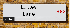
Map of Lutley Lane
| Postcodes | ||
|---|---|---|
| Icon | Postcodes for Lutley Lane | |
| Walking Distances | ||
| Distance Info | Green Circle = 10 Minutes Walk (800 metres) | |
About Lutley Lane
Lutley Lane is a street located in the town of Halesowen and near the town of Halesowen. The street has a length of approximately 2,184 metres.
Lutley Lane is located within the Dudley District (B) Council's jurisdiction. They provide various services, like refuse collection, and manage council tax collection. It's situated in the West Midlands region of the UK.
Lutley Lane has been assigned the Unique Street Reference Number of 11401202 and 11403975 in the National Street Gazetteer.
Lutley Lane is located within the county of West Midlands, situated in the West Midlands region of the UK. It's 106.68 miles North West from central London., 8.22 miles West from Birmingham, 18.2 miles North from Worcester and 24.53 miles West from Coventry.

Do you know why this road is called Lutley Lane?
What's it like to live here?
Ask the community a question about Lutley Lane.
Do you have any questions, memories to share or know any facts about Lutley Lane? We'd love to know more.
Also on streetlist.co.uk, can you help?
Swing Swang Lane
28th April 2024
I am trying to find out why the lane is named Swing Swang?
It has been known known this since at least 1905 when hedge making contents used to be held here.
Swing Swang is often used to describe a fairground ride. I remember Swing Boats. Were they a bit like this or is Swing Swang another name for swings?
Swing Swangs are also mentioned in connection to orchards. Or were orchards just good places to have swings?
Eldroth Road
15th April 2024
I wondered if anyone has any old pictures of Wenning Bank House in the 1940’s and also Lane Side before of the same era .. we visited today with my Mum in law as she used to live at both these properties. Also any photos of the schools around that time .. thank you.
Can You Help?Napps Way
15th April 2024
Why is the road called Napps Way (belonging to Napp, but minus an
apostrophe as is usual with such nomenclature)? Moreover, who or
what is, or was, “Napp” in the respective, possessive case?
Several years ago, I met an elderly man (probably in his late-eighties)
who lives on Bentham Drive, Liverpool 16, and during a conversation
with him whilst in a Northwest Passenger Transport Ambulance on the
way to the former RLUH (Royal Liverpool University Hospital), he told
me that he could remember (when he was a boy, living in Childwall,
Liverpool 16) that, “Where Napps Way is now, during WW2, there was
a two-man gun emplacement on the, then, open land to protect the
railway line passing over Childwall Valley Road - next to the railway
bridge - when suddenly, as they were loading a live “shell” into the gun’s
breach, the aforementioned “shell” accidentally exploded in the gun’s
breach killing both of the two soldiers, that had been manning the gun,
instantly! (Very sad, of course, but could - perhaps - two ghosts relating
to those two, very unfortunately and prematurely-killed soldiers have
haunted that place of their deaths ever since - and have any residents
of Napps Way - formerly and in its latest incarnation - seen two, WW2
(uniformed) soldiers unexpectedly appear in or near their homes?)
Estate Agents near Lutley Lane
| Name | Address | Website |
|---|---|---|
| The Property Penguin | 7 The Hayes, Stourbridge,DY9 8NX | Visit Website |
| Bloore King & Kavanagh | 8 Hagley Road, Halesowen, B63 4RG | Visit Website |
| Connells | 10 Hagley Road, Halesowen, B63 4RG | Visit Website |
Location Details
| Lutley Lane | |
|---|---|

| |
| Latitude | 52.442893 |
| Longitude | -2.086688 |
| OS Easting (X): | 394108 |
| OS Northing (Y): | 282814 |
| OS Grid Reference: | SO941828 |
Neighbourhood Policing |
| Police Force: West Midlands |
 View Neighbourhood Crime and Policing View Neighbourhood Crime and Policing |
| Find a Local Neighbourhood Watch Scheme |
Frequently asked Questions for Lutley Lane
What Council (Local Authority) is Lutley Lane in?
Lutley Lane is located within the local authority area of Dudley Council which is a Metropolitan District.
What Parish Council is Lutley Lane in?
Lutley Lane is in an unparished area.
What Electoral Ward is Lutley Lane in?
Lutley Lane is located within the ward of Hayley Green and Cradley South.
What County is Lutley Lane in?
Lutley Lane is located within the ceremonial county of West Midlands.
What Constituency is Lutley Lane in?
Lutley Lane is located within the constituency of Halesowen and Rowley Regis.
What Part of the UK is Lutley Lane in?
Lutley Lane is located within the West Midlands (England) region of the United Kingdom.
What County Council area is Lutley Lane in?
Lutley Lane is located within the West Midlands Council area.
What Police Force area is Lutley Lane in?
Lutley Lane is located within the West Midlands Police area.
Roads that have a Junction with Lutley Lane
| Street | Junction Type |
|---|---|
| Wynall Lane South | pseudo node |
| Hagley Road (A456) | junction |
| Birley Grove | junction |
| Portsdown Road | junction |
| Huntingtree Road | junction |
Sunset and Sunrise times for Lutley Lane
| Sunrise | 05:17 |
|---|---|
| Sunset | 20:52 |
Latest Weather Conditions for Lutley Lane
| Observed at Weather Station: | Coleshill 10 May 2024 at 13:00 (16.94 miles away) |
|---|---|
| Current Weather: | Partly cloudy (day) |
| Temperature and Humidity: | 23.1°C (48.9%) |
| Wind Direction and Speed: | ESE (3 mph) |
Population Statistics
| ONS Area Code | E00049646, E00049626, E00049619 & E00049629 |
|---|---|
| ONS Area Name | Ageing in Suburbia, Semi-Detached Ageing & White Suburban Communities |
| Average Age | 43.34, 47.81 & 44.86 |
| Area Population | 1530.00, 1801.00 & 1452.00 |
| Male Population | 754.00, 876.00 & 695.00 (49%) |
| Female Population | 776.00, 925.00 & 757.00 (51%) |
| Benefit Claimants | 13, 8 & 12 (1%) |
| LSOA Code: | E01009812, E01009807 &E01009808 |
|---|---|
| LSOA Name: | Dudley 043E, Dudley 043A &Dudley 043B |
| SOA Code: | 8b |
| SOA Name: | |
| MSOA Code: | E02002042 |
| MSOA Name: | Dudley 043 |
Nearest Supermarkets
| Tesco Hasbury Express |
|---|
| 364 Hagley Rd, Hasbury, Halesowen, B63 4JS |
| 0345 026 9361 |
| Distance: 0.82 Miles |
| Directions from Lutley Lane to Tesco Hasbury Express |
| Tesco Stourbridge Rd Express |
|---|
| 175 Stourbridge Rd, Halesowen, B63 3UD |
| 0345 675 7004 |
| Distance: 1.23 Miles |
| Directions from Lutley Lane to Tesco Stourbridge Rd Express |
| Asda Halesowen |
|---|
| Queensway Mount, Halesowen, B63 4AB |
| 0121 504 4200 |
| Distance: 1.5 Miles |
| Directions from Lutley Lane to Asda Halesowen |
| Iceland Halesowen |
|---|
| 24/25 Hagley Street, Halesowen, Birmingham, B63 3AU |
| 01215850321 |
| Distance: 1.55 Miles |
| Directions from Lutley Lane to Iceland Halesowen |
Telephone Information
| Area Code |
|---|
| Area Code: 01384 - Dudley |
| Area Code: 01562 - Kidderminster |
| Area Code: 0121 - Birmingham |
Local Government
| Local Council Details |
|---|
| Within the area of Dudley |
| Visit the Council's Website |
| Council House, Priory Road, Dudley, West Midlands &DY1 1HF |
| Send email |
| Telephone Number: 01384 812 345 |
| Local Member of Parliament |
|---|
| Within the Westminster Parliamentary Constituency of Halesowen and Rowley Regis |
| The Member of Parliament is James Morris |
| Details for the MP James Morris on parliament.uk |
| Details for the MP James Morris on theyworkforyou.com |
| In the 2019 General Election James Morris won with a majority of 12,074 the result was Con hold. The total electorate was 68,300 |
| Wards, Parish Councils and County Councils |
|---|
| Ward: Hayley Green and Cradley South Ward |
| Ceremonial County: West Midlands |
Nearest Schools
England Primary Schools
Our Lady and St Kenelm RC School
Address: Our Lady and St Kenelm RC School, Bundle Hill, Halesowen, West Midlands, B63 4AR
Distance: 1.37 miles
Contact: 01384816880
Halesowen CofE Primary School
Address: Halesowen CofE Primary School, High Street, Halesowen, West Midlands, B63 3BB
Distance: 1.56 miles
Contact: 01384818885
St Margaret's At Hasbury CofE Primary School
Address: St Margaret's At Hasbury CofE Primary School, Hagley Road, Hasbury, Halesowen, West Midlands, B63 4QD
Distance: 1.13 miles
Contact: 01384818660
Huntingtree Primary School
Address: Huntingtree Primary School, Huntingtree Road, Halesowen, West Midlands, B63 4HY
Distance: 0.84 miles
Contact: 01384818650
Caslon Primary Community School
Address: Caslon Primary Community School, Beeches View Avenue, Halesowen, West Midlands, B63 2ES
Distance: 0.66 miles
Contact: 01384818875
Lutley Primary School
Address: Lutley Primary School, Brookwillow Road, Halesowen, West Midlands, B63 1BU
Distance: 0.53 miles
Contact: 01384818220
Lutley Primary School
Address: Lutley Primary School, Brookwillow Road, Halesowen, West Midlands, B63 1BU
Distance: 0.53 miles
Contact:
Cradley CofE Primary School
Address: Cradley CofE Primary School, Church Road, Cradley, Halesowen, West Midlands, B63 2UL
Distance: 1.40 miles
Contact: 01384818230
Colley Lane Primary Academy
Address: Colley Lane Primary Academy, Colley Lane, Halesowen, West Midlands, B63 2TN
Distance: 1.29 miles
Contact: 01384900450
Colley Lane Primary School
Address: Colley Lane Primary School, Colley Lane, Halesowen, West Midlands, B63 2TN
Distance: 1.29 miles
Contact:
Wollescote Primary School
Address: Wollescote Primary School, Drummond Road, Wollescote, Stourbridge, West Midlands, DY9 8YA
Distance: 1.11 miles
Contact: 01384818500
Hob Green Primary School
Address: Hob Green Primary School, Hob Green Road, Pedmore Fields, Stourbridge, West Midlands, DY9 9EX
Distance: 1.20 miles
Contact: 01384210288
Hob Green Primary School
Address: Hob Green Primary School, Hob Green Road, Pedmore Fields, Stourbridge, West Midlands, DY9 9EX
Distance: 1.20 miles
Contact:
Hagley Primary School
Address: Hagley Primary School, Park Road, Hagley, Stourbridge, West Midlands, DY9 0NS
Distance: 2.63 miles
Contact: 01562883280
England Secondary Schools
Windsor High School and Sixth Form
Address: Windsor High School and Sixth Form, Richmond Street, Halesowen, West Midlands, B63 4BB
Distance: 1.32 miles
Contact: 01215501452
Nearest Hospitals
| Name | Address | Postcode | Distance | Map |
|---|
Nearest Dentists
Dentists near Lutley Lane
| Name | Address | Postcode | Distance | Map |
|---|
Nearest GP Surgeries
Doctors near Lutley Lane
MEADOWBROOK SURGERY
Address: 4 MEADOWBROOK ROAD, HALESOWEN, WEST MIDLANDS, B63 1AB
Distance: 0.70 miles
Contact: tel: 0121 5501034
WYCHBURY MEDICAL GROUP
Address: 121 OAKFIELD ROAD, WOLLESCOTE, STOURBRIDGE, WEST MIDLANDS, DY9 9DS
Distance: 1.03 miles
Contact: tel: 01384 322300
CHAPEL HOUSE LANE SURGERY (DR MUCKLOW)
Address: CHAPEL HOUSE LANE SURGERY, CHAPEL HOUSE LANE, HALESOWEN, WEST MIDLANDS, B63 2JW
Distance: 1.10 miles
Contact: :
HALESOWEN MEDICAL PRACTICE
Address: 2 QUARRY LANE, HALESOWEN, WEST MIDLANDS, B63 4WD
Distance: 1.16 miles
Contact: tel: 0121 5504917
HALESOWEN MEDICAL PRACTICE - COVID LOCAL VACCINATION SERVICE 2
Address: 2 QUARRY LANE, HALESOWEN, B63 4WD
Distance: 1.16 miles
Contact: :
ALEXANDRA MEDICAL CENTRE
Address: 1 SHORT STREET, HALESOWEN, WEST MIDLANDS, B63 3UH
Distance: 1.26 miles
Contact: tel: 0121 5855188
Nearest Dispensing Chemists
Pharmacies near Lutley Lane
| Name | Address | Postcode | Telephone | Map | Distance in Km |
|---|
Nearest Opticians
Opticians near Lutley Lane
SPEXMANIAX LTD
Address: 84 LONGMOOR ROAD, HALESOWEN, WEST MIDLANDS, B63 1AN
Distance: 0.56 miles
Contact: :
SCRIVENS OPTICIANS (HALESOWEN)
Address: UNIT 37 HAGLEY MALL, CORNBOW CENTRE, HALESOWEN, B63 4AL
Distance: 1.54 miles
Contact: :
SPECSAVERS (HALESOWEN)
Address: 36 HAGLEY MALL, CORNBOW SHOPPING CENTRE, HALESOWEN, WEST MIDLANDS, B63 4AL
Distance: 1.54 miles
Contact: :
CHAPMAN & MYERS OPTICIANS (HALESOWEN)
Address: 9 HAGLEY STREET, HALESOWEN, B63 3AS
Distance: 1.59 miles
Contact: :
BOOTS OPTICIANS (HALESOWEN)
Address: 2 HAGLEY STREET, HALESOWEN, DUDLEY, WEST MIDLANDS, B63 3AS
Distance: 1.59 miles
Contact: :
SPECIAL LOOKS OPTICIANS - STOURBRIDGE
Address: 84A PEDMORE ROAD, STOURBRIDGE, DY9 8DA
Distance: 1.61 miles
Contact: :
Transport
Nearest Rail Stations
Lye (West Midlands) Station is 1.70 miles away.
Address: Lye station, Station Road, Lye, West Midlands, DY9 8ES
Lye (West Midlands) is situated on the Birmingham to Worcester via Kidderminster line.
Lye (West Midlands) Station is staffed on a part time basis.
Directions from Lutley Lane to Lye (West Midlands) Rail Station
Cradley Heath Station is 1.86 miles away.
Address: Cradley Heath station, Forge Lane, Cradley Heath, West Midlands, B64 5AL
Cradley Heath is situated on the Birmingham to Worcester via Kidderminster line.
Cradley Heath Station is staffed on a part time basis.