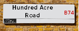
Map of Hundred Acre Road
| Postcodes | ||
|---|---|---|
| Icon | Postcodes for Hundred Acre Road | |
| Walking Distances | ||
| Distance Info | Green Circle = 10 Minutes Walk (800 metres) | |
About Hundred Acre Road
Hundred Acre Road is a street located in the Settlement of Streetly. The street has a length of approximately 1,095 metres.
Hundred Acre Road is located within the Walsall District (B) Council's jurisdiction. They provide various services, like refuse collection, and manage council tax collection. It's situated in the West Midlands region of the UK.
Hundred Acre Road has been assigned the Unique Street Reference Number of 41900168 in the National Street Gazetteer.
Hundred Acre Road is located within the county of West Midlands, situated in the West Midlands region of the UK. It's 106.01 miles North West from central London., 6.4 miles North from Birmingham, 19.57 miles North West from Coventry and 29.71 miles North East from Worcester.

Do you know why this road is called Hundred Acre Road?
What's it like to live here?
Ask the community a question about Hundred Acre Road.
Do you have any questions, memories to share or know any facts about Hundred Acre Road? We'd love to know more.
Also on streetlist.co.uk, can you help?
Swing Swang Lane
28th April 2024
I am trying to find out why the lane is named Swing Swang?
It has been known known this since at least 1905 when hedge making contents used to be held here.
Swing Swang is often used to describe a fairground ride. I remember Swing Boats. Were they a bit like this or is Swing Swang another name for swings?
Swing Swangs are also mentioned in connection to orchards. Or were orchards just good places to have swings?
Estate Agents near Hundred Acre Road
| Name | Address | Website |
|---|---|---|
| Paul Carr | 133 Chester Road, Streetly, Sutton Coldfield, B74 2HE | Visit Website |
| Dixons | 820 Kingstanding Road, Birmingham, West Midlands, B44 9RT | |
| Lets Go | 317b Chester Road, Streetly, Sutton Coldfield, WS9 0PH | Visit Website |
We have found 8 postcodes for Hundred Acre Road
Location Details
| Hundred Acre Road | |
|---|---|

| |
| Latitude | 52.571423 |
| Longitude | -1.887615 |
| OS Easting (X): | 407615 |
| OS Northing (Y): | 297112 |
| OS Grid Reference: | SP076971 |
Neighbourhood Policing |
| Police Force: West Midlands |
 View Neighbourhood Crime and Policing View Neighbourhood Crime and Policing |
| Find a Local Neighbourhood Watch Scheme |
Frequently asked Questions for Hundred Acre Road
What Council (Local Authority) is Hundred Acre Road in?
Hundred Acre Road is located within the local authority area of Walsall Council which is a Metropolitan District.
What Parish Council is Hundred Acre Road in?
Hundred Acre Road is in an unparished area.
What Electoral Ward is Hundred Acre Road in?
Hundred Acre Road is located within the ward of Streetly.
What County is Hundred Acre Road in?
Hundred Acre Road is located within the ceremonial county of West Midlands.
What Constituency is Hundred Acre Road in?
Hundred Acre Road is located within the constituency of Aldridge-Brownhills.
What Part of the UK is Hundred Acre Road in?
Hundred Acre Road is located within the West Midlands (England) region of the United Kingdom.
What County Council area is Hundred Acre Road in?
Hundred Acre Road is located within the West Midlands Council area.
What Police Force area is Hundred Acre Road in?
Hundred Acre Road is located within the West Midlands Police area.
Roads that have a Junction with Hundred Acre Road
| Street | Junction Type |
|---|---|
| Bridle Lane | junction |
| Bankside Crescent | junction |
| Forest Close | junction |
| Hillside Drive | junction |
| Moss Way | junction |
| Boundary Road | junction |
| Fordwater Road | junction |
| Goodwood Drive | junction |
| Brabham Crescent | junction |
| Brabham Crescent | junction |
| Silverstone Drive | junction |
| Aldridge Road | junction |
Sunset and Sunrise times for Hundred Acre Road
| Sunrise | 05:09 |
|---|---|
| Sunset | 20:58 |
Latest Weather Conditions for Hundred Acre Road
| Observed at Weather Station: | Coleshill 14 May 2024 at 11:00 (10.47 miles away) |
|---|---|
| Current Weather: | Overcast |
| Temperature and Humidity: | 14.7°C (87.8%) |
| Wind Direction and Speed: | SE (7 mph) |
Population Statistics
| ONS Area Code | E00052478, E00052479, E00168261, E00052471, E00052472 & E00052475 |
|---|---|
| ONS Area Name | Indian Tech Achievers, Multi-Ethnic Suburbia, Multi-Ethnic Professionals with Families & Semi-Detached Ageing |
| Average Age | 45.80, 41.84 & 45.46 |
| Area Population | 1487.00, 1984.00 & 1569.00 |
| Male Population | 744.00, 968.00 & 760.00 (49%) |
| Female Population | 743.00, 1016.00 & 809.00 (51%) |
| Benefit Claimants | 11, 12 & 6 (1%) |
| LSOA Code: | E01010389, E01010391 &E01010387 |
|---|---|
| LSOA Name: | Walsall 032B, Walsall 032D &Walsall 028C |
| SOA Code: | 8a, 8c &8b |
| SOA Name: | |
| MSOA Code: | E02002141 &E02002137 |
| MSOA Name: | Walsall 032 &Walsall 028 |
Nearest Supermarkets
| Tesco Streetly Express |
|---|
| 184 Chester Rd, Streetly, Sutton Coldfield, B74 3NA |
| 0345 675 7023 |
| Distance: 0.45 Miles |
| Directions from Hundred Acre Road to Tesco Streetly Express |
| Iceland Kingstanding |
|---|
| 557 Kingstanding Road, Kingstanding Circle, Birmingham, B44 9TA |
| 01213558026 |
| Distance: 1.42 Miles |
| Directions from Hundred Acre Road to Iceland Kingstanding |
| Asda Queslett |
|---|
| 6 Old Horns Crescent Off Queslet Road, Great Barr, Birmingham, B43 7HA |
| 0121 360 0238 |
| Distance: 1.68 Miles |
| Directions from Hundred Acre Road to Asda Queslett |
| Tesco New Oscott Extra |
|---|
| 11 Princess Alice Dr, Sutton Coldfield, B73 6RB |
| 0345 677 9493 |
| Distance: 1.96 Miles |
| Directions from Hundred Acre Road to Tesco New Oscott Extra |
Telephone Information
| Dialling Code | Telephone Exchange | Telephone Cabinet | Fibre to the Cabinet or Fibre to the Premises |
|---|---|---|---|
| 0121 | STREETLY - CMSTRE | P26 | FTTC |
Broadband Information
| Speed | Average Speed | Median Speed | Maximum Speed | Next-generation access (NGA) | Number of Connections |
|---|---|---|---|---|---|
| Less than 2 Mbps | 11.6 | 6.8 | >=30 | Y | 28 |
Local Government
| Local Council Details |
|---|
| Within the area of Walsall |
| Visit the Council's Website |
| The Civic Centre, Walsall, West Midlands &WS1 1TP |
| Send email |
| Telephone Number: 01922 650 000 |
| Local Member of Parliament |
|---|
| Within the Westminster Parliamentary Constituency of Aldridge-Brownhills |
| The Member of Parliament is Wendy Morton |
| Details for the MP Wendy Morton on parliament.uk |
| Details for the MP Wendy Morton on theyworkforyou.com |
| In the 2019 General Election Wendy Morton won with a majority of 19,836 the result was Con hold. The total electorate was 60,138 |
| Wards, Parish Councils and County Councils |
|---|
| Ward: Streetly Ward |
| Ceremonial County: West Midlands |
Nearest Schools
England Secondary Schools
Cardinal Wiseman Catholic School
Address: Cardinal Wiseman Catholic School, Old Oscott Hill, Kingstanding, Birmingham, West Midlands, B44 9SR
Distance: 1.54 miles
Contact: 01213606383
The Streetly Academy
Address: The Streetly Academy, Queslett Road East, Streetly, Sutton Coldfield, West Midlands, B74 2EX
Distance: 0.32 miles
Contact: 01213532709
Barr Beacon School
Address: Barr Beacon School, Old Hall Lane, Aldridge, Walsall, West Midlands, WS9 0RF
Distance: 1.32 miles
Contact: 01213666600
England Primary Schools
Maryvale Catholic Primary School
Address: Maryvale Catholic Primary School, Old Oscott Hill, Kingstanding, Birmingham, West Midlands, B44 9AG
Distance: 1.62 miles
Contact: 01216751434
Kingsland Primary School (NC)
Address: Kingsland Primary School (NC), Bandywood Crescent, Birmingham, B44 9NA
Distance: 0.98 miles
Contact: 01214647707
Sundridge Primary School
Address: Sundridge Primary School, Sundridge Road, Kingstanding, Birmingham, West Midlands, B44 9NY
Distance: 0.99 miles
Contact: 01214647720
Banners Gate Primary School
Address: Banners Gate Primary School, Coppice View Road, Sutton Coldfield, West Midlands, B73 6UE
Distance: 1.08 miles
Contact:
New Oscott Primary School
Address: New Oscott Primary School, Markham Road, Sutton Coldfield, West Midlands, B73 6QR
Distance: 1.53 miles
Contact: 01216753658
Kings Rise Academy
Address: Kings Rise Academy, Hornsey Road, Kingstanding, Birmingham, West Midlands, B44 0JL
Distance: 1.55 miles
Contact: 01214644635
Meadow View JMI School
Address: Meadow View JMI School, Frampton Way, Great Barr, Birmingham, West Midlands, B43 7UJ
Distance: 0.77 miles
Contact: 01213666182
Manor Primary School
Address: Manor Primary School, Briar Avenue, Streetly, Sutton Coldfield, West Midlands, B74 3HX
Distance: 0.71 miles
Contact: 01213531738
Lindens Primary School
Address: Lindens Primary School, Hundred Acre Road, Streetly, Sutton Coldfield, West Midlands, B74 2BB
Distance: 0.21 miles
Contact: 01213539273
Pheasey Park Farm Primary School
Address: Pheasey Park Farm Primary School, Wimperis Way, Great Barr, Birmingham, West Midlands, B43 7DH
Distance: 1.09 miles
Contact:
St Anne's Catholic Primary School, Streetly
Address: St Anne's Catholic Primary School, Streetly, Blackwood Road, Streetly, Sutton Coldfield, West Midlands, B74 3PL
Distance: 0.62 miles
Contact: 01213535114
Blackwood School
Address: Blackwood School, Blackwood Road, Streetly, Sutton Coldfield, West Midlands, B74 3PH
Distance: 0.75 miles
Contact:
Nearest Hospitals
| Name | Address | Postcode | Distance | Map |
|---|
Nearest Dentists
Dentists near Hundred Acre Road
| Name | Address | Postcode | Distance | Map |
|---|
Nearest GP Surgeries
Doctors near Hundred Acre Road
DR KUMAR RS
Address: THE OAKS MEDICAL CENTRE, 119 CHESTER ROAD, STREETLY, SUTTON COLDFIELD, WEST MIDLANDS, B74 2HE
Distance: 0.40 miles
Contact: tel: 01213531888
SUTTON PARK SURGERY
Address: 34 CHESTER ROAD NORTH, SUTTON COLDFIELD, WEST MIDLANDS, B73 6SP
Distance: 0.61 miles
Contact: :
BLACKWOOD HEALTH CENTRE
Address: BLACKWOOD ROAD, SUTTON COLDFIELD, WEST MIDLANDS, B74 3PL
Distance: 0.62 miles
Contact: tel: 0121 3537558
QUESLETT MEDICAL CENTRE
Address: 522 QUESLETT ROAD, GREAT BARR, BIRMINGHAM, WEST MIDLANDS, B43 7DY
Distance: 1.06 miles
Contact: tel: 0121 3608560
APOLLO SURGERY
Address: 619 KINGS ROAD, GREAT BARR, BIRMINGHAM, WEST MIDLANDS, B44 9HW
Distance: 1.19 miles
Contact: tel: 0121 3608668
COLLINGWOOD FAMILY PRACTICE
Address: COLLINGWOOD CENTRE, COLLINGWOOD DRIVE, GREAT BARR, BIRMINGHAM, WEST MIDLANDS, B43 7NF
Distance: 1.22 miles
Contact: tel: 0121 3252090
Nearest Dispensing Chemists
Pharmacies near Hundred Acre Road
| Name | Address | Postcode | Telephone | Map | Distance in Km |
|---|
Nearest Opticians
Opticians near Hundred Acre Road
DIRECT VISION OPTICIANS (GREAT BARR)
Address: 122 HILLINGFORD AVENUE, BIRMINGHAM, WEST MIDLANDS, B43 7JU
Distance: 1.20 miles
Contact: :
VERNON WALKER OPTICIANS
Address: 21 THE PRECINCT, KINGSTANDING, BIRMINGHAM, WEST MIDLANDS, B44 9HH
Distance: 1.29 miles
Contact: :
SCRIVENS OPTICIANS (KINGSTANDING)
Address: 635 KINGSTANDING ROAD, BIRMINGHAM, B44 9SU
Distance: 1.33 miles
Contact: :
THE SPECTACLE COMPANY
Address: 766 KINGSTANDING ROAD, BIRMINGHAM, WEST MIDLANDS, B44 9ST
Distance: 1.35 miles
Contact: :
VISION EXPRESS (PRINCESS ALICE DRIVE)
Address: 11 PRINCESS ALICE DRIVE, SUTTON COLDFIELD, B73 6RB
Distance: 1.87 miles
Contact: :
R J OWEN OPTICIANS
Address: 10 WARREN FARM ROAD, BIRMINGHAM, WEST MIDLANDS, B44 0QU
Distance: 2.05 miles
Contact: :
Transport
Nearest Rail Stations
Butlers Lane Station is 2.54 miles away.
Address: Butlers Lane station, Butlers Lane, Four Oaks, West Midlands, B74 4RT
Butlers Lane is situated on the Bristol to Brimingham Line.
Butlers Lane Station is staffed on a part time basis.
Directions from Hundred Acre Road to Butlers Lane Rail Station
Four Oaks Station is 2.57 miles away.
Address: Four Oaks station, Lichfield Road, Sutton Coldfield, West Midlands, B74 2TD
Four Oaks is situated on the Bristol to Brimingham Line.
Four Oaks Station is staffed on a part time basis.