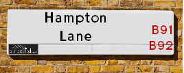
Map of Hampton Lane
| Postcodes | ||
|---|---|---|
| Icon | Postcodes for Hampton Lane | |
| Walking Distances | ||
| Distance Info | Green Circle = 10 Minutes Walk (800 metres) | |
About Hampton Lane
Hampton Lane is a street located in the village of Catherine-de-Barnes and in the town of Solihull. The street has a length of approximately 2,853 metres.
Hampton Lane is located within the Solihull District (B) Council's jurisdiction. They provide various services, like refuse collection, and manage council tax collection. It's situated in the West Midlands region of the UK.
Hampton Lane has been assigned the Unique Street Reference Numbers of 35005580, 35002213 and 35005581 in the National Street Gazetteer.
Hampton Lane is located within the county of West Midlands, situated in the West Midlands region of the UK. It's 94.62 miles North West from central London., 7.59 miles South East from Birmingham, 10.28 miles West from Coventry and 25.23 miles North East from Worcester.

Do you know why this road is called Hampton Lane?
What's it like to live here?
Ask the community a question about Hampton Lane.
Do you have any questions, memories to share or know any facts about Hampton Lane? We'd love to know more.
Also on streetlist.co.uk, can you help?
Swing Swang Lane
28th April 2024
I am trying to find out why the lane is named Swing Swang?
It has been known known this since at least 1905 when hedge making contents used to be held here.
Swing Swang is often used to describe a fairground ride. I remember Swing Boats. Were they a bit like this or is Swing Swang another name for swings?
Swing Swangs are also mentioned in connection to orchards. Or were orchards just good places to have swings?
Eldroth Road
15th April 2024
I wondered if anyone has any old pictures of Wenning Bank House in the 1940’s and also Lane Side before of the same era .. we visited today with my Mum in law as she used to live at both these properties. Also any photos of the schools around that time .. thank you.
Can You Help?Napps Way
15th April 2024
Why is the road called Napps Way (belonging to Napp, but minus an
apostrophe as is usual with such nomenclature)? Moreover, who or
what is, or was, “Napp” in the respective, possessive case?
Several years ago, I met an elderly man (probably in his late-eighties)
who lives on Bentham Drive, Liverpool 16, and during a conversation
with him whilst in a Northwest Passenger Transport Ambulance on the
way to the former RLUH (Royal Liverpool University Hospital), he told
me that he could remember (when he was a boy, living in Childwall,
Liverpool 16) that, “Where Napps Way is now, during WW2, there was
a two-man gun emplacement on the, then, open land to protect the
railway line passing over Childwall Valley Road - next to the railway
bridge - when suddenly, as they were loading a live “shell” into the gun’s
breach, the aforementioned “shell” accidentally exploded in the gun’s
breach killing both of the two soldiers, that had been manning the gun,
instantly! (Very sad, of course, but could - perhaps - two ghosts relating
to those two, very unfortunately and prematurely-killed soldiers have
haunted that place of their deaths ever since - and have any residents
of Napps Way - formerly and in its latest incarnation - seen two, WW2
(uniformed) soldiers unexpectedly appear in or near their homes?)
Estate Agents near Hampton Lane
| Name | Address | Website |
|---|---|---|
| Simon Burt Privilege | Malvern House New Road, Solihull, B91 3DL | Visit Website |
| Simon Burt The Estate Agent | Malvern House New Road, Solihull, B91 3DL | Visit Website |
| John Shepherd | 6-8, Drury Lane Solihull B91 3BD | Visit Website |
We have found 17 postcodes for Hampton Lane
Location Details
| Hampton Lane | |
|---|---|

| |
| Latitude | 52.418268 |
| Longitude | -1.751771 |
| OS Easting (X): | 416880 |
| OS Northing (Y): | 280101 |
| OS Grid Reference: | SP169801 |
Ordnance Survey Maps for Hampton Lane
If you purchase a map through the links below, we may earn an affiliate commission.
| Map Series | link | Ordnance Survey |
| Explorer 1:25,000 220 Birmingham, Walsall, Solihull and Redditch | Check Price on Amazon | |
| Landranger 1:50,000 139 Birmingham and Wolverhampton | Check Price on Amazon |
Neighbourhood Policing |
| Police Force: West Midlands |
 View Neighbourhood Crime and Policing View Neighbourhood Crime and Policing |
| Find a Local Neighbourhood Watch Scheme |
Frequently asked Questions for Hampton Lane
What Council (Local Authority) is Hampton Lane in?
Hampton Lane is located within the local authority area of Solihull Council which is a Metropolitan District.
What Parish Council is Hampton Lane in?
Hampton Lane is in an unparished area.
What Electoral Ward is Hampton Lane in?
Hampton Lane is located within the ward of Silhill &Bickenhill.
What County is Hampton Lane in?
Hampton Lane is located within the ceremonial county of West Midlands.
What Constituency is Hampton Lane in?
Hampton Lane is located within the constituency of Solihull &Meriden.
What Part of the UK is Hampton Lane in?
Hampton Lane is located within the West Midlands (England) region of the United Kingdom.
What County Council area is Hampton Lane in?
Hampton Lane is located within the West Midlands Council area.
What Police Force area is Hampton Lane in?
Hampton Lane is located within the West Midlands Police area.
Roads that have a Junction with Hampton Lane
| Street | Junction Type |
|---|---|
| Warwick Road (B4025) | junction |
| Park Avenue | pseudo node |
| Radford Rise | junction |
| Oakland Close | junction |
| Beechnut Lane | junction |
| Albany Gardens | junction |
| School Lane | junction |
| Alderham Close | junction |
| Warwick Road (B4102) | junction |
| Warwick Road (B4025) | junction |
| Yew Tree Lane (B4105) | junction |
| Solihull By-Pass (A41) | junction |
| Solihull By-Pass (A41) | junction |
| Marsh Lane | pseudo node |
| Field Lane | junction |
| Lugtrout Lane | junction |
| Bickenhill Lane | junction |
| Barbers Lane | junction |
Sunset and Sunrise times for Hampton Lane
| Sunrise | 05:26 |
|---|---|
| Sunset | 20:40 |
Latest Weather Conditions for Hampton Lane
| Observed at Weather Station: | Coleshill 4 May 2024 at 02:00 (5.02 miles away) |
|---|---|
| Current Weather: | Overcast |
| Temperature and Humidity: | 8.7°C (94.7%) |
| Wind Direction and Speed: | SSW (6 mph) |
Population Statistics
| ONS Area Code | E00051714, E00051716, E00051705, E00051712, E00051698 & E00051151 |
|---|---|
| ONS Area Name | Delayed Retirement, Communal Retirement & Indian Tech Achievers |
| Average Age | 52.85, 47.26 & 42.67 |
| Area Population | 1604.00, 1891.00 & 1498.00 |
| Male Population | 703.00, 906.00 & 730.00 (47%) |
| Female Population | 901.00, 985.00 & 768.00 (53%) |
| Benefit Claimants | 9, 10 & 13 (1%) |
| LSOA Code: | E01010226, E01010227 &E01010115 |
|---|---|
| LSOA Name: | Solihull 016B, Solihull 015C &Solihull 015A |
| SOA Code: | 3c, 3b &3a |
| SOA Name: | |
| MSOA Code: | E02002096 &E02002095 |
| MSOA Name: | Solihull 016 &Solihull 015 |
Nearest Supermarkets
| Morrisons Solihull |
|---|
| George Road, Solihull B91 3BQ |
| 0121 7090680 |
| Distance: 1 Miles |
| Directions from Hampton Lane to Morrisons Solihull |
| Tesco Lode Heath Express |
|---|
| 8-10 Hermitage Rd, Lode Heath, Solihull, B91 2LJ |
| 0345 026 9240 |
| Distance: 1.03 Miles |
| Directions from Hampton Lane to Tesco Lode Heath Express |
| Sainsburys Solihull |
|---|
| 11 Poplar Way, Solihull, England, B91 3BX |
| 0121 704 2402 |
| Distance: 1.15 Miles |
| Directions from Hampton Lane to Sainsburys Solihull |
| Tesco Solihull High Street Express |
|---|
| 1-3 High Street, Solihull, B91 3SJ |
| 0345 610 6779 |
| Distance: 1.19 Miles |
| Directions from Hampton Lane to Tesco Solihull High Street Express |
Telephone Information
| Dialling Code | Telephone Exchange | Telephone Cabinet | Fibre to the Cabinet or Fibre to the Premises |
|---|---|---|---|
| 0121 | SOLIHULL - CMSOL | P42 | FTTC |
Broadband Information
| Speed | Average Speed | Median Speed | Maximum Speed | Next-generation access (NGA) | Number of Connections |
|---|---|---|---|---|---|
| Greater than 2 Mbps | 27.8 | 7 | >=30 | Y | 3 |
Local Government
| Local Council Details |
|---|
| Within the area of Solihull |
| Visit the Council's Website |
| PO Box 18, Council House, Solihull, West Midlands &B91 3QS |
| Send email |
| Telephone Number: 0121 704 6000 |
| Local Member of Parliament |
|---|
| Within the Westminster Parliamentary Constituency of Solihull &Meriden |
| The Member of Parliament is Julian Knight &Saqib Bhatti |
| Details for the MP Julian Knight &Saqib Bhatti on parliament.uk |
| Details for the MP Julian Knight &Saqib Bhatti on theyworkforyou.com |
| In the 2019 General Election Julian Knight &Saqib Bhatti won with a majority of 21,273 the result was Con hold. The total electorate was 78,760 |
| Wards, Parish Councils and County Councils |
|---|
| Ward: Silhill &Bickenhill Ward |
| Ceremonial County: West Midlands |
Nearest Schools
England Primary Schools
Coppice Junior School
Address: Coppice Junior School, Coppice Road, Solihull, West Midlands, B92 9JY
Distance: 0.91 miles
Contact:
Damson Wood Nursery and Infant School
Address: Damson Wood Nursery and Infant School, Stockwell Rise, Solihull, West Midlands, B92 9LX
Distance: 1.04 miles
Contact: 01217058652
Damson Wood Nursery and Infant School
Address: Damson Wood Nursery and Infant School, Stockwell Rise, Solihull, West Midlands, B92 9LX
Distance: 1.04 miles
Contact:
Yew Tree Primary School
Address: Yew Tree Primary School, Wherretts Well Lane, Solihull, West Midlands, B91 2SD
Distance: 0.56 miles
Contact:
St Alphege Church of England Junior School
Address: St Alphege Church of England Junior School, Widney Manor Road, Solihull, West Midlands, B91 3JG
Distance: 1.37 miles
Contact: 01217042714
St Alphege Church of England Infant and Nursery School
Address: St Alphege Church of England Infant and Nursery School, New Road, Solihull, West Midlands, B91 3DW
Distance: 1.09 miles
Contact: 01217050443
Greswold Primary School
Address: Greswold Primary School, Buryfield Road, Solihull, West Midlands, B91 2AZ
Distance: 1.32 miles
Contact: 01217054738
St Augustine's Catholic Primary School
Address: St Augustine's Catholic Primary School, Whitefields Road, Solihull, West Midlands, B91 3NZ
Distance: 1.80 miles
Contact:
England Higher Schools
Solihull Sixth Form College
Address: Solihull Sixth Form College, Widney Manor Road, Solihull, West Midlands, B91 3WR
Distance: 1.23 miles
Contact: 01217042581
Solihull College & University Centre
Address: Solihull College & University Centre, Blossomfield Campus, Blossomfield Road, Solihull, West Midlands, B91 1SB
Distance: 1.80 miles
Contact: 01216787000
England Secondary Schools
Lode Heath School
Address: Lode Heath School, Lode Lane, Solihull, West Midlands, B91 2HW
Distance: 1.18 miles
Contact: 01217041421
St Peter's Catholic School
Address: St Peter's Catholic School, Whitefields Road, Solihull, West Midlands, B91 3NZ
Distance: 1.80 miles
Contact:
Nearest Hospitals
| Name | Address | Postcode | Distance | Map |
|---|
Nearest Dentists
Dentists near Hampton Lane
| Name | Address | Postcode | Distance | Map |
|---|
Nearest GP Surgeries
Doctors near Hampton Lane
YEW TREE MEDICAL CENTRE
Address: 100 YEW TREE LANE, SOLIHULL, WEST MIDLANDS, B91 2RA
Distance: 0.59 miles
Contact: :
SOLIHULL HEALTHCARE PARTNERSHIP
Address: GROVE SURGERY, 3 GROVE ROAD, SOLIHULL, WEST MIDLANDS, B91 2AG
Distance: 0.99 miles
Contact: tel: 0121 7051105
GPS HEALTHCARE, KNOWLE SURGERY - COVID LOCAL VACCINATION SERVICE
Address: GPS HEALTHCARE, KNOWLE SURGERY, 1500 WARWICK ROAD, KNOWLE, SOLIHULL, B93 9LE
Distance: 1.99 miles
Contact: :
THE BLYTHE PRACTICE
Address: 1500 WARWICK ROAD, KNOWLE, SOLIHULL, WEST MIDLANDS, B93 9LE
Distance: 1.99 miles
Contact: :
HAMPTON SURGERY
Address: FENTHAM HALL, MARSH LANE, HAMPTON-IN-ARDEN, SOLIHULL, WEST MIDLANDS, B92 0AH
Distance: 2.14 miles
Contact: tel: 01675 442510
MEADOWSIDE FAMILY HEALTH CENTRE
Address: 30 WINCHCOMBE ROAD, SOLIHULL, B92 8PJ
Distance: 2.27 miles
Contact: :
Nearest Dispensing Chemists
Pharmacies near Hampton Lane
| Name | Address | Postcode | Telephone | Map | Distance in Km |
|---|
Nearest Opticians
Opticians near Hampton Lane
MIDLAND EYE
Address: 50 LODE LANE, SOLIHULL, B91 2AW
Distance: 1.01 miles
Contact: :
PERSPECTIVE OPTICIANS LTD
Address: 56 DRURY LANE, MELL SQUARE, SOLIHULL, WEST MIDLANDS, B91 3BH
Distance: 1.03 miles
Contact: :
A B OPTICS LIMITED (WARWICK ROAD)
Address: 681A WARWICK ROAD, SOLIHULL, WEST MIDLANDS, B91 3DA
Distance: 1.08 miles
Contact: :
BOOTS OPTICIANS (SOLIHULL)
Address: 57 MILL LANE, SOLIHULL, WEST MIDLANDS, B91 3AT
Distance: 1.09 miles
Contact: :
VISION EXPRESS (SOLIHULL)
Address: 77 - 79 HIGH STREET, SOLIHULL, B91 3SW
Distance: 1.15 miles
Contact: :
SPECSAVERS (SOLIHULL)
Address: 90 HIGH STREET, SOLIHULL, WEST MIDLANDS, B91 3TA
Distance: 1.18 miles
Contact: :
Transport
Nearest Rail Stations
Solihull Station is 1.57 miles away.
Address: Solihull station, Station Approach, Solihull, West Midlands, B91 1LE
Solihull is situated on the Chiltern Main Line and is managed by Chiltern Railway.
Solihull Station is an unstaffed station.
Widney Manor Station is 1.81 miles away.
Address: Widney Manor station, Widney Manor Road, Solihull, West Midlands, B91 3JW
Widney Manor is situated on the Chiltern Main Line.
Widney Manor Station is staffed on a part time basis.