Map of Higher Causeway
| Postcodes | ||
|---|---|---|
| Icon | Postcodes for Higher Causeway | |
| Walking Distances | ||
| Distance Info | Green Circle = 10 Minutes Walk (800 metres) | |
About Higher Causeway
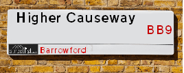
Higher Causeway is a street located in the town of Barrowford. It uses the postcode BB9 8QJ. The street has a length of approximately 433 metres.
Higher Causeway is located within the Pendle District (B) Council's jurisdiction. They provide various services, like refuse collection, and manage council tax collection. It's situated in the North West region of the UK.
Higher Causeway has been assigned the Unique Street Reference Number of 29801771 in the National Street Gazetteer.
Higher Causeway is located within the county of Lancashire, situated in the North West region of the UK. It's 185.04 miles North West from central London., 25.63 miles North from Manchester, 27.21 miles South East from Lancaster and 27.91 miles West from Leeds.

Do you know why this road is called Higher Causeway?
What's it like to live here?
Ask the community a question about Higher Causeway.
Do you have any questions, memories to share or know any facts about Higher Causeway? We'd love to know more.
Also on streetlist.co.uk, can you help?
Swing Swang Lane
28th April 2024
I am trying to find out why the lane is named Swing Swang?
It has been known known this since at least 1905 when hedge making contents used to be held here.
Swing Swang is often used to describe a fairground ride. I remember Swing Boats. Were they a bit like this or is Swing Swang another name for swings?
Swing Swangs are also mentioned in connection to orchards. Or were orchards just good places to have swings?
Estate Agents near Higher Causeway
| Name | Address | Website |
|---|---|---|
| Hilton & Horsfall Estate Agents | 75 Gisburn Road Barrowford BB9 6DX | Visit Website |
| Petty Estate Agents Ltd | 134B Gisburn Road, Barrowford, BB9 6HQ | Visit Website |
| Northstone | Parrock Road, Barrowford, BB9 6QF | Visit Website |
We have found 1 postcode for Higher Causeway
Location Details
| Higher Causeway | |
|---|---|

| |
| Latitude | 53.849718 |
| Longitude | -2.219669 |
| OS Easting (X): | 385550 |
| OS Northing (Y): | 439321 |
| OS Grid Reference: | SD856393 |
Neighbourhood Policing |
| Police Force: Lancashire |
 View Neighbourhood Crime and Policing View Neighbourhood Crime and Policing |
| Find a Local Neighbourhood Watch Scheme |
Frequently asked Questions for Higher Causeway
What Council (Local Authority) is Higher Causeway in?
Higher Causeway is located within the local authority area of Pendle Council which is a District Council.
What Parish Council is Higher Causeway in?
Higher Causeway is located within the area of Barrowford Parish Council.
What Electoral Ward is Higher Causeway in?
Higher Causeway is located within the ward of Barrowford & Pendleside.
What County is Higher Causeway in?
Higher Causeway is located within the ceremonial county of Lancashire.
What Constituency is Higher Causeway in?
Higher Causeway is located within the constituency of Pendle.
What Part of the UK is Higher Causeway in?
Higher Causeway is located within the North West (England) region of the United Kingdom.
What County Council area is Higher Causeway in?
Higher Causeway is located within the Lancashire Council area.
What Police Force area is Higher Causeway in?
Higher Causeway is located within the Lancashire Police area.
Roads that have a Junction with Higher Causeway
| Street | Junction Type |
|---|---|
| Wheatley Lane Road | junction |
| Wheatley Lane Road | junction |
| Oaklands Avenue | junction |
| Ridgeway | junction |
| Nora Street | junction |
| Oaklands Avenue | junction |
| Ann Street | junction |
| Broadway Place | junction |
| Gisburn Road (A682) | junction |
Sunset and Sunrise times for Higher Causeway , BB9 8QJ
| Sunrise | 05:05 |
|---|---|
| Sunset | 21:05 |
Latest Weather Conditions for Higher Causeway, BB9 8QJ
| Observed at Weather Station: | Stonyhurst 14 May 2024 at 20:00 (10.08 miles away) |
|---|---|
| Current Weather: | Clear night |
| Temperature and Humidity: | 14.7°C (73.4%) |
| Wind Direction and Speed: | (0 mph) |
Population Statistics
| ONS Area Code | E00127773 |
|---|---|
| ONS Area Name | Industrious Transitions |
| Average Age | 44.34 |
| Area Population | 1580.00 |
| Male Population | 781.00 (49%) |
| Female Population | 799.00 (51%) |
| Benefit Claimants | 8 (1%) |
| LSOA Code: | E01025175 |
|---|---|
| LSOA Name: | Pendle 008B |
| SOA Code: | 8b |
| SOA Name: | |
| MSOA Code: | E02005247 |
| MSOA Name: | Pendle 008 |
Nearest Supermarkets
| Morrisons Nelson |
|---|
| Pendle Street, Nelson BB9 7UZ |
| 01282 449196 |
| Distance: 0.72 Miles |
| Directions from Higher Causeway to Morrisons Nelson |
| Asda Colne |
|---|
| Unit 1, Swinden Retail Park Corporation Street, Colne, BB8 8LU |
| 01282 870156 |
| Distance: 0.94 Miles |
| Directions from Higher Causeway to Asda Colne |
| Tesco Colne Market St Express |
|---|
| 52 Market St, Colne, BB8 0HS |
| 0345 675 7024 |
| Distance: 2.25 Miles |
| Directions from Higher Causeway to Tesco Colne Market St Express |
| Sainsburys Colne |
|---|
| Windy Bank, Colne, England, BB8 9HY |
| 01282 892333 |
| Distance: 2.29 Miles |
| Directions from Higher Causeway to Sainsburys Colne |
Telephone Information
| Area Code |
|---|
| Area Code: 01282 - Burnley |
| Area Code: 01200 - Clitheroe |
Broadband Information
| Speed | Average Speed | Median Speed | Maximum Speed | Next-generation access (NGA) | Number of Connections |
|---|---|---|---|---|---|
| Greater than 2 Mbps | 8.2 | 7.8 | 18.2 | N | 32 |
Local Government
| Local Council Details |
|---|
| Within the area of Pendle |
| Visit the Council's Website |
| Market Street, Nelson, Lancashire &BB9 7LG |
| Send email |
| Telephone Number: 01282 661 661 |
| Local Member of Parliament |
|---|
| Within the Westminster Parliamentary Constituency of Pendle |
| The Member of Parliament is Andrew Stephenson |
| Details for the MP Andrew Stephenson on parliament.uk |
| Details for the MP Andrew Stephenson on theyworkforyou.com |
| In the 2019 General Election Andrew Stephenson won with a majority of 6,186 the result was Con hold. The total electorate was 65,292 |
| Wards, Parish Councils and County Councils |
|---|
| Ward: Barrowford & Pendleside Ward |
| Ceremonial County: Lancashire |
Nearest Schools
England Primary Schools
Blacko Primary School
Address: Blacko Primary School, Gisburn Road, Blacko, Nelson, Lancashire, BB9 6LS
Distance: 1.31 miles
Contact:
Colne Lord Street School
Address: Colne Lord Street School, Lord Street, Colne, Lancashire, BB8 9AR
Distance: 1.73 miles
Contact:
Colne Primet Primary School
Address: Colne Primet Primary School, Tatton Street, Colne, Lancashire, BB8 8JE
Distance: 1.28 miles
Contact: 01282864607
Castercliff Primary School
Address: Castercliff Primary School, Marsden Hall Road North, Nelson, Lancashire, BB9 8JJ
Distance: 1.29 miles
Contact: 01282617627
Great Marsden St John's Primary School A Church of England Academy
Address: Great Marsden St John's Primary School A Church of England Academy, Trent Road, Nelson, Lancashire, BB9 0NX
Distance: 1.58 miles
Contact: 01282615055
Walverden Primary School
Address: Walverden Primary School, Bracewell Street, Nelson, Lancashire, BB9 0TL
Distance: 1.21 miles
Contact: 01282614834
Barrowford School
Address: Barrowford School, Rushton Street, Barrowford, Nelson, Lancashire, BB9 6EA
Distance: 0.11 miles
Contact: 01282615644
Barrowford St Thomas Church of England Primary School
Address: Barrowford St Thomas Church of England Primary School, Wheatley Lane Road, Barrowford, Nelson, Lancashire, BB9 6QT
Distance: 0.30 miles
Contact: 01282614462
Holy Saviour Roman Catholic Primary School, Nelson
Address: Holy Saviour Roman Catholic Primary School, Nelson, Holland Place, Off Reedyford Road, Nelson, Lancashire, BB9 8HD
Distance: 0.43 miles
Contact: 01282612319
Marsden Community Primary School
Address: Marsden Community Primary School, Percy Street, Nelson, Lancashire, BB9 0BE
Distance: 1.25 miles
Contact: 01282612769
Bradley Primary School
Address: Bradley Primary School, Dover Street, Nelson, Lancashire, BB9 7RF
Distance: 0.73 miles
Contact: 01282615772
Nelson St Philip's Church of England Primary School
Address: Nelson St Philip's Church of England Primary School, Leeds Road, Nelson, Lancashire, BB9 9TQ
Distance: 0.90 miles
Contact: 01282614463
Nelson St Paul's Church of England Primary School
Address: Nelson St Paul's Church of England Primary School, Hibson Road, Nelson, Lancashire, BB9 0PY
Distance: 1.53 miles
Contact: 01282617035
St John Southworth Roman Catholic Primary School, Nelson
Address: St John Southworth Roman Catholic Primary School, Nelson, Lomeshaye Road, Nelson, Lancashire, BB9 0DQ
Distance: 1.19 miles
Contact:
Whitefield Infant School and Nursery
Address: Whitefield Infant School and Nursery, Every Street, Nelson, Lancashire, BB9 7HF
Distance: 0.94 miles
Contact: 01282612807
Lomeshaye Junior School
Address: Lomeshaye Junior School, Norfolk Street, Nelson, Lancashire, BB9 7SY
Distance: 0.86 miles
Contact: 01282612063
Pendle Primary Academy
Address: Pendle Primary Academy, Walter Street, Brierfield, Nelson, Lancashire, BB9 5AW
Distance: 1.95 miles
Contact: 01282615927
Wheatley Lane Methodist Voluntary Aided Primary School
Address: Wheatley Lane Methodist Voluntary Aided Primary School, Fence, Burnley, Lancashire, BB12 9ED
Distance: 1.84 miles
Contact: 01282617214
England Secondary Schools
Ss John Fisher and Thomas More Roman Catholic High School
Address: Ss John Fisher and Thomas More Roman Catholic High School, Gibfield Road, Colne, Lancashire, BB8 8JT
Distance: 1.15 miles
Contact: 01282865299
Colne Primet Academy
Address: Colne Primet Academy, Dent Street, Colne, Lancashire, BB8 8JF
Distance: 1.29 miles
Contact: 01282863970
Pendle Vale College
Address: Pendle Vale College, Oxford Road, Nelson, Lancashire, BB9 8LF
Distance: 1.11 miles
Contact: 01282682240
Marsden Heights Community College
Address: Marsden Heights Community College, Edge End Lane, Nelson, Lancashire, BB9 0PR
Distance: 1.61 miles
Contact:
England Higher Schools
Nelson and Colne College
Address: Nelson and Colne College, Scotland Road, Nelson, Lancashire, BB9 7YT
Distance: 0.37 miles
Contact: 01282440200
Nearest Hospitals
| Name | Address | Postcode | Distance | Map |
|---|
Nearest Dentists
Dentists near Higher Causeway
| Name | Address | Postcode | Distance | Map |
|---|
Nearest GP Surgeries
Doctors near Higher Causeway
BARROWFORD HEALTH CENTRE
Address: LEE STREET, BARROWFORD, NELSON, LANCASHIRE, BB9 8NR
Distance: 0.16 miles
Contact: tel: 01282 619944
BARROWFORD SURGERY
Address: 2A-4 RIDGEWAY, BARROWFORD, NELSON, LANCASHIRE, BB9 8QP
Distance: 0.19 miles
Contact: tel: 01282 612621
ELMS FEDERATED PRACTICE - PENDLE VALLEY MILL SURGERY
Address: CARR ROAD, NELSON, LANCASHIRE, BB9 7SR
Distance: 0.81 miles
Contact: :
DR JEHANGIR (SH)
Address: YARNSPINNERS PRIMARY HCC, YARNSPINNERS WHARF, CARR ROAD, NELSON, LANCASHIRE, BB9 7SR
Distance: 0.81 miles
Contact: tel: 01282 657680
WHITEFIELD HEALTHCARE
Address: CARR ROAD, NELSON, LANCASHIRE, BB9 7SR
Distance: 0.81 miles
Contact: tel: 01282 657700
NELSON MEDICAL PRACTICE
Address: YARNSPINNERS PRIMARY HCC, YARNSPINNERS WHARF, CARR ROAD, NELSON, LANCASHIRE, BB9 7SR
Distance: 0.81 miles
Contact: tel: 01282 657710
Nearest Dispensing Chemists
Pharmacies near Higher Causeway
| Name | Address | Postcode | Telephone | Map | Distance in Km |
|---|
Nearest Opticians
Opticians near Higher Causeway
N. P. SHER - BARROWFORD
Address: 1A GISBURN ROAD, BARROWFORD, NELSON, LANCASHIRE, BB9 8NB
Distance: 0.24 miles
Contact: :
SPECTACLE FACTORY SHOP (NELSON)
Address: 51 SCOTLAND ROAD, NELSON, LANCASHIRE, BB9 7UY
Distance: 0.80 miles
Contact: :
4948 COLNE
Address: ASDA STORES LTD, CORPORATION STREET, COLNE, LANCASHIRE, BB8 8LU
Distance: 0.93 miles
Contact: :
EYE CARE OPTICAL
Address: 14 MANCHESTER ROAD, NELSON, BB9 7EG
Distance: 0.94 miles
Contact: :
SPECSAVERS (NELSON)
Address: 8 MARSDEN MALL, PENDLE RISE SHOPPING CENTRE, NELSON, LANCASHIRE, BB9 9SL
Distance: 0.97 miles
Contact: :
BROWN OPTOMETRISTS
Address: 35 RAILWAY STREET, NELSON, LANCASHIRE, BB9 9SG
Distance: 1.02 miles
Contact: :
Transport
Nearest Rail Stations
Nelson Station is 1.04 miles away.
Address: Nelson station, Hibson Road, Nelson, Lancashire, BB9 9SF
Nelson is situated on the East Lancashire line and is managed by Northern.
Nelson Station is staffed on a part time basis.
Colne Station is 1.61 miles away.
Address: Colne station, Primet Hill, Colne, Lancashire, BB8 9NX
Colne is situated on the East Lancashire line and is managed by Northern.
Colne Station is an unstaffed station.