Map of Bradford Road
| Postcodes | ||
|---|---|---|
| Icon | Postcodes for Bradford Road | |
| Walking Distances | ||
| Distance Info | Green Circle = 10 Minutes Walk (800 metres) | |
About Bradford Road
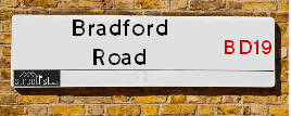
Bradford Road is a street located in the town of Cleckheaton. The street has a length of approximately 1,928 metres.
Bradford Road is located within the Kirklees District (B) Council's jurisdiction. They provide various services, like refuse collection, and manage council tax collection. It's situated in the Yorkshire and The Humber region of the UK.
Bradford Road has been assigned the Unique Street Reference Number of 19409823 and 19423020 in the National Street Gazetteer.
Bradford Road is located within the county of West Yorkshire, situated in the Yorkshire and The Humber region of the UK. It's 168.42 miles North West from central London., 8.63 miles South West from Leeds, 26.24 miles North West from Sheffield and 27.72 miles North East from Manchester.

Do you know why this road is called Bradford Road?
What's it like to live here?
Ask the community a question about Bradford Road.
Do you have any questions, memories to share or know any facts about Bradford Road? We'd love to know more.
Also on streetlist.co.uk, can you help?
Swing Swang Lane
28th April 2024
I am trying to find out why the lane is named Swing Swang?
It has been known known this since at least 1905 when hedge making contents used to be held here.
Swing Swang is often used to describe a fairground ride. I remember Swing Boats. Were they a bit like this or is Swing Swang another name for swings?
Swing Swangs are also mentioned in connection to orchards. Or were orchards just good places to have swings?
Eldroth Road
15th April 2024
I wondered if anyone has any old pictures of Wenning Bank House in the 1940’s and also Lane Side before of the same era .. we visited today with my Mum in law as she used to live at both these properties. Also any photos of the schools around that time .. thank you.
Can You Help?Napps Way
15th April 2024
Why is the road called Napps Way (belonging to Napp, but minus an
apostrophe as is usual with such nomenclature)? Moreover, who or
what is, or was, “Napp” in the respective, possessive case?
Several years ago, I met an elderly man (probably in his late-eighties)
who lives on Bentham Drive, Liverpool 16, and during a conversation
with him whilst in a Northwest Passenger Transport Ambulance on the
way to the former RLUH (Royal Liverpool University Hospital), he told
me that he could remember (when he was a boy, living in Childwall,
Liverpool 16) that, “Where Napps Way is now, during WW2, there was
a two-man gun emplacement on the, then, open land to protect the
railway line passing over Childwall Valley Road - next to the railway
bridge - when suddenly, as they were loading a live “shell” into the gun’s
breach, the aforementioned “shell” accidentally exploded in the gun’s
breach killing both of the two soldiers, that had been manning the gun,
instantly! (Very sad, of course, but could - perhaps - two ghosts relating
to those two, very unfortunately and prematurely-killed soldiers have
haunted that place of their deaths ever since - and have any residents
of Napps Way - formerly and in its latest incarnation - seen two, WW2
(uniformed) soldiers unexpectedly appear in or near their homes?)
Estate Agents near Bradford Road
| Name | Address | Website |
|---|---|---|
| Yorkshire Residential Sales & Letting Ltd | Hub 26 Hunsworth Lane Cleckheaton BD19 4LN | Visit Website |
| Robert Watts Property Management | Lion Chambers, 63 Northgate, Cleckheaton, BD19 3HZ | |
| EweMove | Cavendish House Littlewood Court West 26 Industrial Estate Cleckheaton BD19 4TE | Visit Website |
We have found 22 postcodes for Bradford Road
Location Details
| Bradford Road | |
|---|---|

| |
| Latitude | 53.730867 |
| Longitude | -1.718702 |
| OS Easting (X): | 418555 |
| OS Northing (Y): | 426113 |
| OS Grid Reference: | SE186261 |
Neighbourhood Policing |
| Police Force: West Yorkshire |
 View Neighbourhood Crime and Policing View Neighbourhood Crime and Policing |
| Find a Local Neighbourhood Watch Scheme |
Frequently asked Questions for Bradford Road
What Council (Local Authority) is Bradford Road in?
Bradford Road is located within the local authority area of Kirklees Council which is a Metropolitan District.
What Parish Council is Bradford Road in?
Bradford Road is in an unparished area.
What Electoral Ward is Bradford Road in?
Bradford Road is located within the ward of Cleckheaton.
What County is Bradford Road in?
Bradford Road is located within the ceremonial county of West Yorkshire.
What Constituency is Bradford Road in?
Bradford Road is located within the constituency of Batley and Spen.
What Part of the UK is Bradford Road in?
Bradford Road is located within the Yorkshire and The Humber region of the United Kingdom.
What County Council area is Bradford Road in?
Bradford Road is located within the West Yorkshire Council area.
What Police Force area is Bradford Road in?
Bradford Road is located within the West Yorkshire Police area.
Roads that have a Junction with Bradford Road
| Street | Junction Type |
|---|---|
| Whitehall Road (A58) | roundabout |
| Whitehall Road (A58) | roundabout |
| Chain Bar Road | junction |
| Hunsworth Lane (B6121) | junction |
| Exchange Street | junction |
| Heaton Street | junction |
| Farfield Street | junction |
| Victoria Street | junction |
| Collinson Street | junction |
| Law Street | junction |
| Booth Street | junction |
| Canary Street | junction |
| Balme Road | junction |
| Brooklyn Court | junction |
| Wesley Street | junction |
| Coach Lane | junction |
| Scott Lane (B6120) | junction |
| Valley Road | junction |
| Chapel Street | junction |
| Station Road | junction |
| King Street | junction |
| Commercial Street | junction |
| Horncastle Street | junction |
| Albion Street | junction |
| Church Street | junction |
| Cheapside | junction |
| Dewsbury Road (A638) | pseudo node |
Sunset and Sunrise times for Bradford Road
| Sunrise | 05:10 |
|---|---|
| Sunset | 20:56 |
Latest Weather Conditions for Bradford Road
| Observed at Weather Station: | Bingley Samos 10 May 2024 at 02:00 (8.15 miles away) |
|---|---|
| Current Weather: | Partly cloudy (night) |
| Temperature and Humidity: | 10.9°C (88.5%) |
| Wind Direction and Speed: | SW (2 mph) |
Population Statistics
| ONS Area Code | E00055759, E00055757, E00055730, E00055753, E00055756, E00055751 & E00055782 |
|---|---|
| ONS Area Name | Transitional Eastern European Neighbourhoods, Retired Communal City Dwellers, Hampered Aspiration, Families in Terraces and Flats, White Professionals & Hard-Pressed European Settlers |
| Average Age | 41.53, 40.67 & 39.10 |
| Area Population | 1689.00, 2047.00 & 1694.00 |
| Male Population | 839.00, 1005.00 & 847.00 (50%) |
| Female Population | 850.00, 1042.00 & 847.00 (50%) |
| Benefit Claimants | 57, 23 & 22 (2%) |
| LSOA Code: | E01011061, E01011063 &E01011062 |
|---|---|
| LSOA Name: | Kirklees 005B, Kirklees 005C &Kirklees 003A |
| SOA Code: | 4b &5b |
| SOA Name: | |
| MSOA Code: | E02002275 &E02002273 |
| MSOA Name: | Kirklees 005 &Kirklees 003 |
Nearest Supermarkets
| Tesco Cleckheaton Superstore |
|---|
| 49 Northgate, Cleckheaton, BD19 3HS |
| 0345 677 9167 |
| Distance: 0.45 Miles |
| Directions from Bradford Road to Tesco Cleckheaton Superstore |
| Sainsburys Gomersal Oxford Road Local |
|---|
| 298 Oxford Road, Gomersal, England, BD19 4PX |
| 1274861878 |
| Distance: 1.41 Miles |
| Directions from Bradford Road to Sainsburys Gomersal Oxford Road Local |
| Waitrose At Harts Head Moor West Services |
|---|
| M62 motorway, Junction 25/26, Clifton, Brighouse, Yorks |
| HD6 4JX |
| Distance: 1.76 Miles |
| Directions from Bradford Road to Waitrose At Harts Head Moor West Services |
| Asda Wyke |
|---|
| Towngate, Wyke, BD12 9JF |
| 01274 476100 |
| Distance: 2.06 Miles |
| Directions from Bradford Road to Asda Wyke |
Telephone Information
| Area Code |
|---|
| Area Code: 01274 - Bradford |
| Area Code: 01422 - Halifax |
| Area Code: 01484 - Huddersfield |
| Area Code: 0113 - Leeds |
Broadband Information
| Speed | Average Speed | Median Speed | Maximum Speed | Next-generation access (NGA) | Number of Connections |
|---|---|---|---|---|---|
| Greater than 2 Mbps | 10 | 8.1 | 14.2 | Y | 3 |
Local Government
| Local Council Details |
|---|
| Within the area of Kirklees |
| Visit the Council's Website |
| Civic Centre 3, Market Street, Huddersfield &HD1 1WG |
| Send email |
| Telephone Number: 01484 221 000 |
| Local Member of Parliament |
|---|
| Within the Westminster Parliamentary Constituency of Batley and Spen |
| The Member of Parliament is Tracy Brabin |
| Details for the MP Tracy Brabin on parliament.uk |
| Details for the MP Tracy Brabin on theyworkforyou.com |
| In the 2019 General Election Tracy Brabin won with a majority of 3,525 the result was Lab hold. The total electorate was 79,558 |
| Wards, Parish Councils and County Councils |
|---|
| Ward: Cleckheaton Ward |
| Ceremonial County: West Yorkshire |
Nearest Schools
England Primary Schools
Gomersal St Mary's Church of England Voluntary Controlled Primary School
Address: Gomersal St Mary's Church of England Voluntary Controlled Primary School, Shirley Avenue, Gomersal, Cleckheaton, West Yorkshire, BD19 4NA
Distance: 1.33 miles
Contact: 01274874550
Birkenshaw Church of England Voluntary Controlled Primary School
Address: Birkenshaw Church of England Voluntary Controlled Primary School, Station Lane, Birkenshaw, Bradford, West Yorkshire, BD11 2JE
Distance: 2.03 miles
Contact: 01274651232
Gomersal Primary School
Address: Gomersal Primary School, Oxford Road, Gomersal, Cleckheaton, West Yorkshire, BD19 4PX
Distance: 1.38 miles
Contact: 01274879313
Littletown Junior Infant and Nursery School
Address: Littletown Junior Infant and Nursery School, Bradford Road, Liversedge, West Yorkshire, WF15 6LP
Distance: 1.33 miles
Contact: 01274878136
Headlands Church of England Voluntary Controlled Junior, Infant and Nursery School
Address: Headlands Church of England Voluntary Controlled Junior, Infant and Nursery School, Headlands Road, Liversedge, West Yorkshire, WF15 6PR
Distance: 1.72 miles
Contact: 01924767066
East Bierley Church of England Voluntary Controlled Primary School
Address: East Bierley Church of England Voluntary Controlled Primary School, South View Road, East Bierley, Bradford, West Yorkshire, BD4 6PH
Distance: 2.13 miles
Contact: 01274681235
Howard Park Community School
Address: Howard Park Community School, St. Peg Lane, Cleckheaton, BD19 3SA
Distance: 0.64 miles
Contact: 01274864972
Hightown Junior Infant & Nursery School
Address: Hightown Junior Infant & Nursery School, Hightown Road, Liversedge, West Yorkshire, WF15 8BL
Distance: 1.15 miles
Contact: 01274865745
Millbridge, A Share Primary Academy
Address: Millbridge, A Share Primary Academy, Vernon Road, Liversedge, West Yorkshire, WF15 6HU
Distance: 2.02 miles
Contact: 01924668836
Woodlands CofE Primary School
Address: Woodlands CofE Primary School, Mill Carr Hill Road, Oakenshaw, Bradford, West Yorkshire, BD12 7EZ
Distance: 1.42 miles
Contact:
Whitechapel Church of England Primary School
Address: Whitechapel Church of England Primary School, Whitechapel Road, Cleckheaton, West Yorkshire, BD19 6HR
Distance: 0.33 miles
Contact: 01274876461
Scholes Village Primary School
Address: Scholes Village Primary School, Old Popplewell Lane, Scholes, Cleckheaton, West Yorkshire, BD19 6DN
Distance: 1.46 miles
Contact: 01274679541
Worthinghead Primary School
Address: Worthinghead Primary School, Wyke Lane, Wyke, Wyke Lane, Bradford, West Yorkshire, BD12 9EL
Distance: 1.79 miles
Contact: 01274414904
England Secondary Schools
Whitcliffe Mount School
Address: Whitcliffe Mount School, Turnsteads Avenue, Cleckheaton, West Yorkshire, BD19 3AQ
Distance: 0.50 miles
Contact:
BBG Academy
Address: BBG Academy, Bradford Road, Birkenshaw, West Yorkshire, BD19 4BE
Distance: 1.42 miles
Contact: 01274871225
Nearest Hospitals
| Name | Address | Postcode | Distance | Map |
|---|
Nearest Dentists
Dentists near Bradford Road
| Name | Address | Postcode | Distance | Map |
|---|
Nearest GP Surgeries
Doctors near Bradford Road
CLECKHEATON GROUP PRACTICE
Address: CROSS CHURCH STREET, CLECKHEATON, WEST YORKSHIRE, BD19 3RQ
Distance: 0.58 miles
Contact: tel: 01274 957846
PARKVIEW SURGERY
Address: GREENSIDE, CLECKHEATON, WEST YORKSHIRE, BD19 5AP
Distance: 0.64 miles
Contact: tel: 01274 872200
THE GREENWAY MEDICAL PRACTICE
Address: THE GREEN WAY PRACTICE, CLECKHEATON HEALTH CENTRE, GREENSIDE, CLECKHEATON, WEST YORKSHIRE, BD19 5AP
Distance: 0.64 miles
Contact: tel: 01274 399505
OXFORD ROAD BRANCH SURGERY
Address: 284A OXFORD ROAD, GOMERSAL, CLECKHEATON, WEST YORKSHIRE, BD19 4PY
Distance: 1.46 miles
Contact: tel: 01274 852995
YORK HOUSE
Address: 284A OXFORD ROAD, GOMERSAL, WEST YORKSHIRE, BD19 4PY
Distance: 1.46 miles
Contact: tel: 01274 852985
LIVERSEDGE MEDICAL CENTRE
Address: VALLEY ROAD, LIVERSEDGE, WEST YORKSHIRE, WF15 6DF
Distance: 1.69 miles
Contact: tel: 01924 407771
Nearest Dispensing Chemists
Pharmacies near Bradford Road
| Name | Address | Postcode | Telephone | Map | Distance in Km |
|---|
Nearest Opticians
Opticians near Bradford Road
SMITH AND HUGHES OPTICIANS
Address: 35-37 NORTHGATE, CLECKHEATON, WEST YORKSHIRE, BD19 3HS
Distance: 0.47 miles
Contact: :
OPENSHAW OPTICIANS
Address: UNIT 4, 16 CHEAPSIDE, CLECKHEATON, BD19 5AF
Distance: 0.51 miles
Contact: :
STYLE & VISION (CLECKHEATON)
Address: 6 BRADFORD ROAD, CLECKHEATON, WEST YORKSHIRE, BD19 3RJ
Distance: 0.53 miles
Contact: :
CLECKHEATON SPECSAVERS
Address: 4/4B CENTRAL PARADE, CLECKHEATON, BD19 3RU
Distance: 0.58 miles
Contact: :
SPECSAVERS (CLECKHEATON)
Address: 4-4B CENTRAL PARADE, CLECKHEATON, BD19 3RU
Distance: 0.58 miles
Contact: :
ZAHRA ASGHAR LTD T/A WYKE OPTICIANS (TOWN GATE)
Address: 55 TOWN GATE, WYKE, BRADFORD, WEST YORKSHIRE, BD12 9JD
Distance: 2.12 miles
Contact: :
Transport
Nearest Rail Stations
Low Moor Station is 1.92 miles away.
Address: Low Moor station, New Works Road, Low Moor, West Yorkshire, BD12 7BD
Low Moor is situated on the Calder Valley line and is managed by Northern.
Low Moor Station is an unstaffed station.
Brighouse Station is 3.36 miles away.
Address: Brighouse station, Railway Street, Brighouse, West Yorkshire, HD6 1LE
Brighouse is situated on the Calder Valley line and is managed by Northern.
Brighouse Station is an unstaffed station.