Map of Primrose Close
| Postcodes | ||
|---|---|---|
| Icon | Postcodes for Primrose Close | |
| Walking Distances | ||
| Distance Info | Green Circle = 10 Minutes Walk (800 metres) | |
About Primrose Close
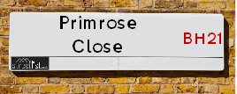
Primrose Close is a street located in the town of Wimborne Minster. It uses the postcode BH21 4EZ. The street has a length of approximately 155 metres.
Primrose Close is located within the Dorset Council's jurisdiction. They provide various services, like refuse collection, and manage council tax collection. It's situated in the South West region of the UK.
Primrose Close has been assigned the Unique Street Reference Number of 12206371 and 12206372 in the National Street Gazetteer.
Primrose Close is located within the county of Dorset, situated in the South West region of the UK. It's 94.48 miles South West from central London., 8.07 miles North West from Bournemouth, 19.71 miles South West from Salisbury and 20.85 miles East from Dorchester.

Do you know why this road is called Primrose Close?
What's it like to live here?
Ask the community a question about Primrose Close.
Do you have any questions, memories to share or know any facts about Primrose Close? We'd love to know more.
Also on streetlist.co.uk, can you help?
Swing Swang Lane
28th April 2024
I am trying to find out why the lane is named Swing Swang?
It has been known known this since at least 1905 when hedge making contents used to be held here.
Swing Swang is often used to describe a fairground ride. I remember Swing Boats. Were they a bit like this or is Swing Swang another name for swings?
Swing Swangs are also mentioned in connection to orchards. Or were orchards just good places to have swings?
Estate Agents near Primrose Close
| Name | Address | Website |
|---|---|---|
| Bloor Homes | Wimborne BH21 4FA | Visit Website |
| Savills | Wessex House, Priors Walk, East Borough, Wimborne, BH21 1PB | Visit Website |
| Symonds & Sampson | 5 West Street, Wimborne, BH21 1JN | Visit Website |
We have found 1 postcode for Primrose Close
Location Details
| Primrose Close | |
|---|---|

| |
| Latitude | 50.810443 |
| Longitude | -1.985288 |
| OS Easting (X): | 401036 |
| OS Northing (Y): | 101272 |
| OS Grid Reference: | SU010013 |
Neighbourhood Policing |
| Police Force: Dorset |
 View Neighbourhood Crime and Policing View Neighbourhood Crime and Policing |
| Find a Local Neighbourhood Watch Scheme |
Frequently asked Questions for Primrose Close
What Council (Local Authority) is Primrose Close in?
Primrose Close is located within the local authority area of Dorset Council which is a Unitary Authority.
What Parish Council is Primrose Close in?
Primrose Close is in an unparished area.
What Electoral Ward is Primrose Close in?
Primrose Close is located within the ward of Colehill & Wimborne Minster East.
What County is Primrose Close in?
Primrose Close is located within the ceremonial county of Dorset.
What Constituency is Primrose Close in?
Primrose Close is located within the constituency of Mid Dorset and North Poole.
What Part of the UK is Primrose Close in?
Primrose Close is located within the Array region of the United Kingdom.
What County Council area is Primrose Close in?
Primrose Close is located within the Dorset Council area.
What Police Force area is Primrose Close in?
Primrose Close is located within the Dorset Police area.
Roads that have a Junction with Primrose Close
| Street | Junction Type |
|---|---|
| Bluebell Crescent | junction |
| Dewberry Close | junction |
Sunset and Sunrise times for Primrose Close , BH21 4EZ
| Sunrise | 05:23 |
|---|---|
| Sunset | 20:45 |
Latest Weather Conditions for Primrose Close, BH21 4EZ
| Observed at Weather Station: | Bournemouth Airport 10 May 2024 at 20:00 (6.91 miles away) |
|---|---|
| Current Weather: | Clear night |
| Temperature and Humidity: | 15.4°C (64.0%) |
| Wind Direction and Speed: | N (0 mph) |
Population Statistics
| ONS Area Code | E00103269 |
|---|---|
| ONS Area Name | Rural White-Collar Workers |
| Average Age | 47.28 |
| Area Population | 1084.00 |
| Male Population | 534.00 (49%) |
| Female Population | 550.00 (51%) |
| LSOA Code: | E01020380 |
|---|---|
| LSOA Name: | East Dorset 007C |
| SOA Code: | 8a |
| SOA Name: | |
| MSOA Code: | E02004249 |
| MSOA Name: | East Dorset 007 |
Nearest Supermarkets
| Waitrose Wimborne |
|---|
| Rowlands Hill, Wimborne, Dorset, BH21 1AN |
| 01202 840157 |
| Distance: 0.71 Miles |
| Directions from Primrose Close to Waitrose Wimborne |
| Tesco Broadstone Express |
|---|
| 184 Lower Blandford Rd, Broadstone, BH18 8DP |
| 0345 026 9194 |
| Distance: 3.52 Miles |
| Directions from Primrose Close to Tesco Broadstone Express |
| Tesco Ferndown Superstore |
|---|
| Pennys Walk, Ferndown, BH22 9TH |
| 0345 677 9270 |
| Distance: 4.1 Miles |
| Directions from Primrose Close to Tesco Ferndown Superstore |
| Iceland Ferndown |
|---|
| 51/53 Victoria Road, Ferndown, Dorset, BH22 9HU |
| 01202893534 |
| Distance: 4.14 Miles |
| Directions from Primrose Close to Iceland Ferndown |
Telephone Information
| Area Code |
|---|
| Area Code: 01202 - Bournemouth |
| Area Code: 01258 - Blandford Forum |
| Area Code: 01425 - Ringwood |
Local Government
| Local Council Details |
|---|
| Within the area of Dorset |
| Local Member of Parliament |
|---|
| Within the Westminster Parliamentary Constituency of Mid Dorset and North Poole |
| The Member of Parliament is Michael Tomlinson |
| Details for the MP Michael Tomlinson on parliament.uk |
| Details for the MP Michael Tomlinson on theyworkforyou.com |
| In the 2019 General Election Michael Tomlinson won with a majority of 14,898 the result was Con hold. The total electorate was 65,427 |
| Wards, Parish Councils and County Councils |
|---|
| Ward: Colehill & Wimborne Minster East Ward |
| Ceremonial County: Dorset |
Nearest Schools
England Secondary Schools
Queen Elizabeth's School
Address: Queen Elizabeth's School, Blandford Road, Pamphill, Wimborne, Dorset, BH21 4DT
Distance: 0.90 miles
Contact: 01202885233
St Michael's Church of England Middle School, Colehill
Address: St Michael's Church of England Middle School, Colehill, Colehill Lane, Colehill, Wimborne, Dorset, BH21 7AB
Distance: 0.82 miles
Contact: 01202883433
Allenbourn Middle School
Address: Allenbourn Middle School, East Borough, Wimborne, Dorset, BH21 1PL
Distance: 0.49 miles
Contact:
England Primary Schools
Hayeswood First School
Address: Hayeswood First School, Cutlers Place, Colehill, Wimborne, Dorset, BH21 2HN
Distance: 1.59 miles
Contact: 01202882379
St Catherine's Catholic Primary School, Wimborne
Address: St Catherine's Catholic Primary School, Wimborne, Cutlers Place, Colehill, Wimborne, Dorset, BH21 2HN
Distance: 1.59 miles
Contact:
St Catherine's Catholic Primary School, Wimborne
Address: St Catherine's Catholic Primary School, Wimborne, Cutlers Place, Colehill, Wimborne, Dorset, BH21 2HN
Distance: 1.59 miles
Contact:
Hayeswood First School
Address: Hayeswood First School, Cutlers Place, Colehill, Wimborne, Dorset, BH21 2HN
Distance: 1.59 miles
Contact:
Colehill First School
Address: Colehill First School, Pilford Heath Road, Colehill, Wimborne, Dorset, BH21 2LZ
Distance: 1.47 miles
Contact: 01202882506
Colehill First School
Address: Colehill First School, Middlehill Road, Colehill, Wimborne, Dorset, BH21 2HL
Distance: 1.51 miles
Contact:
St John's Church of England First School, Wimborne
Address: St John's Church of England First School, Wimborne, St John's Hill, Wimborne, Dorset, BH21 1BX
Distance: 0.78 miles
Contact: 01202883675
St John's Church of England Voluntary Controlled First School, Wimborne
Address: St John's Church of England Voluntary Controlled First School, Wimborne, St John's Hill, Wimborne, Dorset, BH21 1BX
Distance: 0.78 miles
Contact:
Wimborne First School
Address: Wimborne First School, Campanula Way, Wimborne, Dorset, BH21 4FW
Distance: 0.17 miles
Contact:
Merley First School
Address: Merley First School, Oakley Straight, Merley, Wimborne, Dorset, BH21 1SD
Distance: 1.76 miles
Contact: 01202888455
Merley First School
Address: Merley First School, Oakley Straight, Merley, Wimborne, Dorset, BH21 1SD
Distance: 1.76 miles
Contact:
Pamphill Voluntary Controlled Church of England First School
Address: Pamphill Voluntary Controlled Church of England First School, Pamphill Green, Wimborne, Dorset, BH21 4EE
Distance: 1.19 miles
Contact:
Nearest Hospitals
| Name | Address | Postcode | Distance | Map |
|---|
Nearest Dentists
Dentists near Primrose Close
| Name | Address | Postcode | Distance | Map |
|---|
Nearest GP Surgeries
Doctors near Primrose Close
WALFORD MILL MEDICAL CENTRE
Address: KNOBCROOK ROAD, WIMBORNE, DORSET, BH21 1NL
Distance: 0.40 miles
Contact: tel: 01202 886999
THE OLD DISPENSARY
Address: 32 EAST BOROUGH, WIMBORNE, DORSET, BH21 1PL
Distance: 0.49 miles
Contact: tel: 01202 880786
QUARTERJACK SURGERY
Address: RODWAYS CORNER, WIMBORNE, DORSET, BH21 1AP
Distance: 0.86 miles
Contact: tel: 01202 848262
THE MAGNA MEDICAL CENTRE
Address: 81 MERLEY LANE, MERLEY, WIMBORNE, DORSET, BH21 3BB
Distance: 1.98 miles
Contact: :
THE HAMWORTHY CLUB - COVID LOCAL VACCINATION SERVICE
Address: MAGNA ROAD, WIMBORNE, BH21 3AP
Distance: 2.97 miles
Contact: :
THE HAMWORTHY CLUB - COVID LOCAL VACCINATION SERVICE 2
Address: MAGNA ROAD, WIMBORNE, BH21 3AP
Distance: 2.97 miles
Contact: :
Nearest Dispensing Chemists
Pharmacies near Primrose Close
| Name | Address | Postcode | Telephone | Map | Distance in Km |
|---|
Nearest Opticians
Opticians near Primrose Close
BOOTS OPTICIANS (WIMBORNE)
Address: 1 THE SQUARE, WIMBORNE, DORSET, BH21 1JA
Distance: 0.71 miles
Contact: :
SCRIVENS OPTICIANS (WIMBORNE)
Address: 6 THE SQUARE, WIMBORNE, BH21 1JA
Distance: 0.71 miles
Contact: :
OPTIQUE 2000 LTD
Address: 7A WEST STREET, WIMBORNE, DORSET, BH21 1JN
Distance: 0.74 miles
Contact: :
SPECSAVERS - WIMBORNE MINSTER
Address: 5-6 CROWN MEAD, WIMBORNE, BH21 1ED
Distance: 0.79 miles
Contact: :
COMPLETE COMMUNITY CARE - HEATH CLOSE
Address: 6 HEATH CLOSE, WIMBORNE, DORSET, BH21 2LP
Distance: 1.52 miles
Contact: :
SCRIVENS OPTICIANS (BROADSTONE)
Address: 169/171 THE BROADWAY, BROADSTONE, DORSET, BH18 8DS
Distance: 3.47 miles
Contact: :
Transport
Nearest Rail Stations
Hamworthy Station is 6.08 miles away.
Address: Hamworthy station, Junction Road, Hamworthy, Dorset, BH16 5AA
Hamworthy is situated on the Portsmouth Direct line|South Western Main Line and is managed by South Western Railway.
Hamworthy Station is staffed on a part time basis.
Parkstone (Dorset) Station is 6.24 miles away.
Address: Parkstone station, Station Road, Parkstone, Dorset, BH14 8UD
Parkstone (Dorset) is situated on the Portsmouth Direct line|South Western Main Line and is managed by South Western Railway.
Parkstone (Dorset) Station is staffed on a part time basis.
Directions from Primrose Close to Parkstone (Dorset) Rail Station